Download
1 / 14
140 likes | 259 Vues
Explore how satellite data complements ground-based monitor data for a complete air quality analysis. Learn about the strengths, limitations, and examples of each data source, including model forecast data. Discover how to correlate satellite and ground-based data to enhance air quality monitoring.

E N D
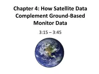
Chapter 4: How Satellite Data Complement Ground-Based Monitor Data 3:15 – 3:45
Sources of Data for Air Quality Analysis • There are three major sources of data for air quality analysis: • Ground-based monitor data • Satellite data • Model forecast data • For a complete picture of air quality, need to use all threesources, when possible!
Ground-Based Monitor Data • Strengths: • Accurate, precise measurements of specific pollutants (PM2.5, PM10, O3,etc.). • Measurements at surface, where people live and breathe the air. • Limitations: • Measurements only in areas where monitors are located; typically, there are large gaps in any country’s monitor network. • Monitors are expensive to purchase and operate.
Satellite Data • Strengths: • Global, regional, and local coverage – satellites provide information for areas where no ground-based monitors exist. • Routine measurements are made daily. • Data are “free” – no cost to users with access to the internet. • Limitations: • Measurements are for entire vertical column of atmosphere, not specific to surface. • Clouds block measurement of many air quality satellite parameters. • Temporal and spatial resolution of satellites can limit data availability.
Model Forecast Data • Strengths: • Forecasts provide information on future air quality conditions; advanced notice allows governments to take action to protect public health. • Limitations: • Model forecasts are NOT measurements! They are predictions of future air quality conditions. • Air quality models are complex combinations of numerical weather models and atmospheric chemistry, physics, and emissions models – the sum is only as good as the individual parts. • Model output can be difficult to interpret for novices or non-experts.
How Can Satellite Data Complement Ground-Based Monitor Data? • Satellites make global measurements, so we can use them to supplement ground-based measurements from a monitor network. • Since satellites measure the total pollutant concentration in a vertical column of atmosphere, it is necessary to correlate satellite data with ground-based monitor data. • Once we know the relationship between satellite and ground-based data, we can apply satellite data to areas where there are no ground-based monitors and obtain and estimate of surface pollutant concentrations.
Example: Correlation between MODIS AOD and PM2.5 for One Location in U.S. Baltimore, Maryland 2005 Terra
Example: Correlation between MODIS AOD and PM2.5for May 2007 in U.S. • Correlation varies by: • Region and season • Vertical aerosol distribution and properties • Meteorological conditions such as relative humidity and boundary layer height • AOD retrievals are also less accurate over bright surfaces such as desert or snow. Image generated by Giovanni , NASA GES DISC
Visualization of Satellite and Monitor Data • Satellite imagery and ground-based monitor data can also be visualized together to provide a more complete picture of air quality conditions. • Try using Google Earth or the mapping products on SERVIR.netto visualize air quality data! Haze Smoke Eastern United States June 13, 2008
Interpretation of Satellite Images • Quantitative for PM2.5 and NO2 • Qualitative for SO2 • Bottom line: use satellite images for information about the distribution and transport of pollutants, but not about the exact concentrations of pollutants. • Don’t forget: if satellites indicate the presence of pollutants, it doesn’t mean concentrations are high at the surface. The pollution could be aloft in the atmosphere, above the surface.
Air Quality Analysis: Final Thoughts • For best results, look at all three types of data when you are conducting an air quality analysis: • Ground-based monitor data • Satellite data • Model forecast data • The three data sources each convey different information! • Don’t forget the strengths and weaknesses of each type of data.