Download
1 / 19
190 likes | 313 Vues
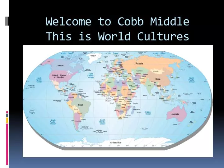
Welcome to Cobb Middle This is World Cultures Coach all. “ Sharpen your eye and tune your ear, so you’ll know what you see and understand what you hear.” Listervelt middleton. Bellringer Sept.7 Terms to know for Lesson 1. Compass rose - north arrow to show directions.

E N D
“Sharpen your eye and tune your ear, so you’ll know what you see and understand what you hear.” Listervelt middleton
Bellringer Sept.7 Terms to know for Lesson 1 Compass rose- north arrow to show directions. Cardinal directions- north, south, east, and west Intermediate directions- northeast, northwest,southeast , and southwest. Scale- maps that are drawn so that a certain distance on the map represents a much larger distance on the earth. Scale bar- tells you what distance on the earth is represented by a certain distance on the map.
Geography Handbook pages GH1-15 What does Geography mean? The study of the earth’s surface, climate, population, etc.
Geography Handbook pages GH1-15 • How do I study Geography? • Must know the five themes of Geography: • 1. location • 2. place • 3. human/ environment interaction • 4. movement • 5. regions
Geography Handbook pages GH1-15 • Recently geographer have looked at geography in six different ways. Six Essential Elements • 1. The World in Spatial Terms • 2. Places and Regions • 3. Physical Systems • 4. Human Systems • 5. Environment and Society • 6. The Uses of Geography
Bellringer Sept.8 Terms to know • Relative location- your location is compared to the location of any other spot on Earth. • Interdependence- depending on other people.
Bellringer Sept.9 Terms to Know • Grid- is a set of vertical and horizontal lines used to identify locations on a map. • Cell- an area where a row and a column meet. • Index- are where names and places on the map are listed.
Vocab. Quiz Today • Take out a sheet of paper and head your paper as instructed. Name, date, period, assignment (Map Vocabulary Quiz). Number your paper 1-10 and sit quietly for more instructions. When your are finished with your quiz, sit quietly and wait until time is up. • Thank you Class
Sept. 13, 2010Terms to Know • Absolute location- where one line of latitude crosses one line of longitude. • Latitude- are called parallels. They measure north and south but are drawn east to west. • Longitude- are called meridians. They measure east to west but are drawn north to south. • Degree- is a measurement of latitude and longitude. It is 1/360th of the distance around the Earth.
Sept.14,2010Terms to Know • Equator- is a line of latitude that divides the Northern and Southern Hemispheres. • Prime Meridian- is a line of longitude that divides the Eastern and Western Hemispheres. • Symbol- helps the reader distinguish different kinds of information. • Legend or Key- were the meaning of the symbols are located.
Sept. 15,2010 • Explain what causes seasons. • Axis- is an imaginary line drawn from the North Pole to the South Pole through the center of the Earth. • Northern Hemisphere- part of the Earth north of the equator. • South Hemisphere- part of the Earth south of the equator.
Sept. 16,2010 • Time Zones- divisions of time on Earth.
Take out a sheet of paper and head your paper as instructed. Name, date, period, assignment (Map Vocabulary Quiz #2). Number your paper 1-12 and sit quietly for more instructions. When you are finished with your quiz, you need to read Understanding Time Zones and complete the practicing map skills on Worksheet 42. • Thank you Class
Sept. 20th, 2010 • Physical map- shows how the land looks- Mountains, rivers, plains, and lakes • Relief map- shows how flat or rugged the land surface is. • Political map- shows how humans have divided the surface of the earth into countries, states, and other political divisions. • Special-purpose map- a map that emphasizes a single idea or a particular kind of information about an area .
Sept. 21, 2010 • Map projection- is a way of showing the rounded earth on a flat piece of paper. • Mercator projection- map projection that shows true directions and land shapes but exaggerated sizes of landmasses. • Planar projection-map projection created by projecting the globe on a plane. • Conic projection- map projection created by placing a cone over part of a globe. • Winkel Tripel projection- map projection that provides a balance between the size and shape of landmasses as they are shown on the map.
Sept. 22, 2010 • Mental map- a person’s internal image of a place.
Sept. 23, 2010 • Global Positioning System (GPS)- the satellites, receivers, and ground stations that allow the location of and exact position on Earth. • Geographic Information System (GIS) - software that analyzes information relating to geographic location.
Sept. 24, 2010 • Take out a sheet of paper and head your paper as instructed. Name, date, period, assignment (Map Vocabulary Quiz #3). Number your paper 1-12 and sit quietly for more instructions. When you are finished with your quiz, begin reviewing Unit 1 The World in Spatial Terms Worksheet pages 58-59. If you finish before time is up sit quietly or find homework or read a book. • Thank you Class