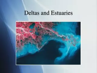
Deltas
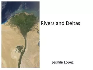
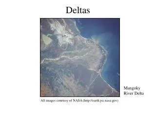
Deltas. Mangoky River Delta. All images courtesy of NASA (http://earth.jsc.nasa.gov). The Nile Delta: a Prototype. Early geographers, reminded of the Greek letter delta when noting its roughly triangular shape, named it accordingly. Introduction. Deltas are transitional environments

Deltas
E N D
Presentation Transcript
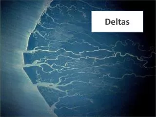
Deltas Mangoky River Delta All images courtesy of NASA (http://earth.jsc.nasa.gov)
The Nile Delta: a Prototype Early geographers, reminded of the Greek letter delta when noting its roughly triangular shape, named it accordingly.
Introduction • Deltas are transitional environments • they are neither fully marine or terrestrial • Deltas are built by the accumulation of river-borne sediment • when the accumulation exceeds sea level • Deltas often contain subordinate systems • marshes, swamps, and tidal flats • Deltas are sensitive to sea level change and alterations to their basins • they are heavily impacted by human activities
Introduction Continued • Deltas occur on every continent on trailing edge continental margins (but the U.S. Atlantic Coast has no real deltas; most East Coast rivers empty into estuaries where their sediment is then dispersed) • marginal seas and protected coasts are especially conducive to delta formation • leading edge continental margins are not conducive • continental shelves are too narrow and deep to allow sediments to accumulate, wave energy is too high and tends to sweep away river sediments, and nearby mountains make for narrow rivers which carry relatively small amounts of sediment
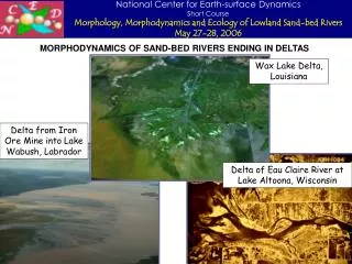
Delta Age • Deltas are geologically young features • Most deltas postdate the period of high sea level rise about 5,000 years ago • However, this is not always the case. • For example, the Mississippi River Delta is built upon much older deltas that are several million years old (although its newest lobe is only about 600 years old)
The Mississippi Delta Jetties have been built and dredging occurs to allow large vessels to navigate the delta channel Note the large amounts of sediment that surrounds the delta A bird’s foot delta located in Louisiana adjacent to the Gulf of Mexico
The Atchafalaya Delta This is one of the few areas where the Louisiana coastline is growing This delta is considered to be the Mississippi’s largest distributary The Atchafalaya diverts large quantities of water from the Mississippi
Delta Environments • Delta Plain: the land-ward, very flat extension of the delta • distributary: branching of the main river channel into a series of smaller channels • these smaller channels distribute water and sediment across the delta plain and delta front • interdistributary bays and marshes: broad relatively flat areas between distributaries with either open water (bays) or marsh (herbacious wetland)
Delta Environments Continued • Delta plain • levees: the built-up areas adjacent to the channel • where sediments accumulate because this area is flooded more frequently (sediments are often coarser on levees as the coarse material drops out of suspension before the finer material (i.e. silt)) • crevasse: cuts through the levee • crevasse splay: cuts through the levee allow sediments to spill across the delta plain in a broad fan-like shape
Delta Environments Continued • Delta front: where the seaward edge of the delta plain merges with the sub-tidal portion of the delta • sand is deposited first and is therefore closer to the delta front • distributary mouth bars may form with this sandy material • Prodelta: the seaward extension of the delta, which is largely built of fine sediments (silt & clay) • waves and in some cases tides rework this material • largely below sea-level
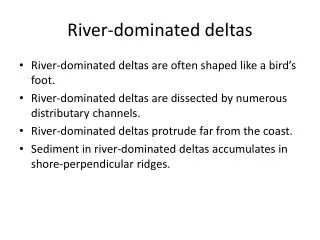
Delta Formation • Deltas can be river, tide, or wave dominated or can be influenced by a mixture of these forces • these forces determine the fate of the river-borne sediment and the resultant morphology of the delta • river-dominated (Mississippi Delta) • a well developed delta plain, often with one lobe (the most recent one) projecting out beyond the general delta front • tide-dominated (Ganges Delta-largest) • freshwater is over-powered by tidal currents • strong tidal currents mold the delta into elongate forms that are parallel to river flow and perpendicular to the coast • often resemble estuaries due to the presence of embayed salt marshes, swamps, and tidal flats
River vs. Tide Dominated Deltas large mangrove forest (largest remaining habitat of the Bengal tiger) Mississippi Delta Ganges Delta Prone to devastating floods
Delta Formation Continued • wave-dominated • smooth shorelines with relatively few distributaries • tend to be smaller than other types of deltas as wave action limits growth • limited marsh or swamp areas • mixed or intermediate • deltas where one force (wave, river, or tidal) does not dominate • the Nile River Delta shows characteristics of river and wave domination as it has both well developed distributaries and a smooth delta front
Wave Dominated Delta Wave action has smoothed the coastline Rhone River Delta
Nile Delta Well developed distributaries Smooth delta front A mixed or intermediate delta influenced by both river and wave forces
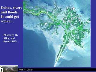
Delta Progradation/Retrogradation • Delta growth depends on drainage basin conditions • the most important factors for the vitality of the delta are soil type and rainfall • large amounts of rainfall and loose soils increase delta growth • changes in climate, topography, and sediment supply may alter the growth of the delta • humans can alter all of these important factors
Delta Progradation/Retrogradation • Progradation: the growth of a delta seaward • this occurs by the accumulation of sediments in zones that shift seaward over time • sandy materials first, then silt, and then clay • if you bored through a delta you would find clay materials toward the bottom (essentially the prodelta that was over-ridden) and coarser materials toward the surface • deltas will continue to prograde as long as the sediment supply exceeds the rate of relative sea level rise
More Delta Progradation/Retrogradation! • Retrogradation • occurs when the delta begins to disappear because the supply of sediment is not enough to offset sea level rise • this can happen for a variety of reasons • sea level rises too fast • drought in the river basin decreases river flow • sediment supply declines due to climate change or human influence
Delta plain Delta Cycle Delta front Pro-delta
Human-Impact • People can affect Deltas in many ways • For example, people often create dams which block sediment from reaching the delta • Both the Nile and the Mississippi Deltas are examples of this phenomenon
The Aswan Dam and the Nile Delta Aswan Dam (1971) The dam provides flood control, increased irrigable land area, and much needed hydroelectric power (about 40 percent of the country’s electricity). Lake Nasser The Aswan Dam has disrupted the Nile Delta’s normal development. The dam traps sediments formerly used to build the delta and agricultural area, allows saltwater intrusion, and reduces the amount of nutrients present in the Nile’s water.
Effects of Sea Level Rise Sediment once transported by the Nile River to the coast, average of 100x10 6 t yr-1, is now almost cut off.
People and the Mississippi Sediment deposited by distributaries The channel requires frequent dredging so that large vessels can navigate the channel Note the large sediment plumes Although the Mississippi River still carries 200 million tons of sediment into the Gulf of Mexico every year, much more sediment would be carried if not for the dams and levees constructed by people in its drainage basin for flood control & other purposes.
Causes • The Mississippi River water level has fluctuated and fluctuates a great deal due to weather phenomena, glacial melt, and human use. The river valley has been struck by devastating floods many times. Since the early 1800s, Americans have attempted to control the level of the river using different engineering techniques. • The most effective means of controlling the river has been damming, especially far upstream from the delta. However, these flood control measures have led to the worst coastal erosion and wetland loss in the United States. • Since the turn of the 20th century, the rate of coastal land loss has accelerated from 5 mi2/yr in the 1930s to 40 mi2/yr in the 1970s. • The current rate of loss is approximately 25 mi2/yr (Penland, 1995). Flood control has cut off the sediment supply to the Mississippi Delta, which formerly counteracted the subsidence. • Diversion control has stopped the delta from delta switching, the process by which the Mississippi River has built and maintained its delta plain, causing a net loss of land (Penland, 1995). The average amount of shoreline erosion is 10m/yr.
Other Factors • Canals: cause of bank erosion and incursion of saltwater into low salinity and brackish marshes • Oil and Gas: fluid withdrawal and land collapse and subsidence • Old pipelines: constructed since the 1930s • Not really monitored until 1960s.
The Danube Delta This delta attracts many tourists who enjoy watching the delta’s birds and other inhabitants The Danube is the second longest river in Europe The Danube Delta is the second largest in Europe (4300 square kilometers) and is home to one of the biggest reed beds in the world, vast stretches of other wetland types, and much wildlife.
Tonle Sap • Annual flooding from the Mekong swells the lake from 2500 km2 to over 13,000 km2 • Fish spawning and migration cycle with the floods • 40% of Mekong fish catch is in Cambodia (10% in the lake alone) • 80% of animal protein consumed in Cambodia is from freshwater fish
The Irrawaddy River Delta Sediment plumes mangrove forest Fertile mud and sand have been deposited here during the last 2 million years This river delta in Burma is one of the world’s great rice producing regions
Sacred River Delta The delta is a site of some of the earliest European settlements in India Both Rivers are sacred to the Hindu Religion Godavari and Krishna River Delta