Download

1 / 41
450 likes | 1.03k Vues
Zhan Yulin Institute of Remote Sensing Applications, CAS Jan. 23, 2007. Drought and Desertification Monitoring. Contents. Background Drought monitoring Desertification monitoring. Background. UN ESCAP -- the integrated system of water and land resources for arid areas (2001-2004)

E N D
Zhan Yulin Institute of Remote Sensing Applications, CAS Jan. 23, 2007 Drought and Desertification Monitoring
Contents • Background • Drought monitoring • Desertification monitoring
Background • UN ESCAP -- the integrated system of water and land resources for arid areas (2001-2004) Objectives Enhance the capabilities of water and land management in arid areas by using space technology Participating Countries China, D. P.R. Korea, Mongolia, Kazakstan, Uzbekistan, Pakistan • Scientific issues • Drought Monitoring, Desertification Monitoring …...
Background • European Commission-- A Surveillance System for Assessing and Monitoring of Desertification (2005-2010) Objectives • Assessing desertification and land degradation status. • Forecasting of desertification under selected climatic and socio-economic scenarios. • Monitoring of desertification and land degradation status over large areas.
Background • European Commission-- A Surveillance System for Assessing and Monitoring of Desertification (2005-2010) Partners 39 organisations representing 10 EU Member States and 6 Third Country States • China, Spain, Sweden, France, Germany, Greece, Italy, Netherlands, Portugal, United Kingdom, Belgium,Chile,Algeria, Morocco, Senegal, Tunisia
Drought is … Lack of precipitation A period of water shortage
Drought is… Water Supply Water Demand
Methods for drought monitoring • Vegetation Condition Index (VCI) • Crop Water Stress Index (CWSI) • Soil Thermal Inertial Model • Normalized Difference Temperature Index (NDTI ) • Temperature Vegetation Dryness Index ( TVDI) based on the NDVI-Ts Space
NDVI-Ts Space T s dry edge Bare soil T = a +b* NDVI s_max Partial cover Full cover wet edge T s_min NDVI Sandholt et al., 2002
Theoretic Base of TVDI Ts NDVI The Sketch map for NDVI-Ts space
Drought -- Study region and dataset ACR I: Eastern Monsoon Agricultural Climatic Region ACR II: North-Western Arid Agricultural Climatic Region ACR III: Qingzang tableland Cold Agricultural Climatic Region The agricultural climatic regions (central weather bureau of China, 1994) and the distribution of the topsoil moisture observation stations
Drought -- Study region and dataset • NOAA-AVHRR 10 days composite NDVI , thermal infrared (Ch4 and Ch5) dataset from March-May in 2000 • The measured topsoil moisture collected from observation stations
Drought --Data process first ten days in May first ten days in March first ten days in April The Extracted maximum and minimum Ts from NDVI-Ts space for small intervals of NDVI for ARC I in 2000
Drought -- Result first ten days in April first ten days in May first ten days in March Very wet Wet Balanced Dry Severe drought
Drought -- Result θ Severe drought θ θ θ Relations between TVDI and soil moisture in China
Drought – Conclusion and problem • Compared with VCI, CWSI and NDTI, TVDI is a promising method in monitoring drought for large region • the sensor view angle which can has some effect on Ts and NDVI has not been taken into consider • Although China is divided as three ACR, but it still has varied climate types and topography features. • Higher time-spatial resolution image and a more suitable regional dividing method can produce a more promising result with TVDI.
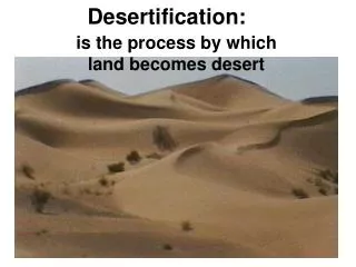
Desertification is … Productive Soil turned into Non- productive Desert
Factors of Desertification • Natural factors • climate • temperature • precipitation • soil • type • erosion • vegetation • species • biomass
Factors of Desertification • Human factors Over mining Population increasing Overgrazing Cutting unregularly
Desertification Indexes • Modified Soil Adjusted Vegetation Index (MSAVI) • Albedo • Land Surface Temperature (LST) • Fractional Vegetation Cover (FVC) • Temperature Vegetation Dryness Index (TVDI)
Comparison between Different Indexes (a) MSAVI (c)MSAVI+Albedo+LST (e)MSAVI+Albedo+LST +TVDI+FVC Non Slight Moderate Heavy Very Heavy NOAA 1995 In Kerchin (d)MSAVI+Albedo+LST+TVDI (b)MSAVI+Albedo
Desertification climate types Thornthwaite method
Desertification indicator system Desertification indicator system in semi arid area for NOAA Desertification indicator system in semi arid area for MODIS
Water Moderate Very Severe Severe Non Slight Hyper Arid Desertification distribution in China Desertification distribution map from NOAA-Avhrr, 1995
Water Moderate Very Severe Severe Non Slight Hyper Arid Desertification distribution in Central Asia Desertification distribution map from NOAA-Avhrr, 1995
Water Moderate Very Severe Severe Non Slight Hyper Arid Desertification distribution in China Desertification distribution map from MODIS, 2001
Water Moderate Very Severe Severe Non Slight Hyper Arid Desertification distribution in Central Asia Desertification distribution map from MODIS, 2001
Identifying the boundary of Desert Occurrence of Onset of green-up • NDVI increases for at least one and a half months; • NDVI reached maximum during the particular periods; • NDVI is greater than 0.05; • This event must occur in April to August.
Identifying the boundary of Desert Study areas including Kazakhstan, Uzbekistan, Turkmenistan, Kirghiz, Tajikistan, Mongolia and western China. AVHRR NDVI 8Km Dataset 1982–2000
Vegetated areas Vegetated areas Vegetated areas Vegetated areas Non-vegetated areas Non-vegetated areas Non-vegetated areas Non-vegetated areas 1982 1986 1990 1993 Occurrence of onset of green-up in different years in the study areas
Vegetated areas Vegetated areas Vegetated areas Vegetated areas Non-vegetated areas Non-vegetated areas Non-vegetated areas Non-vegetated areas 1995 1997 1999 2000 Occurrence of onset of green-upin different years in the study areas
Identifying the boundary of Desert • the onset of green-up event is never detected in the core desert areas. • From desert steppe to typical steppe, the Frequency increases from 2 to 18. • In lower onset frequency zone, the desert steppe (the transitional zone between desert and typical steppe) displayed a typical steppe-like phonological pattern in the wet year and a desert-like pattern in a dry year. Frequency of Occurrence of Onset of green-up in central Asia and western China (1982-2000)
Dynamic change of desertification Coefficient of variation (CoV) of the NDVI • AVHRR NDVI 8Km Dataset 1982–2000 • Annual pixel-level CoV of NDVI • The slope of the NDVI CoV (1982-2000)
Dynamic change of desertification • Areas without changes (near-zero CoV slope) are mapped in green • Areas of improving vegetation cover (positive CoV slope) in red • Areas of declining vegetation cover (negative CoV slope) in blue. NDVI CoV slope map for central Asia and western China(1982-2000).
Desertification monitoring based on geostatistical texture • Desertification in east of Hainan Island result from ilmenites’ over mining. • Desertification in Hainan is difficult to identify directly from origin radiometric bands • Distinguishing between beach sandlot and inner desert • Desertification classification in Hainan different from West-North in china Hainan Island, china DATA:TM(1989) and ETM+ (2003)
Desertification monitoring based on geostatistical texture Method spectral bands geostatistical texture
Desertification monitoring based on geostatistical texture Accuracy:92.4% Accuracy:94.7%
Desertification -- Conclusion • An integrated desertification indexes are proposed • Desertification monitoring method based on geostatistical texture • Desert boundary can be identified by using the occurrence of onset of green-up • Utilizing NDVI CoV, the Dynamic change of desertification was analyzed