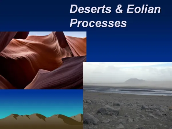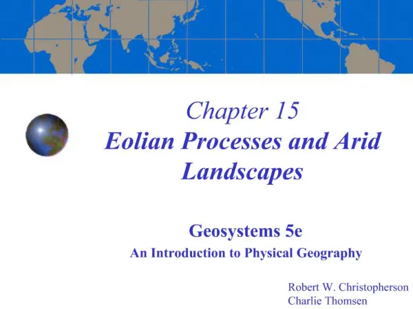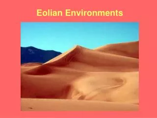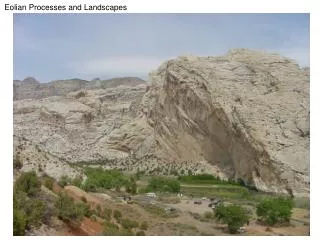
Chapter 15 Eolian Processes and Arid Landscapes
350 likes | 900 Vues
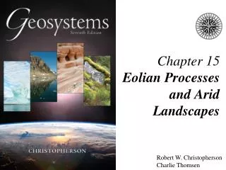
Chapter 15 Eolian Processes and Arid Landscapes. Geosystems 5e An Introduction to Physical Geography. Robert W. Christopherson Charlie Thomsen. Final Exam. The final exam is going to take place on April 11 at 2pm. It will last about 2 hours. It is going to take place at the lecture room.

Chapter 15 Eolian Processes and Arid Landscapes
E N D
Presentation Transcript
Chapter 15Eolian Processes and Arid Landscapes Geosystems 5e An Introduction to Physical Geography Robert W. Christopherson Charlie Thomsen
Final Exam • The final exam is going to take place on April 11 at 2pm. It will last about 2 hours. • It is going to take place at the lecture room. • It is non-cumulative. • Bring #2 pencil. • Same format as the midterm.
Key Learning Concepts: • After reading the chapter you should be able to: • Characterize the unique work accomplished by wind and eolian(caused by wind; refers to erosion, transportation, and deposition of materials; spelled “aeolian” in some countries) processes. • Describe eolian erosion, including deflation, abrasion, and the resultant landforms. • Describe eolian transportation and explain saltation, and surface creep. • Identify the major classes of sand dunes and present examples within each class. • Define loess deposits, their origins, locations, and landforms. • Portray desert landscapes and locate these regions on a world map.
1. Who was Ralph Bagnold? What was his contribution to eolian studies? • A British major, Ralph Bagnold was stationed in Egypt in 1925. Bagnold was an engineering officer who spent much of his time in the deserts west of the Nile, where he measured, sketched, and developed hypotheses about the wind and desert forms. His often-cited work, The Physics of Blown Sand and Desert Dunes, was published in 1941 following the completion of wind-tunnel simulations in London. • Bagnold took Henry Ford at his word that a Model-T Ford could handle the most difficult terrain. He drove a Model-T all over the desert, carrying sections of chicken wire for areas where support was needed under the wheels. Additional wind-tunnel tests completed key aspects of his research on eolian processes.
2. Explain the term eolian and its application in this chapter. • Wind-eroded, wind-transported, and wind-deposited materials are called eolian (also spelled aeolian; named for Aeolus, the ruler of the winds in Greek mythology). The actual ability of wind to move materials is small compared with that of other transporting agents such as water and ice, because air is so much less dense than these other media.
3. Describe the erosional processes associated with moving air. • Two principal wind-erosion processes are deflation, the removal and lifting of individual loose particles, and abrasion, the grinding of rock surfaces with a “sandblasting” action by particles captured in the air. (See next slides)
Desert pavement is formed from larger rocks and fragments left after deflation.
Yardang: A small wind-sculpted rock formation caused by abrasion in Utah. Figure 15.4
4. How are ventifacts and yardangs formed by the wind? • Rocks exposed to eolian abrasion appear pitted, grooved, or polished, and usually are aerodynamically shaped in a specific direction, according to the flow of airborne particles. Rocks that bear such evidence of eolian erosion are called ventifacts. On a larger scale, deflation and abrasion are capable of streamlining rock structures that are aligned parallel to the most effective wind direction, leaving behind distinctive, elongated ridges called yardangs. These can range from meters to kilometers in length and up to many meters in height.
5. Differentiate between a dust storm and a sand storm. • Only the finest dust particles travel significant distances, and consequently the finer material suspended in a dust storm is lifted much higher than the coarser particles of a sand storm, which may be lifted only about 2 meters.
6. What is the difference between eolian saltation and fluvial saltation? • The term saltation was used in Chapter 14 to describe movement of particles along stream beds. The term saltation also is used in eolian processes to describe the wind transport of grains along the ground, grains usually larger than 0.2 mm. About 80% of wind transport of particles is accomplished by this skipping and bouncing action (See Figure 15-6). In comparison with fluvial transport, in which saltation is accomplished by hydraulic lift, eolian saltation is executed by aerodynamic lift, elastic bounce, and impact.
Figure 15.6: Sand Transport; Eolian suspension, saltation, and surface creep are mechanisms of sediment transportation.
7. Explain the concept of “surface creep”. • Wind exerts a drag or frictional pull on surface particles. Bagnold studied the relationship between wind velocity and grain size, determining the fluid threshold (minimum wind speed) required for initial movement of grains of various sizes. A slightly lower wind velocity suffices if the particle already has been set into motion by the impact of a saltating grain. Bagnold termed this lesser velocity the impact threshold. Once in motion, particles continue to be transported by lower wind velocities.
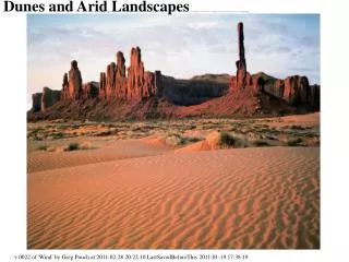
8. What is the difference between an erg and a reg desert? Which type is a sand sea? • A common assumption is that most deserts are covered by sand. Instead, desert pavements predominate across most sub-tropical arid landscapes; only about 10% of desert areas are covered with sand. Sand grains generally are deposited as transient ridges or hills called dunes. A dune is a wind-sculpted accumulation of sand (See next slide). An extensive area of dunes, such as that found in North Africa, is characteristic of an erg desert, which means sand sea. Most desert landscapes are not covered with sand but are desert pavements, which are so common that many provincial names have been used for them–for example, “gibber plain” in Australia, “gobi” in China, and in Africa, “lag gravels” or “serir” or reg desert.
Dune Cross Section: Successive slipfaces exhibit a distinctive pattern as the dune migrates in the direction of the effective wind.
9. What are the three classes of dune forms? • We can simplify dune forms into three classes–crescentic, linear, star dunes, and others. Crescentic dunes are divided into four types: Barchan, Transverse, Parabolic, and Barchanoid Ridge. Barchan dunes are crescent shaped dunes with horns pointed downwind. Winds are constant with little directional variability. Limited sand availability. Transverse dunes are asymmetrical ridges which are transverse (perpendicular) to the wind direction. Surface has abundant sand supply. Parabolic dunes are generated by vegetation, open end faces upwind with U-shaped and arms shaped by the vegetation. Barchanoid ridge dunes, are wavy, symmetrical dune ridges aligned in right angels to the winds. Formed from coalesced barchans. (See next slides).
9. What are the three classes of dune forms? (continued) • The next class of dunes is called linear dunes. They are divided into two types: Longitudinal and Seif. Longitudinal dunes are long, ridge-shaped dunes that are aligned parallel to the wind direction and have two slipface. Average 100 meters high and 100 kilometers long and can reach to 400 meters high. Seif dunes (means sword in Arabic) a sharp-crested sand dune with curved edges, often several miles long. Runs in a series of parallel ridges; most common in the Sahara desert.
Longitudinal Dunes (left) and a Satellite photo of Seif Dunes in Saudi Arabia (Right).
9. What are the three classes of dune forms? (continued) • The third class of dunes is called a Star dune (One type only). Star dunes are giant dunes; Pyramidal or star shaped. Slipsurfaces in multiple directions. Resulting from winds shifting in all directions. (See next slide).
9. What are the three classes of dune forms? (continued) • The last class is named “other” for other types. There are two of them: Dome dunes and Reversing dunes. Dome dunes are circular or elliptical mounds with no slipface. Reversing dunes are asymmetrical ridges formed intermediately between star dunes and transverse dunes formations. Wind direction can alter their shapes between forms. (See next slide).
Sandy Regions of the World: World wide distribution of active and stable sand regions.
10. Another form of material deposits are loess deposits. How are loess materials generated? What form do they assume when deposited? • Pleistocene glaciers advanced and retreated in many parts of the world, leaving behind large glacial outwash deposits of fine-grained clays and silts (<0.06 mm). These materials were blown great distances by the wind and redeposited in unstratified, homogeneous deposits named loess. Loess deposits form some complex weathered badlands and some good agricultural land.
11. Name a few examples of significant loess deposits on Earth. Answer: In Europe and North America, loess is thought to be derived mainly from glacial and periglacial sources. The vast deposits of loess in China, covering more than 300,000 km2, are thought to be derived from desert rather than glacial sources.
12. Desert features: Describe a desert bolson formation from crest to crest. • A typical bolson is a slope-and-basin area between the crests of two adjacent ridges in a dry region- the physiology and geography combine to give the bolson a dry climate, few permanent streams, and internal drainage pattern (no ocean drainage). Basin-and-range relief is abrupt, and rock structures are angular and rugged. As the ranges erode, the transported materials accumulate to great depths in the basins, gradually producing extensive desert plains. (See next slide).
13. What is meant by desertification? • An unwanted expansion of the Earth’s desert lands in a process known as desertification. This now is a worldwide phenomenon along the margins of semiarid and arid lands. Desertification is due principally to poor agricultural practices (overgrazing and agricultural activities that abuse soil structure and fertility), improper soil-moisturemanagement, erosion and salinization, deforestation, and the ongoing global climatic change which is shifting temperature and precipitation patterns. • The United Nations estimates that degraded lands have covered some 2 billion acres since 1930; many millions of additional acres are added each year. An immediate need is to improve the data base for a more accurate accounting of the problem and a better understanding of what is occurring.
The process of desertification: • Figure 15-24 (next slide) is drawn from a map prepared for a U.N. Conference on Desertification. Desertification areas are ranked: A moderate hazard area has an average 10%–25% drop in agricultural productivity; a high hazard area has a 25%–50% drop; and a very high hazard area has more than a 50% decrease. Because human activities and economies, especially unwise grazing practices, appear to be the major cause of desertification, actions to slow the process are readily available. The severity of this problem is magnified by the poverty in many of the affected regions.
Figure 15.24: Desertification Figure 15.24
Movie: Wind, Dust and Deserts • This program shows how deserts are defined by infrequent precipitation and how desertification relates to proximity to the equator, proximity to mountains, and ultimately plate tectonics. Images of landscapes illustrate how wind creates features such as dunes, playas, blow-outs, and even oases. • http://www.learner.org/resources/series78.html
End of Chapter 15Eolian Processes and Arid Landscapes Geosystems 5e An Introduction to Physical Geography Robert W. Christopherson Charlie Thomsen