Download
1 / 23
230 likes | 403 Vues
The sea/land-breeze circulation. Part I: Development w/o Earth rotation. A sea-breeze (or onshore breeze ) is a wind from the sea that develops over land near coasts. It is formed by increasing temperature differences between the land and water;

E N D
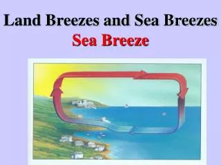
The sea/land-breeze circulation Part I: Development w/o Earth rotation
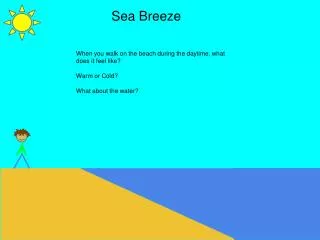
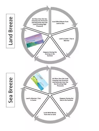
A sea-breeze (or onshore breeze) is a windfrom the sea that develops over land near coasts. It is formed by increasing temperature differences between the land and water; these create a pressure minimum over the land due to its relative warmth, and forces higher pressure, cooler air from the sea to move inland.
Pressure Same mass of water would only be 18.5 feet deep
Pressure differences make winds Sea-breeze is not this deep…
Land breeze: At night, the land cools off faster than the ocean due to differences in their heat capacity, which forces the daytime sea breeze to dye. If the land cools below that of the adjacent sea surface temperature, the pressure over the water will be lower than that of the land, setting up a land breeze as long as the environmental surface wind pattern is not strong enough to oppose it. Movie http://www.classzone.com/books/earth_science/terc/content/visualizations/es1903/es1903page01.cfm
Simulation using the Dynamics and Thermodynamics Demonstration Model (dtdm) code:Perturbation potential temperature (colored); cross-shore horizontal velocity (contour) coastline
Onshore flow always stronger; Vertical scale grows with mixed layer
Perturbation pressure (colored); cross-shore horizontal velocity (contour)
Pressure perturbation 5 km inland H t=50 min L t=5 min L at surface; local H above, decreasing farther aloft
Analysis where At the rigid surface dw/dt = 0, therefore B > 0 for the heated surface, therefore perturbation pressure increases with height
Analysis, continued Why low perturbation pressure at surface? -- Far above heated surface, atmosphere undisturbed, thus ’ ~ 0 there -- If ’ increases with height and approaches zero, surface ’ must be negative