Comprehensive Guide to GIS Data Sources in Civil Engineering
This guide offers an overview of essential GIS data sources valuable for civil engineering, particularly in spatial analysis. It highlights various agencies that provide digital spatial data, including the NRCS, USGS, TCEQ, and NASA. Key datasets such as the National Hydrographic Dataset, National Elevation Dataset, and soil data from STATGO and SSURGO are discussed. Additionally, datasets related to hydrology, vegetation, and administrative boundaries for Texas are featured, along with relevant online resources for accessing this critical information.

Comprehensive Guide to GIS Data Sources in Civil Engineering
E N D
Presentation Transcript
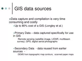
GIS-Data Sources Francisco Olivera, Ph.D., P.E. Srikanth Koka Department of Civil Engineering Texas A&M University
Introduction • It is important to know what data is needed, what format is preferred and where it can be found. • Different agencies develop and/or make available digital spatial data.
NCRS • NRCS: National Resources Conservation Service • STATGO: State Soil Geographic Database • http://www.ftw.nrcs.usda.gov/stat_data.html • Scale: 1:250,000 • SSURGO: Soil Survey Geographic Database • http://www.ftw.nrcs.usda.gov/ssur_data.html • More detailed than STATSGO • Scale: Between 1:12,000 and 1:63,360
USGS • http://seamless.usgs.gov/viewer.htm • Resolution: 30 m • Available datasets • NED: National Elevation Dataset (30 m) • NLCD: National Land Cover Dataset (1992, 2001)
USGS • http://nhd.usgs.gov/ • NHD: National Hydrographic Dataset • Vector data containing surface water features like streams, lakes, ponds, springs, etc. • Scale: 1:100,000
USGS • http://water.usgs.gov/lookup/getspatial?huc250k • HUC: Hydrologic Unit Codes • Vector data containing drainage areas • Four levels of classification: • Regions (2-digit code) • Sub-regions (4-digit code) • Accounting units (6-digit code) • Cataloging units (8-digit code)
BTS • http://www.bts.gov/gis/ntatlas/networks.html • Available data • National Parks • State Boundaries • Airports • Amtrak Stations • U.S. Army Corps of Engineers Ports • U.S. Corps of Engineers Navigable Waterway Nodes • Hydrographic Features metadata • National Highway Planning Network • Railway Network • U.S. Corps of Engineers Navigable Waterway Network
TCEQ • http://www.tceq.state.tx.us/index.html • Available Data: • Digital raster graphs (DRGs) • Monitoring sites • Permit sites • Waste sites
TNRIS • http://www.tnris.state.tx.us/digital.htm • Available Data: • Roads • Hydrography • Vegetation • DOQQs • County boundaries
TWDB • http://www.twdb.state.tx.us/mapping/gisdata.htm • Available Data: • NATURAL FEATURES • Aquifers • River Basins • HUCs • Major Basins • Texas Precipitation • ADMINISTRATIVE • Ground water conservation districts • Regional water planning areas • River authorities • Counties
GLO • http://www.glo.state.tx.us/gis/ • Available Data (for Texas): • County boundaries • Hydrography • Roads • Places, names and populations • Shorelines • Urban areas • City Boundaries • Vegetation areas • Energy resource data • Oil and Gas pipeline • Coastal/Oil Spill Response data • Coastal management program data, etc.
USGS • http://edcdaac.usgs.gov/gtopo30/hydro/ • Hydrologic Datasets for the whole world • Resolution: 30 arc-second (1 km) • Datasets: • Raster: DEM, Flow direction, Flow Accumulation, Slope, Aspect, Compound topographic index • Vector: Streams, Drainage basins
NASA • http://www.nasa.gov/home/index.html • Available Data: • Remotely Sensed Meteorological Data
ESRI • http://arcdata.esri.com/data/tiger2000/tiger_download.cfm • Available data: • Census • Congressional districts • Land marks • Hydrography • Rails • Roads
NCDC • http://www.ncdc.noaa.gov/oa/ncdc.html • Available Data: • Precipitation • Temperature • Wind
USGS • http://waterdata.usgs.gov/nwis • Real time and historic data for: • Surface water • Ground water • Water quality
Other Sources • http://data.geocomm.com/catalog/US/index.html • 10 m resolution DEM • Available only for some areas