Download
1 / 90
960 likes | 1.22k Vues
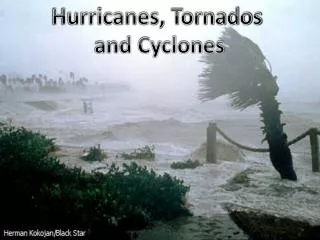
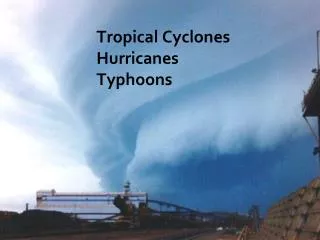
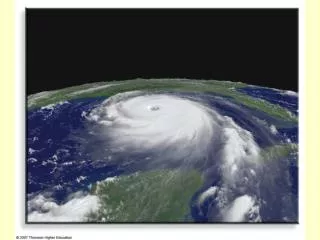
Tropical Cyclones, Hurricanes and Typhoons. Motivation (Why do we care) Definition Where and when do they occur Formation and intensity Structure Hazards. World’s Deadliest Tropical Cyclones. Of the 20 deadliest tropical cyclones, 14 have occurred in South Asia (India, Bangladesh).

E N D
Tropical Cyclones, Hurricanes and Typhoons • Motivation (Why do we care) • Definition • Where and when do they occur • Formation and intensity • Structure • Hazards
World’s Deadliest Tropical Cyclones • Of the 20 deadliest tropical cyclones, 14 have occurred in South Asia (India, Bangladesh). • The deadliest was the great Bhola Cyclone which hit Bangladesh in 1970 resulting in app. 500,000 deaths.
World’s Deadliest Tropical Cyclones • The deadliest storm in the Atlantic Basin occurred in 1780. (22,000 deaths) • Deadliest US storm was the Galveston Hurricane in 1900 which killed app. 8,000 people. • Of the 10 deadliest storms in the US, only 1 has occurred since 1957 (Katrina - 1900 dead)
What About Canada? • On average, about 4 hurricanes impact Atlantic Canada in any given year. • Deadliest hurricane in Canada occurred in 1775 when 4000 people died along the Newfoundland coast. • What about the 2nd deadliest?
Economic Impact • The most obvious impact economically speaking is the rebuilding of damaged infrastructure. • However, other costs that are less often considered include: • The cost of evacuation • The impact on energy production • The cost of severe coastal erosion.
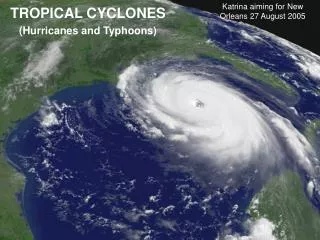
Costliest U.S. Hurricanes • Hurricane Katrina (2005) est. 81 billion dollars. • Hurricane Andrew (1992) est. 40 billion dollars. • If Andrew had made landfall 20 miles to the north, loss of life and property would have easily doubled.
Damage (wind) • Wind damage with Hurricane Andrew was extreme with wind speeds on land measured at 270 kph.
Damage (water) • While Katrina was an extremely strong hurricane while offshore, most of the damage was associated with storm surge and flooding.
Damage (water) • New Orleans is particularly vulnerable to flooding because the city itself is below sea level. • With the storm center passing to the east, most of the flooding came from Lake Pontchartrain.
Damage (water) This is a picture of flooding near Venice, Louisiana that resulted from levee failure.
Damage (water) This is a picture of damage from near Gulfport, Mississippi where the damage was from storm surge. Note that the damage resembles wind damage.
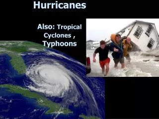
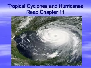
Definition • A tropical cyclone is a warm-core, low pressure system without any "front" attached, that develops over the tropical or subtropical waters, and has an organized circulation with winds of at least 120 kph (74 mph). Depending upon location, tropical cyclones have different names around the world. In the: • Atlantic/Eastern Pacific Oceans - hurricanes • Western Pacific - typhoons • Indian Ocean - cyclones
Definition • What do we mean by warm core? • Literally that the warmest air is located at the center of the storm. • This warm air is generated by a couple of different mechanisms. • Latent Heat Release
Definition • What do we mean by warm core? • Another mechanism is subsidence. As the air in the eye of the cyclone sinks, it warms due to compression.
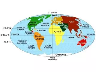
Where and When Note that tropical cyclones do not form near the equator due to the lack of the coriolis effect. Also, storms tend to curve to the north and east as they interact with the westerlies.
Where and When • The Coriolis effect is the apparent deflection of air due to the rotation of the earth. • Air, rather than flowing directly from areas of high pressure to low pressure, rotate to the right of this direction in the Northern Hemisphere.
At least 4 degrees from the equator:Coriolis force can be large enough to produce rotation(deflecting to right in the Northern Hemisphere) Before: After:
Where and When Worldwide, tropical cyclone activity peaks in late summer when water temperatures are warmest.
Where and When In general, sea surface temperatures are warmer along eastern coasts than western coasts and are warmest near Indonesia accounting for the strongest and most frequent activity.
Where and When In general, sea surface temperatures are warmer along eastern coasts than western coasts and are warmest near Indonesia accounting for the strongest and most frequent activity.
Formation and intensity • There are at least four main requirements for tropical cyclogenesis : • enough Coriolis force to develop a low pressure center, • a preexisting low-level focus or disturbance • sufficiently warm sea surface temperatures approximately 27° C at least 60 m deep. • low vertical wind shear • These conditions are necessary but NOT sufficient conditions for the formation of tropical cyclones.
Formation • A low-level disturbance is necessary to start and concentrate convection locally. • Most commonly in the Atlantic basin, the disturbances are either fronts, easterly waves or the intertropical convergence zone. Storms that develop near the coast of Africa from easterly waves are referred to as Cape Verde storms.
Formation • Since easterly waves account for about 60% of all Atlantic basin tropical cyclones, there is a relationship between West African rain and cyclone frequency.
Formation • Why is it that most easterly waves do not develop into hurricanes? • Strong descending air associated with Azores high produces an inversion inhibiting convection. • Vertical wind shear is usually too strong over the tropical Atlantic for the cloud systems to stay together. • The middle layers of the atmosphere are usually too dry.
Formation The Intertropical Convergence Zone(ITCZ), also known as the Intertropical Front, Monsoon trough, Doldrums or the Equatorial Convergence Zone, is a belt of low pressure girdling Earth at the equator. Air, convergences at the surface towards this low pressure and then rises forming a band of clouds and convection which can sometimes form tropical cyclones.
Formation The Intertropical Convergence Zone(ITCZ), migrates with the Sun towards the summer hemisphere. Note that the ITCZ is slightly displaced towards the Northern Hemisphere since there is more land mass.
Intensity • So why do we need warm sea surface temperatures? • Consider the same schematic that we saw earlier:
Intensity • There is a direct relationship between the intensity (central pressure) of the most intense hurricanes and the temperature of the sea-surface over which the storms are moving. • Note from the attached chart that the six strongest hurricanes all occurred in the western Pacific where the sea-surface temperatures are warmest.
Intensity Note that the 5 lowest pressures ever recorded in tropical cyclones all have occurred in the Pacific basin.
Intensity • Predicted maximum intensity of a hurricane based upon average ocean surface temperatures. The agreement between theory and observations is excellent, showing the importance of a warm ocean for hurricane formation.
Intensity • However, we not only need to know how warm the ocean surface is, but how deep is the warm water. That is because the storm itself can cool the sea surface by bringing up cooler water through upwelling.
Intensity • Weak wind shear: • Energy is derived from release of latent heat in the eyewall. • A concentration of energy is necessary for development • If the clouds are carried away by the high winds aloft, then the energy is no longer concentrated sufficiently for the hurricane to develop.
Intensity • Vertical wind shear of less than 10 m/s (20 kts, 22 mph) between the surface and the tropopause is required for tropical cyclone development.
Intensity • Strong wind shear can "blow" the tropical cyclone apart, as it displaces the mid-level warm core from the surface circulation and dries out the mid-levels of the troposphere, halting development.
In what sense is the wind blowing in the vicinity of the Azores High? • Counterclockwise • Clockwise • Directly towards the center • Directly away from the center • CORRECT ANSWER: • Clockwise • Reason: Winds blow clockwise around highs (anticyclones) and counterclockwise around lows (cyclones and hurricanes) in the Northern Hemisphere.
What is the cause of the relative warmth in the center (eye) of a hurricane? • Strong winds • Warm oceans • Condensation heating • Convergence • CORRECT ANSWER: • 3. Condensation heating • Reason: The phase change of condensation from water vapor to liquid water releases heat to the surrounding air in the strong updraft (rainfall) region near the center of the hurricane.
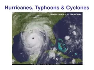
Where would you expect the most significant wind damage? • A • B • C • D • E A B C D CORRECT ANSWER: 3. C Reason: Winds blow counterclockwise around hurricanes. Therefore, the onshore winds would all be at points C, D, and E. Since the strongest winds are closest to the center, the strongest ONSHORE winds (causing the most damage) would be at C. E
Life Cycle • A tropical depression is designated when the first appearance of a lowered pressure and organized circulation in the center of the thunderstorm complex occurs. • Winds near the center are constantly between 20 (37 kph) and 34 knots (23 - 39 mph).
Life Cycle • Once a tropical depression has intensified to the point where its maximum sustained winds are between 35 (63 kph)-64 knots (39-73 mph), it becomes a tropical storm. It is at this time that it is assigned a name. • Tropical Storm Fay (2008) • Note that you can see some banding and symmetry
Life Cycle • As surface pressures continue to drop, a tropical storm becomes a hurricane when sustained wind speeds reach 64 knots (74 mph or 120 kph). A pronounced rotation develops around the central core. • Large bands of clouds and precipitation spiral from the eye wall and are thusly called spiral rain bands.
Life Cycle (North Atlantic) • Cape-Verde type hurricanes usually travel slowly westward (10-20 km per hr) and may take a week to cross the Atlantic. • Once hurricanes have reached the Caribbean or the Gulf of Mexico, they recurve to the north and generally speed up.
Life Cycle • Hurricane winds usually diminish very quickly once landfall occurs • The hurricane has lost its energy source (warm water is the fuel for the latent heating). • The increased surface roughness weakens the system with surface pressures rising, with winds decreasing. • Storms rarely remain hurricanes for more than 12-24 h after landfall.
Storm Structure • The main parts of a tropical cyclone are the rainbands, the eye, and the eyewall. Air spirals in toward the center in a counter-clockwise pattern in the norther hemisphere (clockwise in the southern hemisphere), and out the top in the opposite direction. In the very center of the storm, air sinks, forming an "eye" that is mostly cloud-free.
Storm Structure • The Eye • The hurricane's center is a relatively calm, generally clear area of sinking air and light winds that usually doesn't exceed 15 mph (24 kph) and is typically 20-40 miles (32-64 km) across. An eye will usually develop when the maximum sustained wind speeds go above 74 mph (119 kph) and is the calmest part of the storm.
Storm Structure • Theeyewall • consists of a ring of tall thunderstorms that produce heavy rains and usually the strongest winds. Changes in the structure of the eye and eyewall can cause changes in the wind speed, which is an indicator of the storm's intensity. The eye can grow or shrink in size, and double (concentric) eyewalls can form.
Storm Structure • Rainbands • Curved bands of clouds and thunderstorms that trail away from the eye wall in a spiral fashion. These bands are capable of producing heavy bursts of rain and wind, as well as tornadoes. There are sometimes gaps in between spiral rain bands where no rain or wind is found.
Storm Structure • Tropical Cyclone Size • Typical hurricane strength tropical cyclones are about 300 miles (483 km) wide although they can vary considerably. • The relative sizes of the largest and smallest tropical cyclones on record as compared to the United States.