Tropical Cyclones
Tropical Cyclones. AFWA’s role in the Tropical Cyclone analysis process for JTWC & NHC. Storm Track/Forecast. Definition: A “ FIX ” is an estimate of Tropical Cyclone (TC) weather features Consists of: Position (latitude and longitude) of Low Level Circulation Center (LLCC)


Tropical Cyclones
E N D
Presentation Transcript
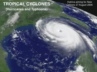
Tropical Cyclones AFWA’s role in the Tropical Cyclone analysis process for JTWC & NHC
Storm Track/Forecast • Definition: • A “FIX” is an estimate of Tropical Cyclone (TC) weather features • Consists of: • Position (latitude and longitude) of Low Level Circulation Center (LLCC) • Intensity (maximum sustained winds)
Storm Track/Forecast • Typical methods of obtaining a fix: • Meteorological Satellite (METSAT) • RADAR (Example:WSR-88D) • Aircraft Reconnaissance (Hurricane Hunters) • Synoptic Weather Observations
Storm Track/Forecast “Why does AFWA perform Tropical Cyclone fixes? NHC and JTWC are already doing this!”
Storm Track/Forecast • Reasons for additional fixes by AFWA: • Unique AFWA capabilities • World-wide DMSP data access/sensor capabilities • Replaces spotty aircraft recon availability • No aircraft in WESTPAC since 1987 • No aircraft reconnaissance in Indian Ocean • Limited recon in Atlantic/EastPac/CentPac
Storm Track/Forecast • Reasons for additional fixes by AFWA: • …(continued)… • No ground truth - high subjectivity • Large impact on final forecast • Formally requested by NHC/JTWC • Requirements validated • Backup Role for JTWC
Storm Track/Forecast The importance of an accurate fix: “But Tropical Cyclone fixes are easily done, right?” “They all have eyes…….just like Hurricane Mitch did here”
Storm Track/Forecast The importance of an accurate fix: No, not really. Even Hurricane Mitch (1998) exhibited an eye feature for merely 25% of its life-cycle. Many TC’s NEVER show an EYE!
Storm Track/Forecast The importance of an accurate fix: Here are some more typical examples. TD 19W 21Aug 00 10Z
CLOUD CANOPY OBSCURES CENTER < 25 % of systems tracked display eyes
CLOUD CANOPY OBSCURES CENTER < 25 % of systems tracked display eyes So… where’s the center?
Storm Track/Forecast Unique AFWA capabilities • DMSP Satellites • Operational Linescan System • Special Sensor Microwave Imager • Superior Data access to worldwide • locations
Infra-Red vs Microwave Imager Infrared - Cloud Canopy SSM/I - Canopy see-through Hurricane Jeanne 23 Sep 1998 F14 IR Hurricane Jeanne 23 Sep 1998 F14 SSM/I
Infra-Red vs Microwave Imager Infrared - Cloud Canopy SSM/I - Canopy see-through Hurricane Jeanne 23 Sep 1998 F14 IR Hurricane Jeanne 23 Sep 1998 F14 SSM/I SSM/I shows an eye that is more clearly defined Infrared - Cloud Canopy is not cleat-cut …... NHC/JTWC does not receive this data world-wide… … but AFWA does!
DMSP Low-Light Visual Capability There is a Tropical Cyclone in this image (really). Where is it? 1.5 NM DMSP Thermal Smooth Infra-red
DMSP Low-Light Visual Capability NOTE: Photo-Multiplier Tube (PMT) resolution is 1.5 NM. 1.5 NM DMSP Light Smooth
DMSP Low-Light Visual Capability DMSP night-time imagery - uses moonlight NOTE: Photo-Multiplier Tube (PMT) resolution is 1.5 NM. 1.5 NM DMSP Light Smooth Center
DMSP Low-Light Visual Capability NHC/JTWC does not receive this data world-wide… … but AFWA does! NOTE: Photo-Multiplier Tube (PMT) resolution is 1.5 NM. 1.5 NM DMSP Light Smooth
DMSP SSM/I Surface Winds Hurricane Jeanne 23 Sep 1998 DMSP F14
DMSP SSM/I Surface Winds Gale force winds are in Red Hurricane Jeanne 23 Sep 1998 DMSP F14
U.S. Tropical Cyclone Warning Centers AORs 180 140 NHC CPHC NHC EQ JTWC Metsat Analysis Bltns (5244) 73 % 27 % 5 Dec
U.S. Tropical Cyclone Warning Centers AORs 180 140 NHC CPHC NHC EQ JTWC No Effective DMSP data access for JTWC in these areas (green)! AFWA provides coverage here. Metsat Analysis Bltns (5244) 73 % 27 % 5 Dec
Storm Track/Forecast The importance of an accurate fix: But the NHC has aircraft reconnaissance in the Atlantic, right? Why is AFWA doing fixes there?
Storm Track/Forecast The importance of an accurate fix: Graphic - courtesy Weather Channel Here’s NHC’s AOR - at the busiest point of the season…..
Storm Track/Forecast The importance of an accurate fix: Graphic - courtesy Weather Channel Aircraft RECON Coverage Here’s the approx. area covered by aircraft RECON - nearly half their storms are not covered.
Storm Track/Forecast The importance of an accurate fix: Graphic - courtesy Weather Channel NO AIRCRAFT COVERAGE HERE!
Storm Track/Forecast The importance of an accurate fix: Graphic - courtesy Weather Channel Also, Notice how the Eastern Pacific is essentially not covered at all…...
U.S. Tropical Cyclone Warning Centers AORs 180 140 NHC CPHC NHC EQ JTWC No Aircraft RECON in these areas! AFWA fixes help offset this loss for JTWC. Metsat Analysis Bltns (5244) 73 % 27 % 5 Dec
U.S. Tropical Cyclone Warning Centers AORs 180 140 Very Limited Aircraft RECON in these areas! AFWA fixes help offset this loss for NHC/CPHC. NHC CPHC NHC EQ JTWC Metsat Analysis Bltns (5244) 73 % 27 % 5 Dec
Storm Track/Forecast The importance of an accurate fix:
Storm Track/Forecast The importance of an accurate fix: So - where’s the aircraft? RADAR? SFC OBS?
Storm Track/Forecast The importance of an accurate fix: Aircraft recon - discontinued in WestPac 1987
Storm Track/Forecast The importance of an accurate fix: WSR-88D RADAR - 240nm from GUAM and Kadena only
Storm Track/Forecast The importance of an accurate fix: WSR-88D Surface Obs - very limited in WestPac AOR.
Storm Track/Forecast The importance of an accurate fix: So - all that’s left - all too often - is two opinions about the location of the LLCC
Storm Track/Forecast The importance of an accurate fix: Which two opinions? JTWC and AFWA!
Storm Track/Forecast The importance of an accurate fix: If you pick “A”, Guam is threatened in 24 hrs... But not if you pick “B”
Storm Track/Forecast The importance of an accurate fix: Gale winds here in green
Storm Track/Forecast The importance of an accurate fix: This could be the difference between getting aircraft & ships sortied (evacuated) on-time or too late! So the choice matters!
Storm Track/Forecast The importance of an accurate fix: This could be the difference between getting aircraft & ships sortied (evacuated) on-time or too late! The overall confidence in a single fix is never high - unless it’s an EYE.
Storm Track/Forecast The importance of an accurate fix: This could be the difference between getting aircraft & ships sortied (evacuated) on-time or too late! If we selected a position in-between the two subjective position estimates….
Storm Track/Forecast The importance of an accurate fix: ….then we have a higher probability of being correct…….
Storm Track/Forecast The importance of an accurate fix: ….or at least not too too far off…....
Storm Track/Forecast The importance of an accurate fix: Most Likely ….when compared to the other two forecasts.
Storm Track/Forecast The importance of an accurate fix: EXTREME Most Likely EXTREME ….when compared to the other two forecasts.
Storm Track/Forecast Formalized Requirements
Storm Track/Forecast Formalized Requirements TYPE OF SUPPORT REQUESTED: {JTWC} a. Tropical cyclone center (position) fixes, including positions using Special Sensor Microwave/Imager (SSM/I) and Tropical Rainfall Measurement Mission (TRMM) data for systems 25 knots and/or meeting a minimum Dvorak current intensity of T1.0. Tropical cyclone intensity and SSM/I 35-knot wind radii, as appropriate, from all meteorological satellite imagery in the Global Satellite database to include high-resolution geostationary images….. b. Tropical cyclone center (position) fix bulletins from SSM/I-only DMSP or TRMM-only for known systems 25 knots and/or meeting a minimum Dvorak current intensity of T1.0.
Storm Track/Forecast Formalized Requirements • {JTWC - Continued} • c. Upon telephone request by the JTWC Typhoon Duty Officer (TDO) or the JTWC METSAT analyst, provide position fixes for tropical disturbances less than Dvorak T1.0. For these systems: • Indicate the latitude/longitude of the center position • Enter "X.X" for the final-T and explain in remarks that the system does not meet Dvorak classification requirements • The "INIT OBS" remark will not be issued until a Dvorak intensity of T1.0 is reached; at this time commence normal Dvorak rules • If a system has previously been classified using Dvorak rules and a center position can no longer be defined, enter "X.X" for the final-T and hold the current intensity of the system up according to Dvorak rules and constraints. This will alleviate the "early killing" of systems associated with undetermined positions on nighttime infrared imagery.
Storm Track/Forecast Formalized Requirements {JTWC - Continued} d. METEOSAT, GMS and GOES tropical cyclone metwatch over the Indian and Pacific Oceans using all available imagery. Suspect areas must be aggressively identified where convection persists for 12 hours or where low-level circulation centers can be observed or inferred. Notification of suspect areas will be made via tropical cyclone fix bulletins and telecon with JTWC.
Storm Track/Forecast Formalized Requirements