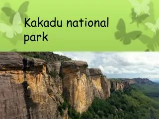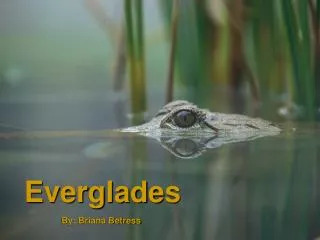
Everglades National Park - Miami Discount Tours
10 likes | 172 Vues
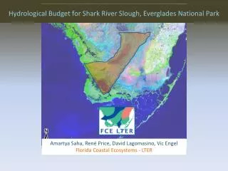
Everglades National Park http://www.miamidiscounttours.com/

Everglades National Park - Miami Discount Tours
E N D
Presentation Transcript
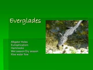
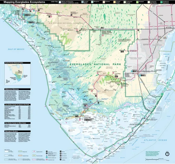
Mapping Everglades Ecosystems Mapping Everglades Ecosystems Mapping Everglades Ecosystems color key color key color key Marine and Estuarine Marine and Estuarine Marine and Estuarine (seagrass, har (seagrass, hardbottom, corals) dbottom, corals) (seagrass, hardbottom, corals) Coastal Coastal Coastal Marsh Marsh Marsh Mangr Mangrove Mangrove ove Cypr Cypress Cypress ess Coastal Coastal Coastal Prairie Prairie Prairie Freshwater Fr Freshwater eshwater Slough Slough Slough Pineland Pineland Pineland Freshwater Fr Freshwater eshwater Marl Prairie Marl Prairie Marl Prairie Har Hardwood dwood Hammock Hammock Hammock Hardwood Coe Visitor Center to Tampa 268 mi 431 km To Naples 25 mi 40 km Big Cypress Bend 95 29 826 839 841 41 Pumpkin Bay Carnestown Water Conservation Area 3A H.P. Williams Roadside Park Ochopee East River Daniels Pt Halfway Creek Canoe Trail Fake Union Bay Ferguson River Visitor Center Gulf Coast Turner River Canoe Trail Big Cypress National Preserve Visitor Center 27 Fakahatchee Bay HARDWOOD HAMMOCK 29 TEN Tamiami Trail Monument Lake Barron Dade-Collier Training and Transition Airport River EVERGLADES CITY Water Conservation Area 3B Kirby Storter Roadside Park Fakahatchee Pass West Pass HIALEAH Chokoloskee 95 821 Monroe Station 41 Bay Midway Tiger Key Round Key 997 CYPRESS Picnic Key Sandfly Island Indian Key Pass Kingston Key CHOKOLOSKEE 112 THOUSAND Key Sunday Bay Chickee Indian Key Miami Florida's Turnpike B I G C Y P R E S S N A T I O N A L P R E S E R V E International Airport Sunday Bay River Lopez River Chokoloskee Pass Comer 836 Lopez Rabbit Key Pass Turtle Key Lumber Key Rabbit Key 836 Miccosukee Cultural Center Loop MIAMI Wilderness Le Jeune Rd Oyster Bay Tree Snail Hammock Tamiami Trail Pinecrest Road (scenic drive) 41 41 House 94 Huston Bay Hammock Tamiami Ranger Station Loop Road Mitchell Landing Shark Valley Visitor Center Bobcat Boardwalk Otter Cave Hammock Trail Bay Sweetwater Bay Chickee 826 Waterway Huston River 1 Crate Key Loop Road Education Center ISLANDS Key Last Huston Bay The Deer Island Watson Place Chatham River Pavilion Chevelier Bay Duck Rock Cove Gun Rock SOUTH MIAMI PINELAND Tram Tour 874 CORAL GABLES Darwins Place (toll road) Cannon Bay Storter Bay N Kendall Drive Pt Not all lands inside the authorized boundary for the northeastern corner of the park have been acquired by the Federal Government. SLOUGH Opossum Key Chatham Bend 94 KENDALL Mormon Key Gopher Key Dads Bay Alligator Bay Crab Key Bight URBAN Kendall-Tamiami Executive Airport Observation Snake Key Krome Avenue DEVELOPMENT ZONE Tower Plate Creek Bay Plate Creek Bay Chickee New Turkey Key Turkey Key RIVER Lostmans Five Bay Lostmans Five Bay Buzzard Key GULF OF MEXICO North Plover Key Two Island Bay Onion Key Mullet Bay Plover Key Chekika Richmond Drive SW 168th Street Bird Key Alligator Authorized Park Boundary SHARK 997 Pt Rocky Creek Bay BISCAYNE Third Bay Wood Key Willy Willy Big Second Hog Key BAY Lostmans Bay Bay Waterway AGRICULTURAL AND RURAL DEVELOPMENT ZONES Lostmans River FRESHWATER SLOUGH 1 First Bay 821 Lostmans Rogers River Bay Chickee Key Black Pt South Florida National Parks South Florida National Parks South Florida National Parks KEY MCLAUGHLIN BISCAYNE E V E R G L A D E S N AT I O N A L PA R K Highland The Cutoff Lake Pt NATIONAL Intracoastal Okeechobee Homestead Air Reserve Base Broad Highland Beach H SW 137th Ave g i Homestead Airport RIVER a l h FRESHWATER MARL PRAIRIE Camp Lonesome PARK River n BROAD d B e Broad River a River c Convoy Point Visitor Center h HOMESTEAD Wood Big Cypress National Preserve North Canal Drive SW 328th Street Pa-hay-okee Overlook Pinelands Rookery Branch Ernest F. Coe Visitor Center Park Headquarters Rock Reef Pass Otter Creek Long Pine Key Creek Broad FLORIDA CITY North Harney R Turkey Pt Biscayne National Park RIVER Long HARNEY Pine Harney River Chickee Canepatch Pine Glades Lake Park Elliott Key TARPON BAY EVERGLADES NATIONAL Entrance Station COASTAL MARSH Card Sound Road Key Trail Rubicon Keys PARK 9336 Dry Tortugas National Park Mangrove Pt Fire Cache Graveyard Creek Long Arsenicker Key RIVER Caesar Creek Shark Pt Sisal Pond Daniel Beard Center River Hidden Lake Education Center Totten Key Royal Palm Visitor Center Anhinga Trail Gumbo Limbo Trail SHARK Old Rhodes Key Ficus Pond Shark River Chickee PONCE DE LEON BAY Watson Habitat restoration area River River River Broad Creek North North River Chickee Watson River Chickee CARD SOUND Shark Wilder Wilderness W ness Waterway Wilderness Waterway aterway Mahogany Hammock Ernest Coe Shark Old Ingraham River Island The Cutoff Card Pt Oyster Bay Angelfish Key Little Sweet Bay Pond and overhanging foliage in some areas. The route takes a minimum of six hours with an outboard motor or seven days by canoe. One-day round trips are not advised. Campsites are available on the route; backcountry per- mits are required. A well–marked inland water route runs from Flamingo to Everglades City. Sequentially numbered markers guide you along its 99 miles (160 kilo- meters). Boats more than 18 feet (6 meters) long or with high cabins and windshields should not attempt the route because of narrow channels Wilderness Roberts River Chickee Oyster Bay Chickee CYPRESS TAYLOR SLOUGH 1 HAWK CHANNEL Roberts Paurotis Pond WHITEWATER Bay Waterway Midway Keys MANGROVE Toll bridge Lane Bay Chickee Joe River Chickee Big Sable Creek Mud Bay Middle Key Nine Mile Pond Canoe Trail Pearl Bay Chickee Hells Bay Chickee CROCODILE LAKE NATIONAL WILDLIFE REFUGE Turtle Reef Short Key C A P E Manatee Bay LARGO Nine Mile Pond Main Key Turtle Harbor Lard Can Joe River South Joe River Chickee Hells Bay Canoe Trail Sound BARNES SOUND West Lake Restrooms Carysfort Reef Noble Hammock Canoe Trail Joe Bay Coe V Coe Visitor Center to Ar isitor Center to Areas in the Park Coe Visitor Center to Areas in the Park eas in the Park Long Northwest Cape 905 Little Thursday Pt Trout Cove Blackwater Sound Royal Palm Visitor Center Long Pine Key Pinelands Pa-hay-okee Overlook Mahogany Hammock Paurotis Pond Nine Mile Pond West Lake Flamingo Visitor Center Key Largo Ranger Station Chekika Shark Valley Gulf Coast Visitor Center 4mi 6mi 7mi 13mi 20mi 24mi 27mi 31mi 38mi 38mi 26mi 50mi 92mi 6km 10km 11km 21km 32km 39km 43km 50km 61km 61km 42km 80km 148km Tarpon Creek Coot Bay Cuthbert Lake JOHN West Lake Davis Cove Cross Key Alligator Bay Largo Little Fox Lake Middle Fox Lake East Fox Lake PENNEKAMP CORAL REEF STATE PARK Pt Seven Palm Lake K EY Snake Bight Trail Canoe Trail S A B L E Pond Snipe Pt Little Madeira Bay Coot Bay Henry Lake Long Lake Deer Key Cattail Lakes Mud Lake Canoe Trail Middle Cape Canal Alligator Creek Mrazek Pond Row dy The Monroe Lake The Lungs COASTAL PRAIRIE Duck Key Homestead Garfield Bight Boggies Canal Trail Lake Blackwater Sound Boggy Key Eagle Key Middle Lake Bear Lake Bend Middle Cape Rattlesnake Key Bear Lake Canoe Trail Snake Bight Tern Key Ingraham Buttonwood Canal Flamingo Porpoise Pt Rankin Bight Terrapin 1 North Nest Key Santini Bight Madeira Bay Terrapin Pt Pass Key Bay Derelict Key Crocodile Pt Mosquito Pt Christian Point Trail Flamingo Visitor Center Otter Key The Elbow Shark Pt Coastal Prairie Trail Nest Keys Lake Key Porjoe Key Largo Sound John Pennekamp Coral Reef State Park Visitor Center Umbrella Madeira Pt Eco Pond El Radabob Key Key Big Key Joe East Cape Canal Whaleback Key Bradley Rankin Key Clubhouse Beach Park Key Triplet Keys Kemp Key Black Betsy Keys Key East Cape Buoy Key Shell Key Buttonwood Sound Dump Keys Camp Key Murray Key Samphire Keys Palm Key Club Key Cormorant Key Bob Keys Middle Ground Oyster Keys Frank Key Coe V Coe Visitor Center to Other Ar isitor Center to Other Areas Coe Visitor Center to Other Areas eas Swash Keys Catfish Key Curlew Key Roscoe Key Brush Keys End Key KEY LARGO Key Largo Ranger Station (between mile markers 98 and 99) Russell Key 11mi 45mi 135mi 18km 72km 217km Buttonwood Keys Homestead Miami International Airport Key West Clive Key Pelican Keys Jim Foot Key Pt Charles Bottle Key Dildo Key Bank Coon Key Manatee Key Stake Key Authorized Park Boundary Dildo Key First National Bank Dead Terrapin Key Whipray Basin Johnson Key Low Key Carl Ross Key Calusa Keys Whipray Keys Rodriguez Key Topsy Key French Reef Message to Boaters Message to Boaters Message to Boaters Sandy Key Man of War Key Cluett Key Corinne Key Man of War Channel Bob Allen Keys Sid Key Captain Key are closed to landings unless otherwise designated. Com- mercial fishing is prohibited in the park. Recreational fishing requires a license in both freshwater and salt- water. Where backcountry camping is allowed, a camp- ing permit is required. Do not use this map for navi- gation. For safe boating, Nat- ional Ocean Survey charts are indispensable. Charts 11430, 11432, 11433, 11451 are for sale at the Coe Visitor Center, Flamingo, and in the Everglades City area. Keys and beaches in Florida Bay FLORIDA BAY Molasses Reef Pollock Keys FLORIDA KEYS Spy Key Crane Keys Tavernier Oxfoot Bank NATIONAL MARINE SANCTUARY Panhandle Key Tavernier Creek HAWK CHANNEL East Key Rabbit Key Basin Crab Keys Tavernier Key Pickles Reef Twin Key Bank Schooner Bank Little Rabbit Key Rabbit Keys Gopher Keys Plantation Plantation Key West Key A T L A N T I C O C E A N Ninemile Bank Twin Keys Conch Reef The Rocks Whale Harbor Channel Snake Creek Windley Key Barnes Key Upper Arsnicker Keys Islamorada Shell Key Davis Reef Peterson Keys Lower Arsnicker Upper Matecumbe Key Lignumvitae Key State Aquatic Preserve Keys Buchanan Keys Crocker Reef Arsenic Bank Water Depths Sprigger Bank 0-3 feet (0-1 meter) Lignumvitae Key North Most of the land and submerged areas in Everglades National Park are in the congressionally designated Marjory Stoneman Douglas Wilderness Area. Teatable Key Marina Picnic area National Park Service campground National Park Service primitive campsite Hiking trail Lighted marker Indian Key Gas station Tripod Bank 3-6 feet (1-2 meters) Waterway Boat launch Unpaved road Canal and gate FLORIDA KEYS NATIONAL MARINE SANCTUARY Lower Matecumbe Key Alligator Reef Private campground Food service Fiesta Key Anne's Beach 1 1 5 10 Kilometers 0 More than 6 feet (more than 2 meters) Wildlife protection area (closed to public) Wilderness Water- way and canoe trail Intracoastal Channel 5 Interpretive trail Lodging 0 1 5 10 Miles Long Key To Key West 70 mi 112 km