Download
1 / 15
150 likes | 289 Vues
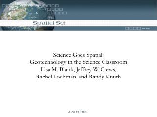
Science Goes Spatial: Geotechnology in the Science Classroom Lisa M. Blank, Jeffrey W. Crews, Rachel Loehman, and Randy Knuth. = A. = F. = B. = G. = C. = H. = D. = I. = E. Spatial Thinking. A.

E N D
Science Goes Spatial: Geotechnology in the Science Classroom Lisa M. Blank, Jeffrey W. Crews, Rachel Loehman, and Randy Knuth
= A = F = B = G = C = H = D = I = E Spatial Thinking
Spatial thinking must be recognized as a fundamental part of K-12 education and as an integrator and a facilitator for problem solving across the curriculum. With advances in computing technologies and the increasing availability of geospatial data, spatial thinking will play a significant role in the information- based economy of the 21st-century. Using appropriately designed support systems tailored to the K-12 context, spatial thinking can be taught formally to all students. A geographic information system (GIS) offers one example of a high-technology support system that can enable students and teachers to practice and apply spatial thinking in many areas of the curriculum (National Research Council, 2005).
In the recently released proceedings from the National Science Teachers Association (http://science.nsta.org/enewsletter/lmr.pdf), an alarming trend was noted: “. . . new and emerging technologies, which help shape the future of science and discovery, are making their way into the K-12 curriculum in a belated or “back-door fashion,” if at all. Technologies that are developed for business applications are being adapted, at best, in a makeshift fashion for educational use. . . For the US to maintain its leadership position in the new information-based world economy . . . emerging technologies with science education potential must be made available to students and teachers.
Overall GTEC Goal: Contribute to a national model that improves the teaching and learning of science in grades 5-12 using geotechnologies.
Earth Observing Systems Education Project (EOS) • GIS4MT • 235 participating schools • Introductory GIS trainings across Montana • Obstacles to full implementation of GIS • Onsite Support • Data sets
GTEC Project Goals: • Increase student interest in science, technology and geotechnologies; • Develop student mastery in using geospatial technologies when solving real-world interdisciplinary problems; • Prepare students for careers in geospatial technologies; • Increase teacher comfort in use of geotechnologies in classroom; • Help teachers infuse geotechnologies into classroom instruction; • Build a national model for introducing geospatial technology to improve 5-12 science teaching and learning.
GTEC is a teacher training model that sustains the use of geospatial technology within Montana classrooms, positions Montana science classrooms as leaders in geotechnology education, and transfers to other sites across the country. • Develop geotechnology educator leadership teams; • Generate spatial data sets that are appropriate for use with school-aged audiences and aligned with national science education standards; • Establish a system of support for dissemination of geospatial applications in the 5-12 science classroom including interactive website, help desk and bi-annual video conferencing; • Found a statewide geospatial technology competition; • Disseminate a national model for introducing geospatial technology to improve 5-12 science teaching and learning
GTEC Outcomes • Explore geospatial resources being used by research scientists across Montana • NTSG – Faith Ann Heinsch and Rachel Loehman • DBS – Bill Granath • FLBS – Niels Maumenee • Precision Agriculture – Bob Rumney • Share work with school district via an in-service workshop
Create geospatial module using GIS data • ESRI Template • Global Climate Change • Two week module • Implement geospatial module in your classroom during the 2006-2007 academic year • Video tape GIS lesson highlighting student use of geospatial data set generated from GTEC summer institute • Participate in pilot student GIS competition spring 2007
GTEC Support • $2000 teacher stipend • $500 classroom mini grant • Four two-hour workshop sessions via video conference: • Weekly help desk support • Graduate credit or OPI hours
Geospatial Careers http://geospatialcareers.net/