DAMS & DIKES/LEVEES
DAMS & DIKES/LEVEES. JACK FORRISTEL. 1.2M Square miles. (CA is 158,647 Square miles). Santa Clara Valley Watershed. 5 individual watersheds 10 reservoirs 168,914 af storage capacity 3.7% of Shasta 0.6% of Lake Mead. Headwaters Of The Mississippi River Lake Itaska, Minnesota.

DAMS & DIKES/LEVEES
E N D
Presentation Transcript
DAMS & DIKES/LEVEES JACK FORRISTEL
1.2M Square miles (CA is 158,647 Square miles)
Santa Clara Valley Watershed • 5 individual watersheds • 10 reservoirs • 168,914 af storage capacity • 3.7% of Shasta • 0.6% of Lake Mead
The RiverEnd To End • 2,341 mi long • 3rd largest in world • One drop takes 90 days to reach the Gulf • Flow is 1.2 mph at source and 3 mph at mouth • 1,475 elevation drop from top to bottom
MississippiDelta • 7,000 years to create. 80 years to control. • Note channel which has “meandered” over the years. • 5.5 MGPS (= 46’ deep x 1228” long x 230’ wide pools every second). • 160M Tons of sediment per year exit the delta and is deposited beyond the continental shelf.
Interesting Facts • 1927 floods covered 27,000 sq mi, caused 200 deaths and displaced 600,000 people. • Congress mandated Corp Of Engineers to control flooding and enhance navigation. Dams and dikes/levees followed. • At New Orleans, river is 1/2 mile wide and 200 ft deep. • Total system has 12,300 miles of waterways. • River is navigable to Minneapolis-St. Paul. • Opened central US to foreign markets and provided competitive/economical transportation system. • Carries 160,000,000 tons of sediment per year to the Gulf. Most flows over the continental shelf to deep water rather than being dispersed and deposited within the wet-lands.
Dams On Upper River • 29 dams on upper river control depth to 9 ft min • Specifically installed to aid navigation - not flood control • During floods, gates are opened • Each dam has locks attached • Tributaries have dams to control flooding & aid navigation
Reasons For Damming Bonneville Dam, Oregon Flood Control Mississippi River Navigation
Reasons For Damming Almaden Community Water-Recreation Hetch Hetchy Community Water (Only)
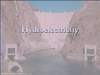
Reasons For Damming Shasta Dam Hydroelectric Generation
Negative Impacts of Dams & Levees • Fisheries may be interrupted by interfering with spawning and water temperatures changes. • Takes away land from other uses • Potential for precluding archeological research • Detract from natural setting • Increased evaporation of surface water • Silting effects all dams • Other you may think of
Levee Types • Mainline & Tributary Levee: Parallels main channel • Ring Levee: Encircles an area • Setback Levee: Backup to existing levee • Sub Levee: Control under seepage • Spur Levee: Protects main levee by directing current riverward
Levees • Mississippi River has 1,602 miles of 25 ft high levees • Sacramento Delta has 1,100 miles of 20 ft high levees controlling flow or isolating land from five rivers: Sacramento - San Joaquin - Mukelumne - Cosumnes - Calaveras • 47% of states total water runoff flows through the Sacramento Delta • South Bay has many miles of very low levees which isolate the evaporation ponds
Commerce • 12 rivers support the commerce of the river system. They are the Ohio, Missouri, Illinois, Arkansas, Tennessee, Cumberland, Green/Baren, Konawha, Kentucky, Monongahela, Allegheny, Clinch. • Total system contains 12,300 miles of waterways. • Generates $284B annually to the economy. • New Orleans is largest grain port in the world. • Grains, coal, coke, petroleum products, sand, gravel, salt sulphur, chemicals and others.
Transportation • Integrated tows can be composed of 40 or more 1,000T barges carrying 200,000 barrels of petroleum. An average though would be 15 barges which is equal to a 3 mile long train or 34 miles of 18 wheelers. • Between 31 July and 12 August there were 636 barges within the system. 321 were traveling upstream while 315 were going down stream.
JTO Dam Demonstration • Very poor description in the teachers edition. • From others, try 6 Fettucine, 12 Spaghetti, 3/8 C flour & 1 tsp Salt. • Objective is to test strength of various types at constant elevation • Let imaginations run wild