Download
1 / 17
170 likes | 339 Vues
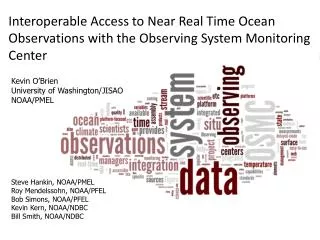
Interoperable Access to Near Real Time Ocean Observations with the Observing System Monitoring Center. Kevin O’Brien University of Washington/JISAO NOAA/PMEL. Steve Hankin , NOAA/ PMEL Roy Mendelssohn, NOAA/ PFEL Bob Simons, NOAA/ PFEL Kevin Kern, NOAA/ NDBC Bill Smith, NOAA/ NDBC.

E N D
Interoperable Access to Near Real Time Ocean Observations with the Observing System Monitoring Center Kevin O’Brien University of Washington/JISAO NOAA/PMEL Steve Hankin, NOAA/PMEL Roy Mendelssohn, NOAA/PFEL Bob Simons, NOAA/PFEL Kevin Kern, NOAA/NDBC Bill Smith, NOAA/NDBC
OSMC background • Database of data and metadata (“realtime”) • GTS -- primary source • Data begins in June, 2004 • 800 million observations from 40K platforms
OSMC tools Monitoring Planning Reporting
What about the data? • Is it useful? • Timely • QC’d data can take months to become available • Forecast models could utilize NRT data to improve their forecasts • Can be used to identify problems with platforms
What about the data? • How do I get to it? • Grab data from GTS • What’s that and how can I connect to it? • What headers do I need? • What format will it be in? • How do I decode the data?
What about the data? • Yes, let’s make it available • How to do so responsibly? • In an interoperable way? Use ERDDAP
ERDDAP • Out of Pacfic Fisheries Environmental Lab • Roy Mendelsohnn, Bob Simons • Data server that provides services • Can ingest and serve data in many common formats • Has a Web page for humans, but utilizes RESTful Web services • Crucial for machine to machine access IN OUT
Oracle Points CF 1.6 Discrete Sampling Geometry features Profiles Surface Trajectories Time Series
Accessing the data • Work flow for real-time ESPreSSO ROMS 4DVar John Wilkin Rutgers Ocean Modeling Group MARACOOS • 72-hour forecast NAM-WRF0Z cycle at 2 am EST [NCEP NOMADS] • RU regional CODAR product – hourly: 4-hour latency delay [RU TDS] • RU glider T,S when available (seldom) (~ 1 hour delay) [RU TDS] • USGS daily average flow available 11:00 EST [USGSwaterdata] • AVHRRIR passes 6-8 per day (~ 2 hour delay) [MARACOOS TDS] • REMSS MW-IR blended SST daily average [PO-DAAC] • HYCOMNCODA 7-day forecast updated daily [NRL] • Jason-2 along-track SLA (4 to 16 hour delay for OGDR) [RADS] • SOOPXBT/CTD, Argo floats, NDBC buoys on GTS[OSMCERDDAP]
Work flow for real-time ESPreSSO ROMS 4DVar Analysis interval is 00:00 – 24:00 UTC • Input pre-processing starts 01:00 EST • Input preprocessing completes approximately 05:00 EST • 4DVAR analysis completes approx 08:00 EST • 24-hour analysis is followed by 72-hour forecast using NCEP NAM 0Z cycle from NOMADS GDS at 02:30 UT (10:30 pm EST) • Forecast complete and transferred to THREDDS by 09:00 EST • Effective forecast is ~ 60 hours ESPreSSO We overlap analysis cycles, performing a new analysis and new forecast every day *Experimental System forPredicting Shelf andSlope Opticswww.myroms.org/espresso
Accessing the data http://osmc.noaa.gov/erddap/tabledap/OSMCV4_DUO_SURFACE_TRAJECTORY.nc? platform_id,platform_code,platform_type,time,longitude,latitude,sst &platform_type=“DRIFTING BUOYS (GENERIC)” &time>=2013-1001T00:00:00Z&time<=2013-10-31T00:00:00Z Live Access Server netCDF file
Accessing the data http://osmc.noaa.gov/erddap/tabledap/OSMCV4_DUO_SURFACE_TRAJECTORY.nc? platform_id,platform_code,platform_type,time,longitude,latitude,sst &platform_type=~“DRIFTING BUOYS (GENERIC)|VOSCLIM” &time>=2013-1001T00:00:00Z&time<=2013-10-31T00:00:00Z Live Access Server netCDF file
Accessing the data http://osmc.noaa.gov/erddap/tabledap/OSMCV4_DUO_SURFACE_TRAJECTORY.kml? platform_code,platform_type,time,longitude,latitude,sst &platform_code=56568 &time>=2013-11-01T00:00:00Z Google Earth kml file
Accessing the data Google Earth kml file
Accessing the data http://osmc.noaa.gov/erddap/tabledap/OSMCV4_DUO_SURFACE_TRAJECTORY? platform_code,time,longitude,latitude,sst &time>=2013-11-28T00:00:00Z&time<=2013-11-29T00:00:00Z &longitude>=50&longitude<=100 &latitude>=-10&latitude<=21 iPython notebook OPeNDAP URL
Moving Forward • Improve performance • Use ERDDAP to create DSGnetCDF files • Ingest those files back into ERDDAP • Create access to dataset based upon the netCDF files • Include delayed-mode data • Serve through ERDDAP • Allow comparison between NRT and delayed mode data
Thank you! • OSMC: www.osmc.noaa.gov • OSMCERDDAP: osmc.noaa.gov/erddap/ • ERDDAP: coastwatch.pfeg.noaa.gov/erddap/ • LAS: ferret.pmel.noaa.gov/LAS Kevin.M.O’Brien@noaa.gov