Download
1 / 19
190 likes | 456 Vues
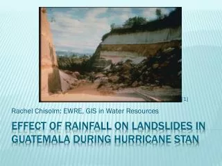
Rachel Chisolm : EWRE, GIS in Water Resources. [1]. Effect of Rainfall on landslides in Guatemala during hurricane stan. Where in the world is Guatemala?. [2]. Background. [3]. [4]. October 1-4, 2005. Path of hurricane/tropical storm Stan. [5]. Topography of Guatemala.

E N D
Rachel Chisolm: EWRE, GIS in Water Resources [1] Effect of Rainfall on landslides in Guatemala during hurricane stan
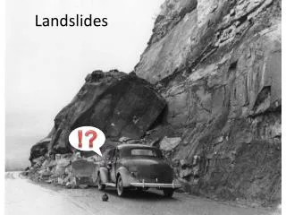
Background [3] [4]
October 1-4, 2005 Path of hurricane/tropical storm Stan [5]
Topography of Guatemala Data downloaded from USGS Global 30 arc-second Elevation Dataset (GTOPO30)
Rainfall during stan • Up to 34 inches of accumulated rain from October 1-10, 2005 • Up to 10.5 inches of rain in a 24 hour period (6 in. at higher elevations where the majority of landslides occurred) [6]
Precipitation Trends in Guatemala Rainy Season Dry Season
A STABILITY INDEX APPROACH TO TERRAIN STABILITY HAZARD MAPPING Measures slope stability taking into account wetness, slope, and soil cohesion Factor of Safety: SInmap [7] Cr= root cohesion; Cs= soil cohesion; θ = slope angle; ρs= wet soil density; ρw= density of water; g = gravitational acceleration; D = vertical soil depth; DW = vertical height of water table; φ = internal friction angle of soil
Elevation and Precipitation Effects on Landslides During Stan Accumulated Precipitation
Areas with the greatest slope combined with higher precipitation levels saw the highest concentration of landslides. Need more refined DEM to accurately map potential landslide areas. Couple with field work. Conclusions
http://www.smate.wwu.edu/teched/geology/GeoHaz/eq-general/eq-general-14.JPGhttp://www.smate.wwu.edu/teched/geology/GeoHaz/eq-general/eq-general-14.JPG http://www.retiredexpat.com//map-central-america.php http://english.peopledaily.com.cn/90001/90777/90852/6454594.html http://www.javno.com/en/world/clanak.php?id=167091 Byron Yury Medina, Fundación Defensores de la Naturaleza, Deslizamientos e ImpactosAmbientales de los Huracanes Mitch y Stan, en Guatemala, http://hercules.cedex.es/hidraulica/PROHIMET/Br07/Comunicaciones/Medina.pdf Resumen del ImpactoAsociado al Huracan “Stan” en Guatemala, Instituto Nacional de Sismología, Vulcanología, Meteorología e HidrologíaI (INSIVUMEH), Octubre de 2005. SINMAP User’s Manual, R.T. Pack, et al, Utah State University http://www.oxfamamerica.org/newsandpublications/news_updates/archive2005/news_update.2005-10-12.9620309335 References
Questions??????? [8]