Download
1 / 40
410 likes | 570 Vues
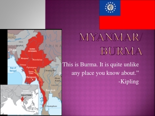
Building Basemaps in the Warzones of Southeast Burma (Myanmar). Joshua Ryan GEOG 596A: May 2014 Advisor: Anthony Robinson. Agenda. Project Motivation and Background Data Collection, Collation, and Merging Identifying Gaps Analysis & Adoption The Final Product Questions.

E N D
Building Basemaps in the Warzones of Southeast Burma (Myanmar) Joshua Ryan GEOG 596A: May 2014 Advisor: Anthony Robinson
Agenda Project Motivation and Background Data Collection, Collation, and Merging Identifying Gaps Analysis & Adoption The Final Product Questions
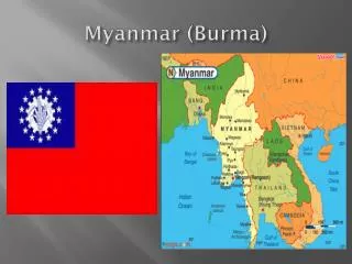
Burma Location China India Burma
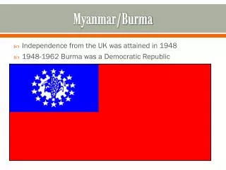
Burma History 1948 – Burma gains Independence from Britain 1949 – Karen National Union (KNU) starts fight for independence (third largest ethnic group) 1962 – Burma Army led a Coup 1988 – Student Uprising crushed 1990 – Aung San SuuKyi won election, put under house arrest 1995 – KNU capital falls to Burma Army 2010 – Elections held, former General TheinSein wins 2011 – KNU signs Cease-fire
Basic Burma Statistics Burma’s economy is ranked 161 of 187 countries according to the IMF Burma health expenditure rate is ranked 189 of 194 countries according to WHO
Project Partners - FBR A multi-ethnic humanitarian service movement seeking to bring help, hope, and love to people in the war zones of Burma. Much of the GPS information was gathered by Rangers . They have teams in all areas of Northern Karen State (FBR, 2014).
Project Partners - FBR Field computer for use in communications and data entry Rangers learning how to use the GPS for reporting and land navigation usage
Project Partners - KDHW Karen Department of Health and Welfare Local ethnic organization responsible for all health related activities in Karen State, Burma. Has recently started a vaccination program.
No Basemaps • Large sections of the ethnic areas have no cold chain due to poor transportation networks • Known outbreaks of vaccine curable diseases • 2008 – Measles affected 512 children and killed 4 • 2014 – Whooping Cough at JSMK • However, no accurate dataset of existing villages could be found.
Project Purpose Research Area To develop a complete geospatial dataset of the villages and transportation networks located in the jungles of South-East Burma.
Project Timeline • 2013 – prefatory work • 2014 – • January: Survey Trip into Burma for Data Collection • February – April: Data Collation & Cleaning • May – June: Spatial Analysis and Fill in the Gaps • July: Encouraging Organizational Use of Improved Spatial Data • October 30 – November 1: Present at International Conference on Humanitarian Medical Missions in Singapore.
Data Collection, Collation, and Merging
Origin of village data-sets MIMU Map KED Map
January Survey Trip Map used during interview Jungle School of Medicine – Kawthoolei 15 students and teachers interviewed
Survey Questions • Other questions – how long to walk between villages in areas with which you are familiar? Initial question – how long is it to walk from where we are now to the nearest village?
Data Collation and Merging Looked for straight equivalence and merged if name was exact and the Lat/Longs were either exact or close - 350 duplicates removed. Looked for Identical Lat/Long - Merged if names seemed to match - 125 duplicates removed Sort by name, look for villages with no Lat/Long and see if local names match. - 26 duplicates removed HsawHtee township villages were duplicated in one of the original files - 57 duplicates removed Look on map to find duplicates - 154 duplicates removed Clean up security areas, add JSMK - 10 removed OSM map used to delete villages under water - 3 removed - Total = 2505. 3230 Total Places -> Merged/deleted down to 2505 Places
Data Collation and Merging Looked for straight equivalence and merged if name was exact and the Lat/Longs were either exact or close - 350 duplicates removed. Looked for Identical Lat/Long - Merged if names seemed to match - 125 duplicates removed Sort by name, look for villages with no Lat/Long and see if local names match. - 26 duplicates removed HsawHtee township villages were duplicated in one of the original files - 57 duplicates removed Look on map to find duplicates - 154 duplicates removed Clean up security areas, add JSMK - 10 removed OSM map used to delete villages under water - 3 removed - Total = 2505. 3230 Total Places -> Merged/deleted down to 2505 Places
Data Collation and Merging Looked for straight equivalence and merged if name was exact and the Lat/Longs were either exact or close - 350 duplicates removed. Looked for Identical Lat/Long - Merged if names seemed to match - 125 duplicates removed Sort by name, look for villages with no Lat/Long and see if local names match. - 26 duplicates removed HsawHtee township villages were duplicated in one of the original files - 57 duplicates removed Look on map to find duplicates - 154 duplicates removed Clean up security areas, add JSMK - 10 removed OSM map used to delete villages under water - 3 removed - Total = 2505. 3230 Total Places -> Merged/deleted down to 2505 Places
Data Collation and Merging Looked for straight equivalence and merged if name was exact and the Lat/Longs were either exact or close - 350 duplicates removed. Looked for Identical Lat/Long - Merged if names seemed to match - 125 duplicates removed Sort by name, look for villages with no Lat/Long and see if local names match. - 26 duplicates removed HsawHtee township villages were duplicated in one of the original files - 57 duplicates removed Look on map to find duplicates - 154 duplicates removed Clean up security areas, add JSMK - 10 removed OSM map used to delete villages under water - 3 removed - Total = 2505. 3230 Total Places -> Merged/deleted down to 2505 Places
Data Collation and Merging Looked for straight equivalence and merged if name was exact and the Lat/Longs were either exact or close - 350 duplicates removed. Looked for Identical Lat/Long - Merged if names seemed to match - 125 duplicates removed Sort by name, look for villages with no Lat/Long and see if local names match. - 26 duplicates removed HsawHtee township villages were duplicated in one of the original files - 57 duplicates removed Look on map to find duplicates - 154 duplicates removed Clean up security areas, add JSMK - 10 removed OSM map used to delete villages under water - 3 removed - Total = 2505. 3230 Total Places -> Merged/deleted down to 2505 Places
Examples of Transliteration Errors Same Village: Points are 300 meters apart Same Village: Points are1.7 km apart Hti -> Htee -> Ti -> Tee Hta -> Ta O -> Oh -> Oo Teh -> Day Joe -> Joy -> Kyo Kee -> Kei -> Ki -> Hkee -> Khee Der -> Duh -> Deh Hkeh -> Geh -> Kay Ko -> Koh -> Goh
Data Collation and Merging Looked for straight equivalence and merged if name was exact and the Lat/Longs were either exact or close - 350 duplicates removed. Looked for Identical Lat/Long - Merged if names seemed to match - 125 duplicates removed Sort by name, look for villages with no Lat/Long and see if local names match. - 26 duplicates removed HsawHtee township villages were duplicated in one of the original files - 57 duplicates removed Look on map to find duplicates - 154 duplicates removed Clean up security areas, add JSMK - 10 removed OSM map used to delete villages under water - 3 removed - Total = 2505. 3230 Total Places -> Merged/deleted down to 2505 Places
Data Collation and Merging Looked for straight equivalence and merged if name was exact and the Lat/Longs were either exact or close - 350 duplicates removed. Looked for Identical Lat/Long - Merged if names seemed to match - 125 duplicates removed Sort by name, look for villages with no Lat/Long and see if local names match. - 26 duplicates removed HsawHtee township villages were duplicated in one of the original files - 57 duplicates removed Look on map to find duplicates - 154 duplicates removed Clean up security areas, add JSMK - 10 removed OSM map used to delete villages under water - 3 removed - Total = 2505. 3230 Total Places -> Merged/deleted down to 2505 Places
Data Collation and Merging Looked for straight equivalence and merged if name was exact and the Lat/Longs were either exact or close - 350 duplicates removed. Looked for Identical Lat/Long - Merged if names seemed to match - 125 duplicates removed Sort by name, look for villages with no Lat/Long and see if local names match. - 26 duplicates removed HsawHtee township villages were duplicated in one of the original files - 57 duplicates removed Look on map to find duplicates - 154 duplicates removed Clean up security areas, add JSMK - 10 removed OSM map used to delete villages under water - 3 removed - Total = 2505. 3230 Total Places -> Merged/deleted down to 2505 Places
Burned Field Analysis Landsat imagery has been gathered since 1972 – Landsat 8 has been in operation since Feb, 2013. Landsat is good at detecting changes in vegetation coverage Several researchers (E. Prins, A. Marx) have used Landsat analysis to detect burned villages in Darfur, Sudan
Burned Field Analysis Use the analytical method developed by Marx and Prins to find all fields that were created using Slash and Burn techniques (known as “swiddens”) Compare with current list of villages Swiddens > than 5km away can be considered to be related to another unidentified village
Mislocated Village Analysis Village A is probably located in the vicinity of B. But all that can be determined is that it is currently misplaced.
Estimated Travel Times • Initial question (JSMK to Law Kaw Wah) provides basis of comparison • Mean/Median comparison, find regular deviation for each person • By applying those deviations to the links in each person’s individual network response, I can create a normalized travel network. • Find network link overlap • In areas with overlapping links, the mean and median of the two normalized links can be found and used, or the longer distance will be used (guaranteeing the estimate is better)
Filling in the Gaps • After the analysis, several organizations will be queried as to the missing point information. These organizations include: • FBR (for GPS data) • KDHW (for population data and clinic location data) • KED (for student and teacher data) • Another round of field surveys may be needed to fill in missing transportation information
Organizational Adoption Survey • For your particular area of expertise (medical, food, education, etc.), does the information on this dataset conceivably help you? • What tasks could this dataset help you accomplish? • Does the dataset look like it covers everything (i.e., are there villages missing; are there villages that you know are not there anymore; does the travel network look correct)?
Anticipated Results and Impact A comprehensive basemap of an area that has been fighting a civil war for the past 60 years. The basemap should help with planning and analysis of vaccination cold chains in Northern Karen State.
Future Work Actual travel routes for roads and potentially even trails Dry season vs rainy season travel times and routes Get Karen names of villages and use a standardized transliteration Increase the diversity of people surveyed (this project only surveyed young healthy people)
Jungle ambulance service Questions? Email: jjr303@psu.edu