Download
1 / 28
280 likes | 464 Vues
Initial Results of the Geoid Slope Validation Survey of 2011 Dru Smith 1 , Simon Holmes 1 , Xiaopeng Li 1 , Yan Wang 1 , Malcolm Archer-Shee 1 , Ajit Singh 1 , Cliff Middleton 1 , Daniel Winester 1 , Dan Roman 1 Beat B ü rki 2 , S é bastien Guillame 2 American Geophysical Union

E N D
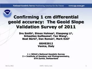
Initial Results of the Geoid Slope Validation Survey of 2011 Dru Smith1, Simon Holmes1, Xiaopeng Li1, Yan Wang1, Malcolm Archer-Shee1, Ajit Singh1, Cliff Middleton1, Daniel Winester1, Dan Roman1 Beat Bürki2, Sébastien Guillame2 American Geophysical Union San Francisco, CA 1 = NOAA’s National Geodetic Survey 2 = Institute for Geodesy and Photogrammetry, ETH Zurich American Geophysical Union Fall Meeting
Genesis of the survey “...the gravimetric geoid used in definingthe future vertical datum of the United States should have an absolute accuracy of 1 centimeter at any place and at any time.” -- The NGS 10 year plan (2008-2018) Admirable!...Achievable? American Geophysical Union Fall Meeting
Goal of the survey • Observe geoid shape (slope) using multiple independent terrestrial survey methods • GPS + Leveling • Deflections of the Vertical • Compare observed slopes (from terrestrial surveys) to modeled slopes (from gravimetry or satellites) • With / Without new GRAV-D airborne gravity American Geophysical Union Fall Meeting
Why not rely on existing surveys? • Most existing marks are not GPS or gravity friendly • Existing leveling is decades old • Existing leveling and GPS are tied to unchecked passive control coordinates • Overlap of existing gravity, GPS or leveling is minimal in space and widely separated in time American Geophysical Union Fall Meeting
Choosing the Place and Time for a New Survey • Criteria: • Significantly exceed 100 km • Under existing GRAV-D data • Avoid trees and woods • Along major roads • Cloud-free nights • No major bridges along the route • Low Elevations • Significant geoid slope • Inexpensive travel costs American Geophysical Union Fall Meeting
The Chosen Line 325 km 218 points 1.5 km spacing South Texas July-October, 2011 hot…Hot…HOT! American Geophysical Union Fall Meeting
Surveys Performed • GPS: 20 identical. units, 10/day leapfrog, 40 hrs ea. • Leveling: 1st order, class II, digital barcode leveling • Gravity: FG-5 and A-10 anchors, 4 L/R in 2 teams • DoV: ETH Zurich DIADEM GPS & camera system • LIDAR: Riegl Q680i-D, 2 pt/m2 spacing, 0.5 km width • IMAGERY: Applanix 439 RGB DualCam, 5000’ AGL • Other: • RTN, short-session GPS, extra gravity marks around Austin, gravity gradients American Geophysical Union Fall Meeting
GPS DoV LIDAR/ Imagery Gravity Leveling American Geophysical Union Fall Meeting
Empirical Error Estimates • sDh (OPUS-S) : 2 - 6 cm • GPSCOM adjustment : ~ 6 mm • (no significant baseline dependency) • sx , sh : 0.03 arcseconds • ~ 0.05 mm / km American Geophysical Union Fall Meeting
Existing Geoids vs GSVS11 American Geophysical Union Fall Meeting
Existing Geoids vs GSVS11 American Geophysical Union Fall Meeting
High Resolution Geoids(vs GPS / Leveling; cm) All separation distances show improvement with GSVS11 survey when airborne gravity are introduced. American Geophysical Union Fall Meeting
SHM representation of geoid agreement with GSVS11 American Geophysical Union Fall Meeting
Agreement with DIADEM DoVs(arcseconds) x h American Geophysical Union Fall Meeting
Conclusions • Adding airborne gravity data improves geoid slope accuracy at all wavelengths • Gravimetric geoid modeling with GPS is a viable alternative to long-line leveling • Improvements still can be made to high resolution geoid modeling American Geophysical Union Fall Meeting
Future Work • Dozens of studies, comparing all of the terrestrial positioning techniques of GSVS11 • Dig deeper on GRACE / GOCO2s disagreements with GSVS11 • GSVS13: Higher elevation, more rugged topography, additional measurements (borehole gravimetry?) American Geophysical Union Fall Meeting
Questions/Comments? Dru.Smith@noaa.gov http://www.ngs.noaa.gov/GEOID/GSVS11/index.shtml American Geophysical Union Fall Meeting
Extra Slides American Geophysical Union Fall Meeting
Note EGM08 2190 vs 220 American Geophysical Union Fall Meeting
Tallies American Geophysical Union Fall Meeting
Tallies • Total persons involved: 46 • NOAA Employees: 43 • First time in the field: 6 • Issues: • Medical Emergencies: 4 • Flat tires: 3 • Inoperative equipment: 2 American Geophysical Union Fall Meeting
EGMs vs GPS / Leveling; cm * GPS/leveling low-pass filtered at 200 km ; GOCO2s nmax=220, GRACE nmax=180 American Geophysical Union Fall Meeting
High Resolution Geoids(vs GPS / Leveling; cm) American Geophysical Union Fall Meeting
Experimental geoids and USGG2009 vs GSVS11 h-H American Geophysical Union Fall Meeting