Download
1 / 45
450 likes | 575 Vues
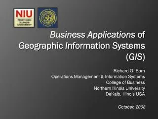
Richard G. Born Operations Management & Information Systems College of Business Northern Illinois University DeKalb, Illinois USA. Business Applications of G eographic I nformation S ystems ( GIS ). October, 2008. Outline. Introduction to Business Geographics

E N D
Richard G. Born Operations Management & Information Systems College of Business Northern Illinois University DeKalb, Illinois USA Business Applications of Geographic Information Systems(GIS) October, 2008
Outline • Introduction to Business Geographics • Business Geographies and Censuses • Case Study: Walgreens Drug Stores • GIS Software: Microsoft MapPoint • Business GIS Projects at the Northern Illinois University College of Business
Why Study Business GIS Systems? Geographic It is estimated that 80% of all corporate data has content that is geographic.
What is “geographic content”? Street Address City State/Region/District/Province Postal Code Country Telephone Number … any data that has location information and could be plotted on a map.
Why 80% geographic content? Manufacturers Suppliers Shippers Customers Stores Warehouses/distribution centers Financial institutions Stockholders Competitors … any entity that is of interest to a company has address information that can be mapped.
The time has come to … …treat geographic data as an organizational asset …realize the value of geo-information as a key business driver …easily spot trends, patterns, and opportunities that are difficult with traditional techniques …provide an exciting way to view and analyze business information
Which is more enlightening? … this table of data
Which is more enlightening? … or this map …
Why are businesses slow at adopting GIS solutions? Many executives are unaware of the existence of business GIS Benefits of GIS are largely intangible GIS cost vs. perceived value is not obvious GIS vendors do not educate mainstream business on how to demonstrate the power of GIS SHARP RISE IN SALES!!! Customer Profile Report Direct Mail Campaigns Business Rules Customer Database Census Information
…why slow at adopting GIS? GIS tends to be implemented at the bottom layers of a company – by the worker bees Relatively few universities have business schools with courses in business GIS Notable exception… NIU’s College of Business
Business GIS Courses at NIU OMIS 379. BUSINESS APPLICATIONS OF GEOGRAPHIC INFORMATION SYSTEMS (3) Examination of leveraging an organization’s spatial data to analyze and solve business problems. Extensive computer laboratory work designing business geographic services using commercially available software. PRQ: GEOG 256 or OMIS 351, or consent of department. OMIS 679. BUSINESS GEOGRAPHICS (3) Examination of geographic information systems development and use from the perspective of contemporary business. Extensive computer laboratory work designing specific geographic systems using commercially available software. CRQ: OMIS 652 or consent of department.
In what department within a typical company does GIS belong? Customer Database Area demographics Customer Database Postal Codes for next Direct Mail Campaign Dissemination of MAPS showing Sales, Revenue, and Profitability Information • Marketing – customer penetration study Business Rules • IT Department • Server requirements • Database development • Planning and networking • Finance Department Business Rules
…which department? • Planning Department • Growing new markets • Growing the customer base • Adding locations for: • Stores • Warehouses • Distribution Centers Supply Chain GIS Identify areas needing optimization • Operations Department GIS can greatly benefit virtually every department within a company!!!
Business Value By Layering Patterns, Opportunities, New questions?
Business Geographies (United States) Government Census Every 10 Years
Business Geographics (Austria) State (Bundesland) Municipality (Gemeinde) District (Bezirk)
Advantages of Census Taking • Age • Population • Education • Employment • Ethnicity • Expenditures • Households • Housing • Income Levels • Industry • Marital Status • Occupation • Transportation • Travel time • Commute time • Vehicles Ownership • Crime • Weather • …..
Political Structuring in Bosnia and Herzegovina 2 Major Entities and the Brcko District 10 Cantons 137 Municipalities Significant Fact: Last official census in 1991 *Maps from Wikipedia
Case Study: Walgreens • A major U.S. pharmacy chain • 7,000 stores planned by 2010 • 5 million customers/day • 583 million prescriptions in fiscal 2007 • Typical store: • 14,500 sq. ft. (1300 sq. m.) • Staff of 25 – 30 people • Annual sales $8.5 million • Pharmacy, photo lab, cosmetics, general merchandise
Walgreens New Location Targeting Determine 10 potential locations for a new Walgreens store in Tulsa, Oklahoma (USA)
Most important Least important Walgreens New Location Targeting Business Rules -- New Store Criteria • New sites cannot be less than 1 mile from an existing Walgreen store • Proposed locations must satisfy the following criteria: • Prescription potential within a mile must exceed 250 prescriptions/day • Total daily intersection traffic must exceed 20,000 cars • The fewer the competitors the better, based upon supply and demand
Potential 4=High, 1=Low After Weighting 1 Mi Rx/Day 9 1 2 3 337 2 3 288 X 3 = 12 3 4 450 279 1 Overlay Using ADD Total Intersection Traffic 2 13 1 23K 13 2 32K X 2 = 6 3 8 20 41K 15 4 56K Competitors 2 2 3 HIGHEST VALUES HAVE HIGHEST POTENTIAL 2 1 X 1 = 2 2 2 4 0 4 6 4 3 Walgreens New Location Targeting
Walgreens New Location Targeting One mile buffers are constructed around existing stores.
Daily Block Group Prescription Potential Daily Intersection Traffic Walgreens New Location Targeting What factors affect the daily prescription potential?
Microsoft Has Changed the Competition Has the know-how to price its desktop product MapPointaffordably. Has made MapPoint easy to learn and use. Targets decision makers, not those who create/maintain complex GIS data. Developed MapPoint Web Service (for corporate internet mapping applications) Affordably bundles demographic data with their software. USA Geographies include states, Metropolitan Statistical Areas (MSAs), counties, ZIP codes, and census tracts
MapPoint’s Two Versions • United States Demographic Data • Streets and Roads for: • Canada • Mexico • United States • Demographics for: • Austria • France • Germany • Great Britain • Italy • Netherlands • Switzerland • Streets and Roads for many countries in Europe (but not Bosnia and Herzegovina) MapPoint North America MapPoint Europe
Location-Enabled (understand location and how to process it) Location-Aware (Real-Time) (application is also aware of its own location) MapPoint Technologies • MapPoint 2009 • Thematic mapping of corporate data • Corporate territory management • Demographic mapping of census data • Determining shortest/fastest routes • MapPoint 2009 Interfaced • with a GPS Device • Real-time navigation • Real-time location-based information logging Disconnected (location information and processing framework are all on the host computer’s hard disk) • MapPoint Web Service • Hosted by Microsoft • Global location-based applications • that work for multiple countries • Store finder • Best route to store • Find competitors • Maintain custom points of interest • MapPoint Location Server • Hosted within your enterprise • Enables real-time location scenarios • using locatable devices • No GPS hardware/software needed • Finding nearby ATMs, restaurants, motels, gas stations • Calculating driving directions • based on current location • and real-time traffic conditions Connected (network connectivity is essential— location information and processing framework are on a remotely located host service)
Disconnected, Location-enabled Projects ESRI ArcGIS Projects Rockford MidTown District Bridges of RiverMist Family Shelter Services Subaru Chicagoland District Sales MapPoint Projects Planned Parenthood Advocacy Affordability of Homes in Kane and McHenry Counties in Illinois
Rockford MidTown District Agency to make this area of Rockford, IL a safe and enjoyable place to live and operate a business Develop a GIS that would aid in trending, forecasting, and justifying its marketing and development plans Crime maps help assess the effect of social programs to reduce crime rates. Major lesson learned – the most difficult part of developing a business GIS is obtaining the data from the constituent parties. City government Police department Other agencies
RockfordMidTownDistrict Adding features to a map: Streets Block groups ZIP codes Labeling features Inserting Titles Legend Scale bar Creating pie chart to show demographics
Bridges of Rivermist New subdivision in DeKalb, IL (home of NIU) Goal was to produce maps that could be used to market lots on the Web Learning activities GPS collection of control point data Heads-up digitization of lots, streets, and ponds Joining corporate data to geographic parcels Students had the feeling of accomplishment in being the first to create a map of a new subdivision.
DuPage County Family Shelter Services An organization in Illinois that provides shelters for immediate safety for domestic violence victims and their children Goal was to determine the best location for a new shelter Students learned: Joining corporate data to spatial data Clipping features Creating map layers Creation of graduated symbols Preprocessing of data in Excel pivot tables
Subaru of America Automobile Sales Subaru wanted a map that could be used to analyze sales in its Chicagoland districts Students learned: How to create Subaru defined territories by dissolving ZIP codes Joining Subaru sales data to ZIP codes
Planned Parenthood Advocacy (PPA) An advocate of reproductive rights and health issues wherever public policy is discussed To better focus marketing efforts, requested maps to show clients by U.S. Congressional Districts Students learned: How to geocode addresses to the street level How to import ESRI shape files (e.g., U.S. 108th Congressional districts) into MapPoint via COM add-ins 108th Congressional Districts and PPA Clients
Affordability of Homes in Kaneand McHenry Counties in Illinois Affordable—any home selling for less than or equal to the median selling price Major finding—clusters of affordability Students learned: Importing an Access database into MapPoint Aggregating data by using shaded area maps Geocoding addresses
Connected, Location-enabled Projects A result of rapid increase in the use of smart phones and pocket PCs Aided by advances in Visual Studio 2005 and 2008, including mobile application development on a pocket PC emulator. MapPoint Web Service applications: Walgreens Store Locator Pocket PC Mapper
Walgreens Store Locator Visual Basic Windows or ASP.NET project Makes use of the MapPoint Web Service
Pocket PC Mapper Built using Visual Basic 2005/2008 A pocket PC Device Application Makes use of the MapPoint Web Service Can find places as well as addresses
GIS methods are ideal for solving many business problems. GIS allows you to analyze and visualize business problems in unique, effective new ways. Biggest challenge in Bosnia and Herzegovina – obtaining current demographic data normally available through periodic censuses In conclusion ...