Download
1 / 22
220 likes | 710 Vues
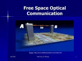
Cloud Layer Effects on Free Space Optical Communications . Don Norquist AFRL/VSBYA Hanscom AFB, MA October 14, 2005. Acknowledgements: Radar, radiometer measurements – Paul Desrochers, AFRL/VSBYM Lidar measurements – Pat McNicholl, AFRL/VSBYM , Mitch Laird, Boston College

E N D
Cloud Layer Effects on Free Space Optical Communications Don Norquist AFRL/VSBYA Hanscom AFB, MA October 14, 2005 Acknowledgements: Radar, radiometer measurements – Paul Desrochers, AFRL/VSBYM Lidar measurements – Pat McNicholl, AFRL/VSBYM, Mitch Laird, Boston College Rawinsonde soundings – George Clement, Utah State University Forecasting, surface obs – John Roadcap, Boston College Satellite imagery analysis – Gary Gustafson, Bob d’Entremont, AER, Inc.
ORCLE: Optical and Radio Frequency Combined Link Experiment • Program to demonstrate world-wide high data rate communication network for the tactical user • Intent: connect airborne, terrestrial, maritime & space military operations for real-time communications • DARPA’s ORCLE focus on air-to-air, air-to-ground links • Goal: Demonstrate advantages of free space optical (FSO) communications operating with radio frequency (RF) communications • Technical Objective: Prototype, flight demonstrate hybrid FSO/RF air-to-air-to-ground links • combine the best attributes of both technologies • simulate hybrid network performance
VSBYA/VSBYM Fall 2004, Winter 2005 HAFB Campaign Purpose: Collect radiosonde observations (RAOBs), satellite imagery, surface observations [routine obs] & radar reflectivity, MW radiometer, lidar signal power [ground truth] Background: FSO designers need to have quantitative information on the effect on signal power resulting from laser propagation through various cloud conditions Study goal: evaluate “routine” obs as a proxy for “ground truth” obs in specifying impact on laser comm. Ten 3-hour collection periods, broken or overcast with ceilings > 1 km AGL, no precipitation reaching ground Current VSBY Initiative: Cloud Characterization
Air Force Cloud Profiling Radar (AFCPR) Ka-band (8.6 mm) Reflectivity, 21 Oct 2004 Satellite Imagery RAOB Launch
Portable Eyesafe Environmental Laser (PEELS, 1.574 µm) Signal Power 21 Oct 2004 Satellite imagery RAOB Launch
RS-90 Rawinsonde Observation 21 Oct 2004, Launch Time 1130 UTC
Geostationary Operational Environmental Satellite (GOES) -12 (11µm) Imagery, 21 Oct 2004, 1132 UTC KBED 211130Z 36005KT 10SM BKN120 04/02 A3020 RMK SLP241 T00390022
Cloud Characterization Analysis Processing Steps • AER, Inc. Cloud Detection and Property Retrieval (CDPR) • Inputs: GOES-12 five-channel imagery, MM5 short-term forecast for surrounding 3-h UTC times • Outputs: cloud top height (CTH), effective particle size (Deff) , ice water path (IWP), ice clouds only • Cloud-Met Data Fusion Algorithm (CMDF) • Inputs: RAOB profile of P, T, Z, RH; CDPR retrievals (SATOB) near RAOB; Sfc obs of clouds (SFCOB) • Process: CP = [a0 a1RH + a2 ] -1 for 3 temperature regimes, augmented by SATOB and SFCOB • Outputs: Cloud probability at each RAOB report level (use CP > 0.51 as indicator of cloudy level)
Alternative Cloud Vertical Structure (CVS) Techniques • Fuzzy Fusion • Use RAOB RH, AltDiff = | CDPR CTH – RAOB Z | as linguistic variables in fuzzy rule base: IF RH = High & AltDiff = Small THEN Cloud = IsCloud WITH 1.000000 IF RH = Low & AltDiff = Big THEN Cloud = CloudFree WITH 1.000000 • Membership functions for RH, AltDiff, Cloud from Mozer and Ayer (1998) • Wang and Rossow (1995, J. Appl. Meteor.) • Based strictly on RAOB RH, with set rules for determining where cloud layers exist • Uses fixed RH thresholds determined from soundings and cloud observations, primarily in the tropics
Comparison of Diagnosed CVS vs. Radar/Lidar Measurements, 21 Oct 2004 Trop CDPR CMDF Fuzzy Fusion Wang & Rossow Radar/Lidar
Laser Transmission and Clouds • Transmittance is fraction of initial laser power (W) remaining at a distance s from the source • Laser light directed vertically downward through N layers of equal thickness Δz has a transmittance of • Total extinction βe is sum of air molecule scattering, aerosol extinction, water vapor absorption, cloud particle scattering/absorption
βair , βaer and kvq in Δz = 20 m: FASCODE for the Environment (FASE90) applied to RAOB profile βcld for ice particles: use CDPR-retrieved IWP, Deff, Δzcld and CMDF-diagnosed CP > 0.51 Compute βcld using three scattering/absorption models Mie theory using Deff/2, IWC = IWP/ ΔZcld (bulk) Fu (1996) empirical equations using IWP, Deff (bulk) Ou et al. (2002) direct + forward scatter using Deff , βcld from Fu model to compute total power for each layer βcld for liquid droplets: reff, LWP from AFCPR reflectivity & radiometer following Frisch et al. (1995) Compute βcld from Mie theory (bulk) Laser Transmittance Calculations
Laser Transmittance Profile Exampleλ = 1.55 µm, P = 10 w, Dreceiver = 1 m Cloud optical depth: (Mie) 0.86, (Fu) 0.81, (UCLA) 0.57 CMDF Cloud Layer
Transmittances for Ice Cloud LayersOu et al., 2002 Model, Satellite Imagery * Suspect humidity sensor, biased low compared to nearby NWS RAOB
Transmittances for Liquid Cloud Layers Mie Theory, Radar and Radiometer
Future Work • Improve CMDF algorithm: decrease false alarms • Estimate Deff,IWC profiles from radar, lidar ice cloud measurements • Estimate reff, LWP from satellite, RAOB data • Identify, apply method to estimate βcld for mixed phase cloud layers • Use AFRL/VSBY thermosonde data sets to assess cloud layer laser impacts in other regions, seasons • Write, submit tech report to support ORCLE project
Cloud-Met Data Fusion Technique • Developed based on 14 Hanscom RAOBs, radar/lidar from August 2001, June 2002, August 2002 • Matched RAOB RH profiles with radar/lidar CTH, CBH to determine cloudy (Y), not cloudy (N) RAOB levels • Computed #Y / (#Y + #N) for each 1% RH category, from all RAOB levels in 14 cases using: • RAOB RH (RHL) for T > 0 C; RHI for T < -40 C; • RH = α RHL + (1- α) RHI ; α = (T/40 + 1) for 0 ≥ T ≥ -40 C • Applied five-point weighted ( #Y + #N) mean smoothing • Fit to nonlinear form: CP = [a0 a1RH + a2 ] -1 for 3 T regimes
CMDF Method Development for T > 0 C -40 < T < 0: RHc = 73%; T < -40: RHc = 67%
Truth Table SummaryBased on 17 Radar/Lidar Cloud Layers * < 50% of diagnosed layer coincided with observed layer
Cloud Layer Position, Thickness Summaryfor Diag/Obs and MisDiag/Obs Cases