Download
1 / 33
330 likes | 446 Vues
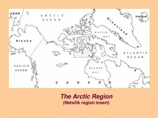
Methodology for Probabilistic Risk Assessments for the Euro-Arctic Region “Arctic Risk” Project http://glwww.dmi.dk/f+u/luft/eng/arctic-risk/main.html of the Nordic Arctic Research Programme (NARP) (2001-2003) A. Baklanov, A. Mahura , J.H. Sørensen

E N D
Methodology for Probabilistic Risk Assessments for the Euro-Arctic Region “Arctic Risk” Project http://glwww.dmi.dk/f+u/luft/eng/arctic-risk/main.html of the Nordic Arctic Research Programme (NARP) (2001-2003) A. Baklanov, A. Mahura, J.H. Sørensen Danish Meteorological Institute, Copenhagen, Denmark International Conference on Computational Information Technologies for Environmental Sciences: “CITES-2005”Novosibirsk, Russia, March 20-23, 2005
GOALS, QUESTIONS & OBJECTIVES • Main Goals: • to develop a methodology for complex risk/vulnerability assessment & mapping; • to evaluate atmospheric transport patterns for harmful pollutants from ERSs based on the probabilistic point of view; and • - to test methodology on estimation of a possible radiation risk to population in the Nordic countries in a case of severe accident at NRS and a long-term environment impact from large industrial sites. • Main Questions: • Which sources appear to be the most dangerous for people living close to and far from these sources? • Which regions are on the highest risk from a possible hypothetical accidental release in the Euro-Arctic region? • What is the probability for contaminant atmospheric transport to different neighbouring countries in a case of an accident at ERSs? • Specific Objectives: • Examination of general atmospheric transport pathways and airflow patterns from ERSs • Estimation of probability of fast transport of contaminant released from ERSs • Evaluation typical transport time, maximum reaching distance and possible impact zones • Investigation of possible impacts of removal processes during transport • GIS-integration of various indicators into a complex risk assessment • Combination of approaches for probabilistic risk analysis and cases studies • Evaluation of probabilistic risk for selected ERSs in the North-West Russia
METHODOLOGY FOR COMPLEX RISK ASSESSMENT After Rigina 2001
USED APPROACHES • Trajectory Modelling to calculate multiyear forward trajectories originated over the NRSs locations using isentropic trajectory model & 3-D DMI trajectory model • Cluster Analysis Technique on Trajectories to identify atmospheric transport pathways from the NRSs regions • Probability Fields Analysis on Trajectories to construct and analyze annual/seasonal/monthly probability fields for airflow, fast transport, etc to identify the potentially most impacted geographical areas • Long-range transport DERMA & DMI-HIRLAM models to simulate meteorological fields and radionuclide transport, dispersion and deposition for the hypothetical accidental releases at NRSs, and compare with results of trajectory modelling • Specific Case Studies to estimate the consequences for environment and population after hypothetical accidents using experimental models based on the Chernobyl effects for the Nordic countries • Evaluation of vulnerability to radioactive deposition to evaluate vulnerability to radioactive contamination concerning its persistence in the ecosystems with a focus on transfer of certain radionuclides into food chains of key importance for the intake and exposure of a whole population and certain groups in the Nordic countries • Complex risk evaluation and mapping to analyse consequences for different geographical areas and various population groups taking into account social-geophysical factors and probabilities and using GIS-analysis
Backward and Adjoint Simulations • Sensitivity of Receptors or Source-term estimation. • Trajectory modelling to calculate backward/forward individual or multiyear trajectory data sets for sensitivity studies. • Cluster and Probability fields analysis of trajectory/ dispersion data sets by month, season, and year (Baklanov and Mahura, 2002). • Adjoint modelling for atmospheric pollution problemto calculate receptor sensitivity or unknown source term based on monitoring data for local- and global scales (Penenko and Baklanov, 2001).
Structure of the Danish nuclear emergency modelling system • DMI-HIRLAM system • G: 0.45° • E and N: 0.15° • D: 0.05° • L: 0.014° • DERMA model • 3-D trajectory model • Long-range dispersion • Deposition of radionuclides • Radioactive decay • Direct and inverse modes • ARGOS system • Radiological monitoring • Source term estimation • Local-Scale Model Chain • Health effects ECMWF global model
The applicability of the method includes: • Initial estimates of probability of the atmospheric transport and consequences in the event of an accident;• Improve emergency response to harmful releases from the ERSs locations;• Social and economical consequences studies of the ERS impact for population and environment of the neighbouring countries;• Multidisciplinary risk and vulnerability analysis, probabilistic assessment of pollutant meso-, regional-, and long-range transport;• Verification and improvement of simple integrated models.
ERS POSSIBLE IMPACT INDICATORS BASED ON TRAJECTORY & DISPERSION MODELLING • Airflow Probability Fields, • Fast Transport Probability Fields, • Typical Transport Time Fields, • Maximum Reaching Distance, • Maximum Possible Impact Zone, • Precipitation Factor or Relative Humidity Fields, • Average and Summary Time Integrated Air Concentration, • Average and Summary Dry Deposition Fields, • Average and Summary Wet Deposition Fields.
INDICATORS FOR COMPLEX RISK ASSESSMENT • For assessment of risk/vulnerability we consider: • 1. Social Geophysical Factors: • proximity to the radiation risk sites; • population density in the area of interest; • presence of critical groups of population; • ecological vulnerability of the area; • risk perception, preparedness of safety measures, systems for emergency response; • economical and technical means, counteracting consequences of a possible accident etc; • 2) Probabilities: • probability of an accident of a certain severity at NRS; • probability of air transport pathways towards the area of interest from NRS (from probabilistic trajectory modelling); • probability of precipitation and deposition over the area of interest during the transport of a plume along trajectories (from probabilistic modelling).
STUDY AREAS AND SELECTED RISK SITES European North North Pacific region
Monthly variations in the average transport time (in days) from the Kamchatka NRS to geographical regions based on the forward trajectories during 1987-1996
PROBABILISTIC NRSs IMPACT INDICATORS FAST TRANSPORT PROBABILITY FIELDS AIRFLOW PROBABILITY FIELDS BGP – Group of German NPPs BNP - Barsebäck NPP
PROBABILISTIC NRSs IMPACT INDICATORS MAXIMUM POSSIBLE IMPACT ZONE & MAXIMUM REACHING DISTANCE TYPICAL TRANSPORT TIME FIELDS INP - Ignalina NPP LRS - Loviisa NPP
ADDITIONAL NRSs IMPACT INDICATORSBASED ON TRAJECTORY MODELING RELATIVE HUMIDITY FIELDS ATMOSPHERIC TRANSPORT PATHWAYS KNPP - Kola NPP KNRS - Kamchatka NRS
NRSs IMPACT INDICATORSBASED ON DISPERSION MODELING AVERAGE INTEGRAL CONCENTRATION AT SURFACE FIELD Kamchatka NRS Vladivostok NRS
NRSs IMPACT INDICATORSBASED ON DISPERSION MODELING SUMMARY WET DEPOSITION FIELD SUMMARY DRY DEPOSITION FIELD Ignalina NPP
GIS-METHODS FOR RISK EVALUATION(Rigina 2001) Total risk function as a sum of risk functions from n NRSs First method to define risk function: Second method to define risk function:
PROBABILISTIC RISK MAPS to the Nordic countries population for Kola NPP Leningrad NPP
ECOMARCInstitute of Radiation Hygiene, St.Petersburg, Russia Total accumulated dose of 137Cs during different time intervals according to the selected scenario of release.
Barsebaeck NPP Annual Average Dose due to Inhalation Annual Average Dose due to Ingestion Annual Average Total/Individual Dose Annual Average Collective Dose
Euro-Arctic Region NRSs Annual Average Total/Individual Dose Annual Average Collective Dose
Norilskiy Nickel Plant Annual Summary Field of SO_4 Time Integrated Air Concentration Wet Deposition Dry Deposition
Severonickel Plant Annual Summary Field of SO_4 Time Integrated Air Concentration Wet Deposition Dry Deposition
Chernobyl Nuclear Power Plant Annual Summary Field of 137Cs Dry Deposition RISO Model DERMA Model
PROBABILISTIC FIELDS ANALYSIS FOR RECEPTOR POINTS TO IDENTIFY SOURCE REGIONS Nome, Alaska Anchorage, Alaska
Bio-terror: Source Determination Hypothetical release of 100 g Anthrax spores Inhalation dose calculated by DERMA based on DMI-HIRLAM-E Measurement stations:
Determination of source location by inverse (adjoint) model calculation using DERMA based on measured data
CONCLUSIONS • Developed and tested a methodology for a complex risk and vulnerability assessment. • Developed and tested a methodological approach for probabilistic atmospheric studies for evaluation of the atmospheric transport of radioactive pollutants from NRSs to different geographical regions. The evaluation is given from the probabilistic point of view. • Suggested to apply a variety of research tools considering them as a sequence of interrelated approaches. Among these tools are the following: • direct and adjoint trajectory and dispersion modelling, • methods of statistical analysis (cluster & probability fields analyses), • specific case studies, • evaluation of vulnerability to radioactive contamination, and • risk evaluation and mapping. • Suggested indicators of possible nuclear risk sites impact: • Airflow Probability Fields & Fast Transport Probability Fields, • Maximum Reaching Distance & Maximum Possible Impact Zone, • Typical Transport Time Fields & Precipitation Factor Fields, • Summary and Average Time Integrated Concentration at Surface, Wet & Dry Deposition Fields. • Estimated and mapped the regional vulnerability and complex probabilistic risk for population of the Nordic countries on example of the Kola and Leningrad NPPs.
APPLICATIONS • The results of this study are applicable for the further GIS analysis to estimate risk and vulnerability as well as for planning of systems for emergency response and preparedness measures in the cases of the accidental releases at ERSs. • The applicability of the method includes: • Initial estimates of probability of the atmospheric transport in the event of an accident; • Improve emergency response to harmful releases from the ERS locations; • Social and economical consequences studies of the ERS impact for population and environment of the neighbouring countries; • Multidisciplinary risk and vulnerability analysis, probabilistic assessment of contaminant meso-, regional-, and long-range transport; • For long-term impact assessment from existing pollutant emission sources. • The methodology was employed for 16 NRSs and 3 NRSs + 2 ERSs in the Euro-Arctic and Siberian / North Pacific regions, respectively.
ACKNOWLEDGMENTS • The authors are grateful for collaboration and constructive comments to Leif Laursen (Danish Meteorological Institute, DMI), Olga Rigina (Danish Technical University, DTU), Ronny Bergman (Swedish Defence Research Authority, FOI), John Merrill (University of Rhode Island, US), Vladimir Penenko and Elena Tsvetova (Siberian Division of RAS, Russia), Daniel Jaffe (University of Washington, Seattle, US),Boris Segerståhl (University of Oulu, Finland), Sven Nielsen (Risø National Laboratory, Denmark), Steen Hoe (Danish Emergency Management Agency). • The computer facilities and data archives at the Danish Meteorological Institute (DMI, Copenhagen, Denmark) and National Center for Atmospheric Research (NCAR, Boulder, USA) had been used in this study. • The authors are grateful for the collaboration, computer assistance, and advice to stuff of the Computer Services (DMI) & Scientific Computing Division (NCAR). • Financial support from the Nordic Arctic Research Programme (NARP) and Nordisk Forskerutdannings Akademi (NorFA)
For more information: Arctic Risk web-site: http://glwww.dmi.dk/f+u/luft/eng/arctic-risk/main.html FUMAPEX web-site: http://fumapex.dmi.dk My e-mail: alb@dmi.dk Thank you !