Download
1 / 39
400 likes | 433 Vues
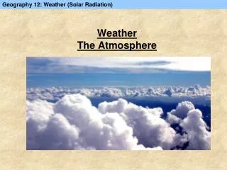
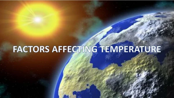
Factors affecting temperature in the atmosphere

E N D
GLOBAL FACTORS AFFECTING TEMPERATURE TEMPERATURE DIFFERENCES
a) LATITUDE • Latitude refers to the distance a place is from the equator. • The sun is over head at the equator all year round but at the poles it is at a greater angle to the ground. • The angle of incidence is greater at the poles as compared to the equator. • EQUATOR: • Sun travels a shorter distance therefore it loses less heat due to scattering, reflection and absorption. Heats a smaller surface area thus places at the equator are hotter. • POLES • Sun rays travel a greater distance and heats a larger surface area therefore it is colder at the poles.
Latitude also affects the length of SUMMER and WINTER • In JANUARY – the south pole is tilted towards the sun and it is summer in the southern hemisphere. • In JANUARY – the north pole is tilted away from the sun. It gets less heat therefore it is winter in the northern hemisphere • In JULY – the north pole is tilted towards the sun and it is summer in the Northern Hemisphere • In JULY – the south pole is tilted away from the sun therefore it is winter in the southern hemisphere • The equator remains the same distance away from the sun all year round so areas along the equator have nosummer or winter.
b) THE SEA • Sea has a high specific heat capacity ( amount of heat required to raise the temperature of 1 unit of a substance by 10C) • More heat is required to heat up water • Sea conducts heat to greater depths • It takes a long time to lose its heat • The sea makes places near the coast warm in winter and cool in summer • These places have a MARITIME CLIMATE • Land has a low specific heat capacity • Less heat is required to heat up land because it is opaque • Heat is only conducted to the surface of the soil • Heat is lost very quickly • Therefore the land is hot in summer and cold in winter. • Places away from the sea are hot in summer and cold in winter • These places have a CONTINENTAL CLIMATE
During the day the land heats up faster than the sea. A HP develops over the sea and a LP pressure develops over the land Air blows from HP to LP creating a SEA BREEZE During the night the land loses heat faster than the sea. A HP develops over the land and a LP develops over the sea. Air blows from high pressure to low pressure creating a LAND BREEZE
C) OCEAN CURRENTS Coriolis force, causes the oceans to flow in currents. These currents flow clockwise in the northern hemisphere and anticlockwise in the southern hemisphere Currents that flow from the equator to the poles carry warm water towards the poles Currents that flow from the poles towards the equator carry cold water towards the equator.
d) ALTITUDE • As altitude increases temperature decreases • REASONS: • At higher altitudes Oxygen, CO2 and water vapor decreases. • The air becomes less dense (thin) (rarefied) • Therefore heat easily escapes • Temperature decreases by 6,50C/1000meters (D.A.L.R)
e) CLOUDS Reduces both incoming/outgoing solar radiation Thick cloud – greater amount of absorption/reflection/scattering Therefore cloud reduces daytime energy (reflecting, absorbing and scattering insolation) But it increases nighttime energy (absorbs/ reflects back long-wave radiation from ground up)
F) WIND Wind of different temperatures change the temperature of the receiving areas Wind from the mountain – usually cold Wind from the sea – warmer in the winter, colder in the summer
Lesson objectives • Be able to explain the difference between Absolute and Relative humidity • Be able to calculate relative Humidity using the relative humidity chart • Know the instruments that are used to measure relative humidity
a) HUMIDITY Humidity refers to the amount of water vapor in the atmosphere When the air contains the maximum amount of water vapor at a given temperature, the air is saturated. Absolute humidity (g of vapour/m3 of air)– Is the water content of air expressed in grams per cubic metre. Air will be humid if it passes over water but dry if it releases all its water during precipitation. Relative Humidity is the amount of water vapor in the air expressed as a percentage of the amount that would be present if the air was saturated.
At 100% relative humidity, the air is saturated and the temperature at that • point is called DEW POINT TEMPERATURE. • The height at which a body of air reaches the DEW POINT is called the • CONDENSATION LEVEL. • Condensation is when air is cooled to its DEW POINT. This can happen in • THREE ways • Radiation from the ground during a clear night • Warm wind blowing over a cold ground • Warm air meeting cold air • Movement of air from water to colder latitudes • Air moving up a mountain
Lesson objectives • Be able to draw and explain the formation of • - Convectional rain • - Orographic rain • - Frontal rain
B) PRECIPITATION Precipitation refers to any form of moisture in the atmosphere and it includes RAIN, SNOW,HAIL and DEW RAIN 1. CONVECTIONAL RAIN • Insolation warms the air above the ground. • The heated air rises. • As it rises, it cools to DPT • Condensation takes place and clouds form. • When the moisture in the clouds is to heavy it comes down as rain called convectional rain.
2. OROGRAPHIC RAIN • Warm air blows in from the sea • The mountain (orographic barrier) forces the air to rise. • The air rises and cools to DPT. • Condensation takes place and clouds form. • When the moisture in the cloud is to heavy, it comes down or orographic rain.
3FRONTAL RAIN (CYCLONIC RAIN) • Warm and cold air masses meet • The cold air sinks and wedges in underneath the warm air and forces the warm air to rise. • As the air rises, it cools to DPT. • Condensation takes place and clouds form • When the moisture in the clouds is to heavy, it comes down as frontal rain.
Where do these rains occur on a global scale? • Orographic rain – generally occurs where there are mountains e.g. Rocky mountains, Andes Mountains, Alps, etc. • Frontal rain – common in mid-latitudes where warm air is coming up from the tropics and it meets cold air from the polar • regions. The weather system that results is called a MID-LATITUDE CYCLONE • Convectional rain is most common in equatorial and tropical regions which are hot. • Equatorial and mid-latitude areas are wet through out the year because they have low pressures all year round. • The areas with the lowest rainfall are: • In the subtropical HP belt such as the Sahara Desert • Higher latitudes in the Northern Hemisphere • In the rain shadow of the mountains e.g. Rocky mountains in North America and the Andes mountains in South America
LESSON OBJECTIVES Understand how SNOW, HAIL AND DEW FORMS. Be able to draw diagrams, explaining the formation of Snow, Hail and Dew
VOCABULARY/TERMINOLOGY SUBLIMATION – when gas changes directly to a solid without passing through the liquid phase CONDENSATION – Change from gas to liquid DEW POINT TEMPERATURE – temperature at which condensation takes place DEW – water droplets that have formed on cold surfaces HYGROSCOPIC NUCLEI – salt, smoke and dust particles in the atmosphere onto which water vapor condenses ATMOSPHERIC INSTABILITY – condition in the atmosphere in which air rises. SATURATION POINT – point at which the relative humidity is 100% HAIL – ice pellets that form in cumulonimbus clouds during thunderstorms.
SNOW • When the temperature drops to below freezing point i.e. below 00C, the water vapor (gas) changes directly into ice (solid) • This process is called sublimation • The ice spicules unite into ice crystals. • If condensation continues, these ice crystals become snow flakes • If the temperature close to the ground is very low, they will reach the ground without melting, forming snow.
Hail generally develops during a FRONTAL or CONVECTIONAL THUNDERSTORM. • In huge cumulonimbus clouds updrafts carry water droplets to temperatures below freezing point and these water droplets freeze into ice pellets. • Downdrafts carry these ice pellets to temperatures above 00C and more water vapor condenses onto the ice particles. • Hail stones may rise and fall several times in the atmosphere until they are so large that they fall to the ground as hail stones. HAIL
DEW • If the air has a high humidity, the skies are clear and the atmosphere is calm (High pressure conditions) • Terrestrial radiation will cool the ground and it will cool the air immediately above the ground to DEW POINT. • Condensation will take place close to the ground forming Dew.
FOG Fog is humid air that has fallen below the DEW POINT and condensation has formed a dense cloud of water droplets forming a cloud that is close to the ground. ACTIVITY Study the diagram of FOG in your workbook and explain how each type of fog is formed. CONSOLIDATION Watch the following video on the formation of fog to consolidate your answer. https://www.youtube.com/watch?v=lav0mpPpHMM
GREEN HOUSE EFFECT AND GLOBAL WARMING
LESSON OBJECTIVES • Be able to explain what an urban heat island is • Understand the difference in structure • between a rural and an urban area • Explain the factors that are responsible for • the urban heat island
Urban heat island refers to the fact that the urban areas are warmer than the Surrounding rural areas WHY????????
Rural areas are made of vegetation and soil, which has a higher specific heat capacity. Hence it takes a longer time to heat up. • The heat energy is also used by the plants to make food by a photosynthesis • Wide open spaces allow heat to easily escape • Rural areas have more wet surfaces. Evaporation cools the atmosphere • Buildings are spaced far apart so there is no obstruction to the wind. • Limited amounts of artificial heating ensures that the temperatures in the rural areas remain cool • Urban areas is made up of tar, concrete, glass and asphalt which has a lower specific heat capacity. Hence urban areas heat up very quickly • The glass acts as a green house and traps the long wave radiation • High building density creates a Canyon effect where wind is channeled between buildings and does not cool down the whole city. • Large amount of traffic increases the heat • High population density also increase the temperature • Artificial heating – from cars, industries and air conditioners increases the temperature in the city.
DARK SURFACES IN A CITY E.G. ROADS AND BUILDINGS HAVE A LOWER ALBEDO THEY ABSORB MORE ENERGY HENCE CITIES ARE WARMER. RURAL AREAS ARE MADE UP OF GREEN VEGETATION WHICH HAS A HIGHER ALBEDO THERE THEY REFLECT MORE ENERGY AND ARE COOLER
Lines on a map showing places of equal temperature are called ISOTHERMS • The city center (CBD) has the highest building density, highest population, the tallest buildings, and the most traffic • Therefore the CBD will have the highest temperature. • As you move away from the CBD, the building density decreases, the population decreases, the height of the building • Decreases, the traffic decreases and the temperature starts to drop towards the rural areas.
HUMIDITY • Cities have a lower humidity than the surrounding rural areas. • High temperatures in the city lower the relative humidity • Precipitation is removed into storm water drains so limited water for evaporation • Limited vegetation in the city limits the amount of transpiration which contributes to humidity
PRECIPITATION Cities have a high precipitation • High temperatures in the city causes air to rise. • If the humidity is high convectional rain can occur • Cities have dust and smoke particles released from cars and factories which are hygroscopic nuclei onto which water vapor condenses produces clouds and rain. • Cities have less snow because temperatures are higher and sublimation cannot occur.