Flooding Queensland 2011
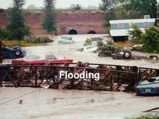
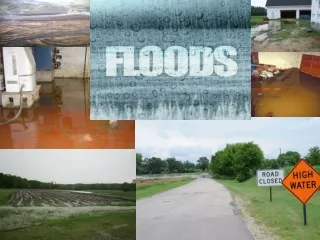
Flooding Queensland 2011. Weather Events. December 2010 – Significant events in 107 locations (wettest month on record) December 24 – Monsoonal trough brought rain from Weipa to Tweed River Cyclone Tasha Cat 1 – 25 December Tasha’s tail – 26 December to 14 January

Flooding Queensland 2011
E N D
Presentation Transcript
Weather Events • December 2010 – Significant events in 107 locations (wettest month on record) • December 24 – Monsoonal trough brought rain from Weipa to Tweed River • Cyclone Tasha Cat 1 – 25 December • Tasha’s tail – 26 December to 14 January • Toowoomba – 10 January micro burst and inland tsunami • Cyclone Anthony Cat 2 – 31 January • Cyclone Yasi Cat 5- 5 February
Ground Events • Fitzroy River Basin Flood – Theodore, Rockhampton • Burnett River Basin Flood – Gayndah, Bundaberg • Condamine/Balonne Basin Flood – Chinchilla, Dalby, Warwick, St George • Mary River Basin Flood – Gympie, Maryborough • Toowoomba and Lockyer Valley System – Helidon, Gatton, Gratham • Bremer River – Rosewood, Ispwich • Brisbane River Catchment – Brisbane City • Coastal Cape Communities – Cooktown, Cairns, Tully, Townsville • Tablelands – Mareeba • Gulf Country - Mt Isa, Charters Towers
Deaths 35
Rail • Normanton – Croydon • Forsyth – Mareeba • Rockhampton – Emerald • Emerald - Winton
Rail • Brisbane Suburban • Ipswich – Toowoomba • Toowoomba – Charleville • Charleville West • Emerald – Winton
13 December 2010 Clayton’s Gully
29 December 2010 Clayton’s Gully 13 January 2011 Clayton’s Gully
17 January 2011 Clayton’s Gully 17 January 2011 Clayton’s Gully
13 January 2011 Cut 18 13 January 2011 Cut 18
17 January 2011 Cut 18 17 January 2011 Cut 18
14 January 2011 Cut 18 14 January 2011 Cut 18
13 January 2011 West of Fig Tree Gully 13 January 2011 West of Fig Tree Gully
20 December 2010 Fig Tree Gully 13 January 2011 Fig Tree Gully
19 January 2011 TR – Site 1 (Downhill) 19 January 2011 TR – Site 1 (Downhill)
19 January 2011 TR – Site 1 (Downhill) 19 January 2011 TR – Site 1 (Downhill)
19 January 2011 TR – Site 4 (Uphill) 21 January 2011 TR – Site 5 (Uphill)
Affected Economic Activity • Coal – Water filled pits, stranded machinery, no rail. • Gas – Bogged drilled equipment, no site access • Minerals – Water filled shafts, no rail • Grain – Damaged harvest • Livestock – Delays and road closures • Construction – Back loading issues, longitudinal dimensions • Sugar – Destroyed crops and mills • Bananas – Damaged crops • Fishery – Lack of electricity
Flood Recovery Road Access Group (FRRAG) Operating since 17 January 2011 AS AT 11 FEBRUARY 2011 .
QUESTIONS • HOTLINE Number 1300 105647 • Email: floodrecovery_roadaccess@tmr.qld.gov.au