Download
1 / 37
370 likes | 524 Vues
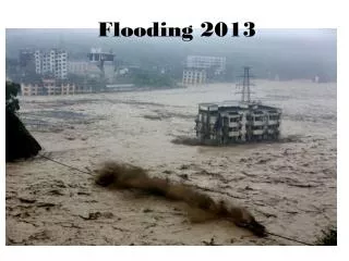
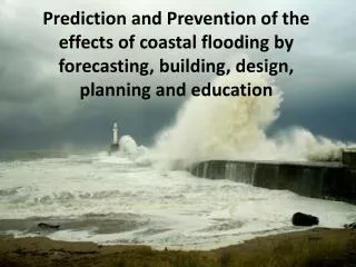
Delve into the causes of recent flooding in Spring Green, explore climate data changes since 1950, and discuss adaptation strategies in a community forum. Discover the potential role of agricultural drainage districts in mitigating flooding risks.

E N D
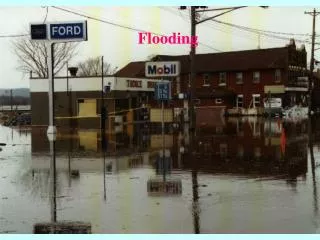
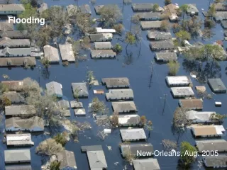
Flooding in Spring Green:A Community Forum • We have listened very closely to your concerns, questions and issues that you raised in the last forum, letters, e-mails, and personal conversations. • Many of you are asking why the flooding is happening now, it didn’t in the past, what is different?
1949 1842 1912 1832
Seeking an Answer • We have taken your comments, questions and ideas back to the campus and have developed three ideas for you to consider. • The purpose of the forum this evening is to present these initial ideas and to ask you to consider them.
What is Different? • Highway 14 improvements and lack of culverts. • More center pivot agriculture. • Impoundments by the river (I.e., Bakkens Pond, Long Lake) • Climate Question: Which one of these is true? Answer: All of the above
The Answer Is … • The answer was all of the above as Highway 14, irrigation systems, impoundments, and climate have all changed since the middle of the last century. • Yet only one of those changes have the potential to cause the level of flooding experienced in recent years in the Spring Green area.
What is this? National Weather Service COOP Weather Station
176 Stations 8 km 5 mi Serbin and Kucharik, 2009, JAMC 10
Changes in Spring Average Precipitation (inches) 1950-2006 SpringGreen
Changes in Summer Average Precipitation (inches) 1950-2006 SpringGreen
Changes in Autumn Average Precipitation (inches) 1950-2006 SpringGreen
Changes in Winter Average Precipitation (inches) 1950-2006 SpringGreen
Change in Annual Average Precipitation (inches) from 1950 to 2006 Average increase of 15%, but highly variable across Wisconsin SpringGreen (from Serbin and Kucharik 2009)
Top 10: 24-hour Precipitation Records MKE Records: 1871-2008 MSN Records: 1879-2008 MKE Records: 1871-present MSN Records: 1879-present TOP 10 24 HOUR PRECIPITATION AMOUNTS AT MADISON... VALUE DATES 1. 5.31 INCHES 9/7/1941 TO 9/8/1941 2. 5.27 INCHES 6/7/2008 TO 6/8/2008 3. 5.20 INCHES 9/12/1915 TO 9/13/1915 4. 5.00 INCHES 8/18/2007 TO 8/19/2007 5. 4.51 INCHES 6/17/1996 6. 4.38 INCHES 5/21/2004 TO 5/22/2004 7. 4.32 INCHES 7/21/1881 8. 4.21 INCHES 7/15/1950 TO 7/16/1950 T9. 4.11 INCHES 6/8/2008 T9. 4.11 INCHES 5/17/2000 TO 5/18/2000 10. 3.95 INCHES 8/1/2001 TO 8/2/2001 TOP 10 24 HOUR PRECIPITATION AMOUNTS AT MILWAUKEE... VALUE DATES 1. 6.84 INCHES 8/5/1986 TO 8/6/1986 2. 5.76 INCHES 6/22/1917 TO 6/23/1917 3. 5.70 INCHES 6/7/2008 TO 6/8/2008 4. 5.28 INCHES 9/7/1941 TO 9/8/1941 5. 5.24 INCHES 6/20/1997 TO 6/21/1997 6. 4.93 INCHES 6/7/2008 7. 4.69 INCHES 6/21/1940 TO 6/22/1940 8. 4.42 INCHES 7/2/2000 9. 4.35 INCHES 7/17/1959 TO 7/18/1959 10. 4.05 INCHES 7/31/1953 TO 8/1/1953 Source: NOAA / National Weather Service, Sullivan / Milwaukee WI
An Inescapable Conclusion You now live in a much wetterworld (on average) than 1950 where there is also a higher probability for extreme rainfall events.
A Wetter B C 1950 Today 2050 Drier Lets Make A Bet If the trend between 1950 and today is represented by the solid line, then which dotted line are you willing to bet will best represent your immediate future?
Projected Change in Annual AveragePrecipitation (inches) 1980-2055 SpringGreen
What Does All This Mean For Spring Green? • The climate will continue to change toward a wetter (and warmer) pattern. • The probability for extreme events (big rain storms) is increasing. • There is increased risk for significant negative impacts with a “do nothing” community response.
Adaptation Strategies • Use a risk/consequence approach and evaluate existing infrastructure to accommodate observed changes in climate; • Develop and evaluate alternative tools and strategies for the design of storm water-related infrastructure, using a collaborative process; • Communicate your recommendations to elected leaders,and other local decision makers.
Another Idea to beDiscussed by the Spring Green Community • One form of infrastructure to be considered is an agricultural drainage district for the western basin
An Agricultural Drainage District • Drainage districts are special purpose districts, like school or sewer districts, formed for the purpose of draining land. • Regulated under Chapter 88 of Wisconsin Statutes http://docs.legis.wisconsin.gov/statutes/statutes/88/I/12/1
Agricultural Drainage • Cannot handle floods • May reduce ground water flooding • NPS pollution a concern • May address airport concerns
Agricultural Drainage • There is a clear sequence of steps for moving from a drainage board to district. • As a unit of government it can borrow start up funds and it can also levy taxes proportionate to benefits received. • Professional help is available as well as some advisory assistance from government agencies.
Agricultural Drainage • The community needs to develop options and explore these in a public setting
A Public Discussion • Boundaries of a Drainage District??? • Drainage south (the river) or west (Bear Creek)??? • Creating greatest benefit to greatest number of citizens in the area??? • Design system to not just manage what is, but what will likely be in near future???
The Impoundments • There is a belief in the community that the impoundments by the river are ‘causing’ the groundwater flooding in the western basin. • If something is believed to be true, then it is true in its consequences. • For those who believe this, you will have an opportunity to test your belief.
Bakkens Pond Year 1: Measure water levels and factors influencing water levels (e.g., rain, irrigation) Year 2: Drain pond, measure water levels and factors influencing water levels. If you believe theimpoundmentshave an impact, then help collectthe data to testyour belief! New test well Graphic Source: Madeline Gotkowitz, WGNHS
Exploring Your Beliefs • If this is to have any impact, then you have to do this. • The DNR, GNHS, airport commission, UW or some other government body cannot do this for you. • They can help coordinate the process, but if you believe the impoundments are the problem, then it is time to explore that belief in a public manner.
Exploring Your Beliefs • If your belief is supported, then the water levels should start falling during the second year of the effort. • If the water levels don’t fall, then you will have to find another explanation for the flooding. • I have given you one -- you live in a much wetter world -- but I am open to hearing others.
This is a public meeting and you now have three ideas to consider: Photo: Wisconsin DNR
Ideas for Discussion • You live in a wetter climate; what are you going to do about it? • A drainage district may help solve flooding in the western basin; is this what you want? • You believe impoundments by the river are the cause of the flooding problem; are you willing to examine the validity of that belief?
GeneralComments or Questions? Thank you for coming together andbegin the process of addressing yourproblems in a way that best meets theneeds and capabilities of this community.