Download
1 / 41
410 likes | 555 Vues
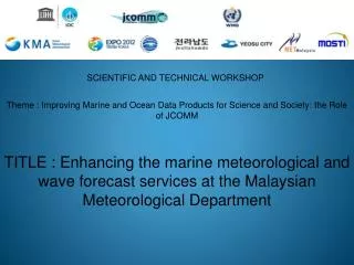
SCIENTIFIC AND TECHNICAL WORKSHOP. Theme : Improving Marine and Ocean Data Products for Science and Society: the Role of JCOMM TITLE : Enhancing the marine meteorological and wave forecast services at the Malaysian Meteorological Department. OUTLINES :

E N D
SCIENTIFIC AND TECHNICAL WORKSHOP Theme : Improving Marine and Ocean Data Products for Science and Society: the Role of JCOMM TITLE : Enhancing the marine meteorological and wave forecast services at the Malaysian Meteorological Department
OUTLINES : • Malaysian Meteorological Department’s (MMD) services • MMD Marine meteorology and oceanography’s users • Observation networks • Operational waves models • Dissemination modes • Conclusion
Malaysian Meteorological Department Services Provided • Weather Forecasts • Severe Weather • Advisory/Warning • Seismology & Tsunami • Warnings • Marine • Meteorology & • Oceanography • Weather Modification • Environmental • Meteorology • Climatology • Agro meteorology
MARINE METEOROLOGY & OCEANOGRAPHY USERS Ferry operators National marine parks OIL & GAS EXPLORATION
MARINE METEOROLOGY & OCEANOGRAPHY USERS Fishing activities Portsauthorities Search and Rescue/Research work Recreational sea sports/ Coastal activities Maritime enforcement authorities
MARINE OBSERVATION NETWORK ACOUSTIC DOPPLER CURRENT PROFILER & RECORDING DOPPLER CURRENT PROFILER Perhentian Island Kota Kinabalu Pangkor Island Sandakan Kuantan Mabul Island Bintulu ADCP – 4 sites RDCP - 3 sites
MARINE OBSERVATION NETWORK COASTAL AUTOMATIC WEATHER STATIONS COASTAL AUTOMATIC WEATHER STATION – 14 LOCATIONS
MARINE OBSERVATION NETWORK – complement observation Survey and Mapping Department
PORT METEOROLOGICAL OFFICER’S SITEs In supporting the WMO Voluntary Observing Ship fleet Kota Kinabalu FT Labuan Port Klang Bintulu Main office for VOS
Voluntary Observing Ship fleet - Info • Covers VOS Malaysia for area bounded 50ºS – 20ºN and 95ºE – 130ºE • Receiving mode : GTS and MetLog Storage : MMD’s Integrated Meteorological system • in IMMT4 format • Quality check and report to the Global Collecting Centre GCC quarterly (Jan, April, July and Oct) • Total ship (current) : 90 vessels Selected (39) , Supplementary (27) and Auxiliary (24)
OPERATIONAL OCEAN WAVE MODELS AT MMD • MMD – WAM wave model • 2) MMD - JMA MRI III wave model
OPERATIONAL OCEAN WAVE MODELS AT MMD MMD – WAM wave model
OPERATIONAL OCEAN WAVE MODELS AT MMD BRIEF INFORMATION ON MMD-WAM ocean wave model • 3rd generation of wave model • Adapted from Thailand WAM and operationalised in Feb 2003 • Fine grid 10ºS – 15ºN/95ºE – 120ºE • Coarse grid 20ºS – 30ºN/85ºE – 135ºE • Outputs : (1) Sig wave – Height, period overlay 10m winds (3 & 6 hourly/ 7 & 16 days) • (2) Max wave – Height and peak period (3 & 6 hourly/ 7 & 16 days) • Data sources : NOGAPS and NCEP-GFS
BRIEF INFORMATION ON MMD-WAM ocean wave model PAST ( in 2003 ) • Duo processor Pentium 3.06 GHz , 4GB RAM 72 GB HD • Software : OS linux Red Hat 7.3, WAM source code G77 Fortran compiler, Perl 5.0, GRADs and image viewer • Domain Coarse Grid: 0.5°x0.5° Map coverage 20S – 30N/85E-135E Fine Grid: 0.25°x0.25° Map coverage 10S – 15N/95E-120E • Output - Time step 3 hours up to 144 hours • Processing time : Coarse Grid approximately 25 minutes & Fine Grid approximately 45 minutes • Data input : NOGAPS Global model 144 hours forecast at 0000 UTC and 1200 UTC
PRESENT/ENHANCEMENT • Gribsimp program for grib1 to binary conversion replaced with wgrib and wgrib2 • Model domain not restricted to square box dimension i.e. domain is rectangular • Downloading of data input is performed via http(OpenDAP) in addition to ftp • Graphical output are displayed in local Malaysian time in addition to UTC • Duo Processor Quad Core 2.4 GHz 16GB RAM 1 TB HD • Software : Fedora Core 14, WAM source code • Gfortran Fortran compiler, Perl 5.0, GRADs and image viewer • Output - Time step : 3 hours up to 384 hours forecast (16 days) • Processing time : Coarse Grid approximately 10 minutes , Fine Grid approximately 25 minutes and Global run approximately 2 hours (non operational) • Execution time : 0300 UTC and 1500 UTC
OPERATIONAL OCEAN WAVE MODEL AT MMD • MMD – WAM (Data source : NOGAPS) • Output • Sig wave height, mean period overlay10m wind • 3 hours interval / up to 7 days forecast • Fine and coarse grids
OPERATIONAL OCEAN WAVE MODEL AT MMD 2) MMD – WAM (Data source : NOGAPS) • Output • Max wave height and peak period • 3 hours interval / up to 7 days forecast • Fine and coarse grids
OPERATIONAL OCEAN WAVE MODEL AT MMD 3) MMD – WAM (Data source : NCEP) • Output • Sig wave height, mean period overlay 10m wind • 3 hours interval/up to 192 hours forecast • 6 hours interval /up to 384 hours forecast • Fine and coarse grids
OPERATIONAL OCEAN WAVE MODEL AT MMD 4) MMD – WAM (Data source : NCEP) • Output • Max wave height and peak period • 3 hours interval/up to 192 hours forecast • 6 hours interval /up to 384 hours forecast • Fine and coarse grids
OPERATIONAL OCEAN WAVE MODELS AT MMD MMD – JMA MRI III wave model
OPERATIONAL OCEAN WAVE MODELS AT MMD BRIEF INFORMATION ON MMD- MRI III ocean wave model • 3rd generation of wave model • Collaboration with the Office of Marine Prediction, JMA • Operationalised in June 2009 • Fine grid 5ºS – 17ºN/95ºE – 124ºE (0.25ºx0.25º) • Coarse grid 15ºS – 35ºN/75ºE – 135ºE (1.0ºx1.0º) • Outputs : (1) Sig wave – Height, period, direction (3 & 6 hourly/ 8 & 16 days) • (2) Wind wave – Height and peak period (3 & 6 hourly/ 8 & 16 days) • (3) Swell wave - Height, period, direction (3 & 6 hourly/ 8 & 16 days) • Data source : NOGAPS and NCEP-GFS
OPERATIONAL OCEAN WAVE MODELS AT MMD BRIEF INFORMATION ON MMD- MRI III ocean wave model • Data source : NOGAPS Output : 3 hourly up to 180 hours forecast • Data source : NCEP-GFS Output : 3 hourly up to 192 hours forecast OR 6 hourly up • to 384 hours forecast • Performance is good in deep sea - swell propagation and evolution as its advantage in • wind wave – swell energy transfer and more realistic swell decaying simulation
OPERATIONAL OCEAN WAVE MODEL AT MMD 5) MMD – MRI III (Data source : NOGAPS) Output : 3 hours/ up to 180 hours forecast Sig wave : Height, direction and mean period Swell wave : Height, direction and mean period
OPERATIONAL OCEAN WAVE MODEL AT MMD 5) MMD – MRI III (Data source : NOGAPS) Output : 3 hours/ up to 180 hours forecast Wind wave : Height, mean period overlay 10 m winds
OPERATIONAL OCEAN WAVE MODEL AT MMD 5) MMD – MRI III (Data source : NCEP GFS) Output : 3 hours up to 192 hours AND 6 hours interval up to 384 hours forecast Sig wave : Height, direction and mean period Swell wave : Height, direction and mean period
OPERATIONAL OCEAN WAVE MODEL AT MMD 5) MMD – MRI III (Data source : NCEP GFS) Output : 3 hours up to 192 hours AND 6 hours interval up to 384 hours forecast Wind wave : Height, mean period overlay 10 m winds
OTHER COASTAL MARINE SERVICES AT MMD MMD – JMA STORM SURGE MODEL
MMD – JMA STORM SURGE MODEL Forecast 7 days / 1 Hour interval Height increment/decrement (cm) overlay surface wind
MMD – JMA STORM SURGE MODEL Point forecast
Modes of Dissemination Normal forecasts • TV Broadcast • Radio Broadcast • Facsimile • Telephone • Electronic and Print Media • MMD Website (www.met.gov.my)
Modes of Dissemination Advisory/warning • TV Broadcast • Radio Broadcast • Facsimile • Telephone • Electronic and Print Media • MMD Website (www.met.gov.my) • Internet Social Media (Facebook and Twitter) • SMS • TV Crawler
ENHANCING SERVICES : DISSEMINATION TO SPECIFIC USERS USER’S INTERFACE
USER’S INTERFACE SELECTION OF PRODUCTS
DISSEMINATION TO SPECIFIC USERS • Various ocean wave models end products are available • – Graphic and tabular formats • External users assess is limited to • related products depending on • their needs • Internal users have no • restriction • Improved services to all users • through easy, convenient & • fast access and up to date info
Conclusion • Enhancing services through : • Improving forecasts’ reliability/accuracies • Improving forecasts’ dissemination & accessibility • Customised forecasts to meet users’ demands and requirements • (users orientated services)