Download
1 / 20
220 likes | 402 Vues
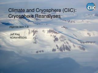
Climate and Cryosphere (CliC): Cryosphere Reanalyses. (Agenda item 7.3). Jeff Key NOAA/NESDIS. Cryosphere Variables. Snow - Snow water equivalent, depth, extent, state, density, snowfall, solid precipitation, albedo Lake and River Ice - Freeze-up/Break-up, thickness, snow on ice

E N D
Climate and Cryosphere (CliC):Cryosphere Reanalyses (Agenda item 7.3) Jeff Key NOAA/NESDIS
Cryosphere Variables • Snow- Snow water equivalent, depth, extent, state, density, snowfall, solid precipitation, albedo • Lake and River Ice- Freeze-up/Break-up, thickness, snow on ice • Sea Ice- extent, concentration, open water, type/age, thickness, motion, icebergs, snow on ice • Glaciers, Ice Caps, Ice sheets- mass balance (accumulation/ablation), thickness, area, length (geometry), firn temperature, snowline/equilibrium line, snow on ice • Frozen Ground/Permafrost- soil temperature/thermal state, active layer thickness, borehole temperature, extent, snow cover
Prediction and Use of Cryosphere Information • Global models: • Many GCMs have ice models and predict ice extent and thickness (see SWIPA comparison of GCMs with regard to ice) • Regional models: • Pan-Arctic Ice-Ocean Modeling and Assimilation System (PIOMAS), 1948 – 2004. • Arctic System Reanalysis (ASR) - coupled ice-ocean, land surface and other models. Under development. • SNODAS at NWS/NOHRSC (an analysis, not a reanalysis) • Others, e.g., coupled ocean-ice model of the ECCO group (http://ecco-group.org) • Product reprocessing • Sea ice extent, concentration, motion, thickness, and age • Snow cover • Snow/ice surface temperature and albedo • Winds (not cryosphere, but relevant)
Assimilation of Snow and Ice Data Snow/ice • Sea ice motion (sat): PIOMAS (U. Washington), experimental. • Sea ice extent (sat): PIOMAS, operational NWP and reanalyses, U.S. Navy PIPs model; Canada; others? • Sea ice concentration (sat): experimental forecast model • Snow cover (sat + surf): operational NWP, NOHRSC; Canada; others? • Snow water equivalent (sat + surf): operational NWP, NOHRSC • Ice surface temperature (sat, surf): experimental. Polar Atmosphere • Polar winds (sat): operational NWP models (11 worldwide). Reanalysis use soon (JRA, ERA, others)
The Pan-Arctic Ice-Ocean Modeling and Assimilation System is a coupled ocean-ice capable of assimilating ice concentration and velocity data. It generates ice thickness, concentration, motion, and snow depth. PIOMAS, 1948-2004 (Jinlun Zhang, University of Washington) Monthly mean model simulated sea ice thickness (m) and satellite observed ice edge (white line) for 9/1979 and 9/2003.
The first dry run of the Arctic System Renalysis is being run at reduced resolution, 30 km. It should be done by the end of this month (March 2010) for the period June 2007-September 2008. It will use sea ice concentration, thickness, albedo, and snow cover. Arctic System Reanalysis (Dave Bromwich, Ohio State University, and others) Eos, Vol. 91, No. 2, 12 January 2010
SNODAS combines all available data, including NWP model output coupled with meteorological and snow observations, to generate a best estimate of gridded snow water equivalent in near real-time. SNOWDAS includes: • data ingest and downscaling procedures, • a spatially distributed energy-and-mass-balance snow model that is run once each day, for the previous 24-hour period and for a 12-hour forecast period, at high spatial (1 km) and temporal (1 hr) resolutions, and • data assimilation and updating procedures. • The snow model is driven by downscaled analysis and forecast fields from a mesoscale, NWP model, surface weather observations, satellite-derived solar radiation data, and radar-derived precipitation data. It is updated with satellite and surface observations of snow extent, snow depth, and snow water equivalent. Assimilation of Snow DataSNODAS at NOHRSC (NOAA/NWS)
Climate Model Assessment and Output for SWIPA (SWIPA = Snow, Water, Ice, and Permafrost of the Arctic, an Arctic Council assessment) IPCC models vary considerably in their ability to hindcast climate patterns based on location, variable of interest, and analysis methods (e.g. means, variance, trends, etc). Some models perform well by some criteria but not by others. Which models are best for assessments such as SWIPA? J. Overland, J. Walsh, V. Kattsov, M. Wang -- SWIPA ad hoc model liaison team
Primary source of model output for 20th and 21st centuries: IPCC Fourth Assessment Report archive at PCMDI (PCMDI: Program for Climate Model Diagnosis and Intercomparison) -- ~23 global climate models -- 1-10 ensemble members from each model -- A2, A1B, B2 scenarios from most models -- simulations span 20th century (prescribed forcing) and 21st century (forcing from scenario) What is the optimum number of models to include? Model selection basis: Simulation of seasonal cycle of recent climate
If the N models with the smallest RMSE are selected:(temperature, 60-90N)
IPCC AR4 models (optimum subset): Simulated Arctic sea ice extent (September) Northern Hemisphere September sea ice extent as simulated by IPCC AR4 Models (now CMIP) models for 20th and 21st century under A1B emission scenario by six models selected for simulating mean and seasonality of sea ice extent within 20% of the observed values. The thick blue line is the ensemble mean of the members in the reduced group, and the thick yellow line is the ensemble mean for all IPCC AR4 models. Thick read line is the observed values based on Hadley Centre sea ice analysis (HadISST). After Wang and Overland (2009).
A few current reprocessing efforts: • Sea ice extent and concentration for SSMR and SSM/I period (NSIDC and Ocean and Sea Ice group of EUMETSAT's Satellite Application Facility) – 8 different ice concentration products! • Sea ice thickness, age, and motion • Sea Ice Charts of the Russian Arctic, 1933-2006 (AARI and NSIDC) • Snow “reanalysis” (NSIDC and Rutgers U.) • Snow/ice surface albedo, surface and TOA radiation • Greenland climate network (K. Steffen) • Soil temperature data recovery and access (V. Romanovsky) • Historical AVHRR polar winds Reprocessing
NOAA Scientific Data Stewardship • NOAA's National Climatic Data Center (NCDC) initiated the Scientific Data Stewardship (SDS) Project to lead the Agency's CDR activities and to coordinate with the partner agencies. • The SDS Project provides fundamental and geophysical CDRs per the recommendations of the U.S. Climate Change Science Program (CCSP), the Global Climate Observing System (GCOS), and the Intergovernmental Panel on Climate Change (IPCC) Fourth Assessment Report. • The Project's goal is to extend proven algorithms to a sufficiently large set of observations that near-seamless long-term aggregate records are obtained. Application of same or similar algorithms across different satellites, when practical, allows development of homogeneous error structures - a key Project goal. The Project expects rigorous error analysis in all of its products.
Snow and Ice CDRs The cryosphere product development team will coordinate the generation, validation, and archival of fundamental and thematic snow and ice climate data records. • Ice/snow surface temperature (AVHRR and MODIS) • Ice/snow surface broadband albedo (AVHRR and MODIS) • Sea ice motion (AVHRR and SSM/I or AMSR-E) • Sea ice concentration and extent (SSM/I and AMSR-E) • Sea ice thickness/age (AVHRR, MODIS, SSM/I and AMSR-E) • Snow cover/extent (AVHRR, SSM/I, AMSR-E) • Surface shortwave and longwave radiation (AVHRR and MODIS) • Surface ice melt onset and freeze-up (SMMR, SSM/I, AMSR-E)
Sea Ice Thickness/Age 1982-2004+ Sea Ice Thickness Age from Motion
Ice Motion 1982-2010
Surface Temperature and Albedo 1982-2004 Skin Temperature Broadband Albedo
Historical Polar Winds from AVHRR1982-2009 A 28 year dataset of wind vectors (speed, direction, height) in both polar regions has been generated from AVHRR data. Daily composite of wind vectors derived from NOAA-17 AVHRR GAC data on March 17, 2003 over Antarctica. The South Pole is at the center of the image. The background is the AVHRR 11 micron brightness temperature image. Wind vectors are grouped into three height categories (for illustration only): below 700 hPa (yellow), from 400 to 700 hPa (cyan), and above 400 hPa.