Download
1 / 19
200 likes | 356 Vues
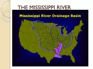
Case Study of CDOM to Salinity Relationships in Mississippi River Outflow. EAS 4480 V.J. Maisonet. Introduction. Real-time distribution of salinity around the world’s coasts are yet not accessible. Large regions of the ocean do not have sufficient data to estimate a mean salinity accurately.

E N D
Case Study of CDOM to Salinity Relationships in Mississippi River Outflow EAS 4480 V.J. Maisonet
Introduction • Real-time distribution of salinity around the world’s coasts are yet not accessible. • Large regions of the ocean do not have sufficient data to estimate a mean salinity accurately. • Ocean salinity is important measure in the determination of ocean circulation • As a result forecast skill is limited leading to large errors in the surface fluxes 2
Introduction • The relationship between CDOM and salinity may vary spatially between regions and watersheds. • As well as temporally dues to seasonal variation in rainfall, biological inputs, soil runoff and vegetation. • It has been demonstrated that a well defined CDOM/SSS relationship is evident in both the MR & AR. • This relationship has been shown to maintain itself during both high and low flow seasons. 3
CDOM Algorithms Tested • Using a algorithm from D’Sa et. al., 2005, CDOM absorbance from the optical ratio Rrs510/Rrs555 using in water samples: • Log(acdom (412)) = -0.643-2.022(Log [Rrs(510)/ Rrs(555)]) (1) • Using a power law equation derived from satellite and field measurements, D’Sa et. al., 2006 created an empirical algorithm for the absorbance of CDOM: • Acdom (412) = 0.227[Rrs(510)/ Rrs(555)]-2.022 (2) 4
Goal • Our goal is to determine a relationship between CDOM and SSS in the coastal zone and test this correlation to attempt to fill the gaps left by the satellites to create a ‘whole picture’ of the sea surface salinity. 5
Tasks • CDOM algorithms (Eq. 1 & 2) were applied to the data set using MATLAB. • A linear regression of the resulting CDOM values with salinity data, with supporting statistics determined which of the algorithms was better suited for the data • The linear regression equations from the best fit(s) were used to create a Salinity Model. • Using the contourf function in MATLAB, the salinity model was used to create a salinity map of the Louisiana shelf. 7
Algorithm comparison • For the 2 datasets visual comparisons between the 2 algorithms were made. 8
Algorithm comparison Ignore #3 9
Algorithm comparison Ignore #3 10
Algorithm comparison • For each flight in May the CDOM/SSS relationship broke down at ~28 PSU • The two algorithms were run through a linear regression in MATLAB also Chi square statistic (chisq), uncertainties (dp), and the mean squared error (sigy) where produced. 11
Salinity Model Development • Empirical salinity models for the optical data were made using the slopes and intercepts of the linear regressions from the 3 May flights • based on: Salinity= p(1)*[CDOM Alg#] + p(2). • Salinity1= -49.78*[CDOM Alg#] + 41.13 • Salinity2= -44.20*[CDOM Alg#] + 35.90 13
Salinity Model Development • To determine the best model, the 2 algorithms were run for each flight and applying a 5km low pass filter. • The Standard Deviations, Root Mean Squared Error was used to determine which Salinity Model best predicted salinity in all flights 14
Salinity Model • The Salinity models are too close to choose which it best • Solution? • Combine all three flights Salinity_combine= -46.48*[CDOM Alg#] + 42.94 18
Salinity Model • The combine salinity model from May was applied to a SeaWiFS monthly composite of May 2007 • It was necessary to shift to using CDOM Algorithm 2 for the CDOM input. • CDOM Algorithm 2 should be utilized in this case since it was created with atmospherically corrected satellite data. 19
Salinity Model Salinity Combine Model Salinity 20
Summary • -Taking the highest error as worst case this salinity model has an error +/- ~4 PS • -This error is quite large and will inhibit the ability to accurately define features seen in satellite salinity maps • -The CDOM/SSS relationship broke down in area of salinities > 28 PSU 21