Download
1 / 17
170 likes | 393 Vues
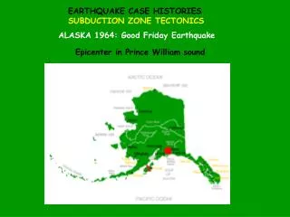
Cascadia Subduction Zone Earthquakes and Critical Infrastructure Workshop Edward Perez, FERC. Background Part 12D Report. Every 5 years. Top-to-bottom review of safety. Accept/Supplement Remedial Action. Safe or not? Seismic Load case Stay up to speed with latest science.

E N D
Cascadia Subduction Zone Earthquakes and Critical Infrastructure WorkshopEdward Perez, FERC Background Part 12D Report. Every 5 years. Top-to-bottom review of safety. Accept/Supplement Remedial Action. Safe or not? Seismic Load case Stay up to speed with latest science. Update analyses as needed.
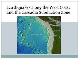
Cascadia Subduction Zone Earthquakes and Critical Infrastructure WorkshopEdward Perez, FERC Two significant seismic reports currently under review. -Probabilistic Hazard Analyses For Mid-Columbia Dams. -EWEB: Seismic Hazard Assessment, Carmen-Smith and Leaburg-Walterville Projects. -Ground motions higher than previous studies. - Results may affect other FERC projects.
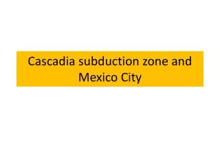
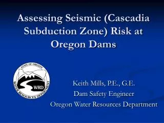
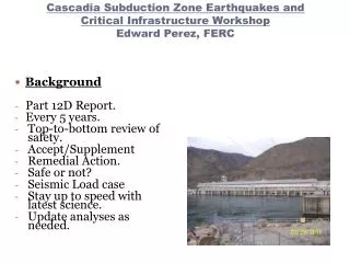
2012 PROBABILISTIC SEISMIC HAZARD ANALYSESPROJECT FOR THE MID-COLUMBIA DAMS Prepared for Public Utility Districts of Chelan, Douglas, and Grant Counties February 2012 Chelan Dam Wells Dam Rocky Reach Dam Priest Rapids Dam Wanapum Dam Rock Island Dam
Seismic Hazard Assessment • Carmen-Smith and Leaburg Walterville • EWEB requested to conduct comprehensive seismic hazard assessment (previous Part 12D studies indicated very low ground motions). • Info needed for Part 12 Subpart D Reports and new fish passage facility design. • Consistent framework for seismic evaluation of existing and proposed facilities. • DSHA,MCE, and PSHA • Located along McKenzie River east of Eugene, OR. • CSZ ( interface and intraplate) and 20 crustal sources. • Intraplate in Oregon? • Nason McCullough, CH2M-Hill
FERC review: • Crustal Faults • Use the most current mapped fault dimensions and locations, as documented in the USGS Fault and Fold Database. • Use the USGS mapped fault length with the Wells and Coppersmith (1994) relationships to estimate maximum moment magnitude. • Use a random crustal (normal fault) event located 15 km from the project site to be consistent with recommendations in northern Oregon Cascades. • Crustal sources: Use the geometric mean of all five GMPE relationships (2008 NGA’s). • Use the median (50th percentile) motions for low activity or low slip rate sources and 84th percentile for high activity or high slip rate sources. As no crustal faults have been identified within the vicinity of EWEB facilities with high activity or slip rates, the 50th percentile motions should be used unless additional evidence of higher activity/slip rates is found.
Seismic Recomendations • Subduction Zone Interface Source • Use the bottom of the transition zone as used by the USGS national seismic hazard mapping to determine the site-to-source distance. • Use a maximum MW 9.0. • Use the 84th Percentile motions – given that this source has an average recurrence interval on the order of about 500 years, it is prudent to use the 84th percentile ground motions.
Seismic Recommendations • Subduction Zone Intraplate Source • Use the most recent information to determine the closest site-to-source distance to the top of the Juan de Fuca plate. • Use a maximum MW 7.2. • Use the median (50th percentile) motions – given that this source has no historical activity of engineering interest (MW greater than 5.0), an anomaly for intraplate sources worldwide. • Recommendation: There is geologic evidence that the Intraplate source may not be capable of generating earthquakes of engineering interest; therefore, use the median ground motions.
Earthquake Time Histories • Considered Motions: • Interface: • 1978 Miyagi-Oki • 1985 Mexico • 1985 Chile • 2010 Chile • Intraplate: • 1949 Olympia • 1965 Puget Sound • 2001 Nisqually • 1974 Peru • 1997 Mexico • Crustal: • 1980 Irpinia, Italy • 1979 Norcia, Italy • 1975 Oroville • 1992 Little Skull Mtn, Nevada • 1980 Mammoth Lakes • 1983 Borah Peak, Idaho