Download
1 / 21
210 likes | 351 Vues
Forest Project Protocol v3.1 Use of FIA Data . John Nickerson FIA Conference February 2010. CAR’s Forest Protocol (Version 3.0). 2. Two-year stakeholder process with public review process Protocols produce offsets that are real, additional, verifiable, and permanent

E N D
Forest Project Protocol v3.1Use of FIA Data John Nickerson FIA Conference February 2010
CAR’s Forest Protocol (Version 3.0) 2 Two-year stakeholder process with public review process Protocols produce offsets that are real, additional, verifiable, and permanent Addresses eligibility, GHG assessment boundaries, co-benefits, monitoring and verification Project accounting is standardized and practical (to the extent possible)
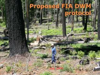
Forest Project Types • Improved Forest Management • Activities that increase forest-based sequestration and/or decrease emissions • Reforestation • Less than 10% canopy cover for at least 10 years, or following a significant natural disturbance that has removed at least 20% of the trees • Avoided Conversion • Removing a significant conversion threat to non-forest use and dedicating the forest to continued forest cover. 3
Key Values in Appendix F Appendix F of the FPP provides data, by Assessment Area, necessary to calibrate project accounting to geographies throughout US: • Common Practice • Diversity Index • Fire Risk Rating • Rotation Age • Mill Efficiency • Wood Product Classes 4
Defining an Assessment Area Assessment Areas are: Forest communities within Ecosections and Supersections Similar species Similar economic drivers, management activity, and regulatory environment Based on the natural forest communities found within the Supersections rather than the presence of a single dominant species as in plantation management Not spatially explicit, since distribution of communities is affected by local environmental attributes 5
Spatial Units – Ecosections and Supersections • Ecosections are spatial units developed by the US Forest Service that have similar physical and biological components • Supersections - a term coined for this project in order to stratify the plots into high site class and low site class (where possible) and maintain statistical reliability • The combination of Ecosections into Supersectons only occurred where adjacent Ecosections share similar environmental, economic, and regulatory attributes 6
Process uses Section-level data from ECOMAP The primary purpose for delineating ecological units is to identify areas at different hierarchical levels that have similar capabilities and potentials for management. (Cleland et. al., 1997) However, more than one forest community can exist at the section level Oak woodlands and conifer-dominated forests Ecological Subregions: Provinces, Sections and Subsections
Refining Forest Communities within Ecosections • Adding a field ‘Forest Community’ or Assessment Area based on FIA Forest Type and Ecosections
Developing Supersections Ecosections are combined into Supersections if: • The Ecosections are adjacent to each other • They exhibit a commonality in environmental factors between them, as evidenced by similar distribution species • The economics of forest management are similar between the Ecosections. • Regulations between Ecosections are similar Averages were compared for independent Ecosections and Supersections to ensure values (carbon tonnes) were within 10% of each other. Otherwise Supersections were separated into component Ecosections 9
Supersection A Supersection B Using Appendix F – Determining Supersections • A project must determine which Supersection(s) its boundaries are within • Maps are available on the Reserve’s website both in hard copy and GIS shapefiles Project 12
Supersection A Project Supersection B Assessment Areas Using Appendix F – Determining Assessment Areas • Each project must use the species list to stratify the project’s area into Assessment Areas • Mapping resolution is 20 acres 13
Using Appendix F – Determining Site Classes • Each project must stratify the project area into high and low site class for each Assessment Area • High site class is defined as Site Class I and II • Low site class is defined as Site Class III, IV, and V • Justification through soils data or site measurements. Where justification not conducted, project must use high site data • Minimum mapping resolution is 1000 acres 14
Using Appendix F – Determining Common Practice • Improved Forest Management Projects must identify the Common Practice statistic (above-ground portion of live trees on private lands) as part of the project’s baseline • It is the extent to which projects can receive credit for avoided emissions • FIA data used because of: • Wide application • Unbiased and objective • standardized • Other statistics (board foot volume, basal area, and standard error) are presented for informative purposes only 15
Improved Forest Management Baseline Project Activity Initial Project Inventory Standing Live Carbon Baseline, provided there are no legal encumbrances to harvest to the FIA average and it makes economic sense to do so Reductions Average Inventory of Standing Live Carbon, derived from FIA data for assessment area • In this scenario, the project will generate credits for both stock retention and growth 16
Improved Forest Management Baseline Modeling of Live Trees Per Acre Basis
Inserting Data in Calculation Worksheet Worksheet to be available for download soon!
Using Appendix F – Determining the Diversity Index • Forest projects must manage for a diversity of native species. The value in Appendix F is the maximum amount (by carbon percentage) of any one native species allowed within a project. The species diversity requirement is based on natural diversity within the Assessment Area • Each FIA plot is attributed with a species reference (Forest Type). • Species diversity is determined calculating the maximum percentage of any one Forest Type (by plot number) within an Assessment Area. • Range of any one species within a project area is limited between 60% and 100% 19
For Questions or Assistance • Full Information Available on Our Website • www.climateactionreserve.org • Contact the Reserve • Call the Programs Team at (213) 891-1444 • Or email questions to: programs@climateactionreserve.org 21