Download
1 / 24
240 likes | 399 Vues
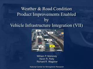
Enhancing Road Weather Information Through Vehicle Infrastructure Integration (VII). Kevin R. Petty Ph.D. and William P. Mahoney III. National Center for Atmospheric Research Boulder, Colorado. AMS Corporate Forum 2007. Weather Impacts Safety, Mobility, and Efficiency. +.

E N D
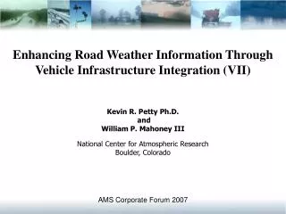
Enhancing Road Weather Information Through Vehicle Infrastructure Integration (VII) Kevin R. Petty Ph.D. and William P. Mahoney III National Center for Atmospheric Research Boulder, Colorado AMS Corporate Forum 2007
Weather Impacts Safety, Mobility, and Efficiency + An investigation of vehicle crashes spanning from 1995 through 2004 revealed that each year there are over 1,500,000 crashes that occur during poor weather conditions, which result in more than 690,000 people injured and nearly 7,400 fatalities* +NOAA Surface Weather Program *FHWA/Mitretek Systems
Mitigating the Impact of Weather • A vigorous road weather research program aimed at understanding road weather phenomena and the effect of weather on safety, capacity and efficiency • Improved modeling capabilities and forecast systems • An integrated observation network and data management system • Enhanced delivery and communication of road weather information • New technologies to improve weather and road condition analyses and forecasts. Vehicle Infrastructure Integration (VII) has the potential to facilitate advancements in each of these areas
What is VII? DEFINITION: Vehicle to Infrastructure (V-I) and Vehicle to Vehicle (V-V) communication through Dedicated Short Range Communications (DSRC- wireless radio comm. 5.9 GHz)
Connects Vehicles and Infrastructure End User Driver Vehicle #1 Data Driver interface Vehicle #2 Data Subscriber Applications On Board Equipment Regional Message Switch DSRC VII System 5.9 DSRC Road Side Equipment
Potential Rural RSE Deployment 10 min spacing @ 60 mph
Urban RSE Deployment 2 min spacing @ 20 mph Detroit
Probe Message Processes • Periodic Data – elements that are routinely available for collection (e.g. temperature and vehicle speed) • Event Data – elements that are available on a irregular basis (e.g. ABS and traction control) • Snapshot – a collection of vehicle data elements (e.g. temperature, barometric pressure, etc.) valid at a specific time • Periodic • Event triggered • Start/Stop • Event triggered and start/stop snapshots have priority over periodic snapshots
Weather-related Vehicle Data Elements • Hours of operation • Elevation • Accelerometer data • Vehicle speed • Heading • Rate of change of steering wheel • Exterior temperature • Windshield wiper setting • Rain sensor • Sun sensor • Adaptive Cruise Control (ACC) radar • Atmospheric Pressure • Ambient noise level • Headlights • Relative humidity • ABS • Traction control • Stability control • Pavement temperature • Brake
Diagnosing Boundary Conditions and Precipitation DaimlerChrysler Vehicle Data Elements andDetroit (DTX) WSR-88D Data 2006-05-25 22:12:13Z 2006-05-25 22:57:43Z
Weather Data Translator (WDT) Processing system to convert vehicle data into useful weather & road condition information
Potential Weather and Road Condition Improvements Improved High-Resolution Modeling As weather models increase in resolution, observations will need to increase as well to better define the regional/local state of the atmosphere. Vehicle observations can fill-in the gaps in the fixed observation network.
Potential Weather and Road Condition Improvements Improved identification of precipitation and precipitation type Currently, precipitation type is determined by airport observations (METARS) which are few and far between! Vehicle data (air temperature, and data from maintenance or patrol vehicles) would greatly improve product accuracy.
Potential Weather and Road Condition Improvements Improved identification of slippery pavement Anti-lock Braking, Traction Control, and Stability Control systems are designed to monitor wheel events linked to the pavement/tire interface. By making appropriate adjustments to other onboard systems (e.g. throttle, braking, etc.) the greatest amount of traction possible is achieved. Although these systems do not directly measure friction, it may be possible to derive information on the state of the roadway from event data.
Potential Weather and Road Condition Improvements Identification of Foggy Regions The use of vehicle data (relative humidity, fog and head lamp settings, speed, and brake data) coupled with other data sets (e.g., satellite, surface analysis data) could be used to diagnose areas where fog is likely. This product concept is challenging!
VII Data Meteorological Data Regional Air Quality Decision Support -Current Pollution concentrations -Predicted Pollution concentrations Auto Emission Calculation Multi-scale Regional Air Quality Model Macro-scale Emission Inventory Potential Weather and Road Condition Improvements Improved air quality predictions Vehicle data (type, location) could be used to replace averaged datasets to analyze and predict air quality.
Potential Weather and Road Condition Improvements Improved pavement conditions Vehicle pavement temperature data could be used to fill-in observations from fixed sensor sites.
Potential Weather and Road Condition Improvements * Identification of slippery pavement* Improved knowledge of pavement temperatures* Improved knowledge of pavement condition (dry, wet, snow covered, etc.)* Reducing radar anomalous propagation (AP)* Improved identification of virga (precipitation not reaching the ground)* Improved identification of precipitation type* Improved identification of foggy regions* Improved characterization of surface conditions for weather models* Improved weather analysis and prediction in complex terrain* Improved air quality monitoring and prediction* Improved diagnosis of boundary layer water vapor
Research Needs and Challenges • Adoption Rates • Data Volume • Probe Message Proc. • Quality and Accuracy • Data Fusion
Research Needs and Challenges • Adoption Rates • Data Volume • Probe Message Proc. • Quality and Accuracy • Data Fusion
Research Needs and Challenges • Adoption Rates • Data Volume • Probe Message Proc. • Quality and Accuracy • Data Fusion
Research Needs and Challenges • Adoption Rates • Data Volume • Probe Message Proc. • Quality and Accuracy • Data Fusion
Research Needs and Challenges • Adoption Rates • Data Volume • Probe Message Proc. • Quality and Accuracy • Data Fusion
Road Weather Impact Products • VII enables tactical and strategic response to weather related surface transportation hazards. • New weather and road condition data (incl. VII and Clarus data) should be integrated into a seamless information database(s) to support: • 511 • In-vehicle information • Traveler information • Highway operations • Control systems • Weather Prediction • Road Condition Prediction • Etc. Improving Safety, Mobility and Efficiency