Behind the Scenes of Storm Chasing: June 7, 2009 AOS 121 and Vortex 2 Insights
250 likes | 385 Vues
Dive into the intricate process of storm chasing as we explore a behind-the-scenes account from June 7, 2009, during AOS 121 and Vortex 2. Understand the atmospheric conditions that contribute to severe weather formation, including the principles of buoyancy, lapse rates, and the utility of Skew-T diagrams. Learn how storm chasers identify weather patterns to forecast tornadoes while balancing safety and excitement. This comprehensive overview combines theoretical meteorology with real-world application, providing valuable insights for enthusiasts and professionals alike.

Behind the Scenes of Storm Chasing: June 7, 2009 AOS 121 and Vortex 2 Insights
E N D
Presentation Transcript
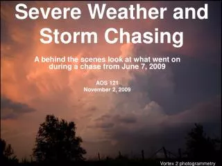
Severe Weather and Storm Chasing A behind the scenes look at what went on during a chase from June 7, 2009 AOS 121 November 2, 2009 Vortex 2 photogrammetry
Thunderstorm Process • Air that is warmer than its surroundings is positively buoyant and will rise. • As air rises, it does expansion work, and cools. • Dry Adiabatic Lapse rate ≈10oC/km • Moist Adiabatic Lapse rate ≈6.5oC/km
Thunderstorm Process Cont’d • Using a Skew-T diagram, we can see the effect of lifting a parcel of air from the surface. • If the surface parcel is warmer, it is likely to rise and form a thunderstorm.
Temperature Dry Adiabats Moist Adiabats Mixing Ratio Td = Dewpoint T = Temperature
Level of Neutral Buoyancy ~ 280mb Level of Free Convection ~ 660mb Lifting Condensation Level ~830mb
Convective Available Potential Energy Convective INhibition LCL
Real World Example June 19th Sounding from Davenport IA
Summary • A Saturated parcel will cool at a slower rate than a Dry air parcel. • Convective Available Potential Energy measures the amount of potential energy in the atmosphere. • By understanding Skew-T diagrams, we can predict when severe weather may occur.
Storm Chasing Objective • Identify weather patterns that will produce rotating thunderstorms. • Find a storm that will produce a tornado, and be a safe distance away, yet close enough to see it… Sound easy???
NO WAY!!! • A long-lived tornado is on the ground for 10 minutes, and its path length is only a few miles. • Most tornadoes are on the ground less than 1 minute. • If you are on the wrong side of the storm, all you will see is hail crushing your windshield. • Needle in a Haystack.
Look at large scale patterns Storm Prediction Center (SPC) Long term Forecast (3 days)
Look smaller features Fronts Clouds Balloon soundings Base support Storm Prediction Center (SPC) Short term Forecast (day of)
Comparison Long range Short range
Morning Outlook Tornado Hail
Satellite NWS KC 7:15 PM
Radar NWS KC 6:45 PM
Acknowledgements • NWS Kansas City Office • Storm Prediction Center • Storm Chasing Class ‘09
Questions ???
