Protecting Utilities with GIS
520 likes | 813 Vues
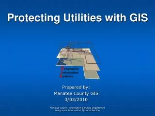
Protecting Utilities with GIS. Prepared by: Manatee County GIS 3/03/2010. Manatee County Basic Stats. Founded: January 9 th , 1855 Location: Coastal West Central Florida Population: 315,766 Residents Area: 893 SqMi. Manatee County GIS.

Protecting Utilities with GIS
E N D
Presentation Transcript
Protecting Utilities with GIS Prepared by: Manatee County GIS 3/03/2010 Manatee County Information Services Department Geographic Information Systems Section
Manatee County Basic Stats Founded: January 9th, 1855 Location: Coastal West Central Florida Population: 315,766 Residents Area: 893 SqMi Manatee County Government - Information Services Department Geographic Information Systems Section
Manatee County GIS GIS is a section within the Information Services Department with 7 members. Currently we support Versioned editing for Planning, Utilities, Property Appraiser, Transportation as well as all other GIS needs within Manatee County. Manatee County Government - Information Services Department Geographic Information Systems Section
What is GIS? • GIS provides a means to visualize, manipulate, analyze and display spatial data • “Smart Maps” are database driven maps Manatee County Government - Information Services Department Geographic Information Systems Section
GIS – The Official Definition • “A Geographic Information System is a system of computer software, hardware and data, and personnel to help manipulate, analyze and present information that is tied to a spatial location.” Manatee County Government - Information Services Department Geographic Information Systems Section
What GIS is Not • GPS – Global Positioning System, a technology often used to collect spatial data for and often confused with a GIS system • Static Maps – Paper or digital maps are often the product of the GIS analysis • Software – No single software package by itself represents a complete GIS system Manatee County Government - Information Services Department Geographic Information Systems Section
Data – Data – Data • Location Data • How Many - What Kind - Where are they • Scale of Data • Local to Globe • Data Presentation • Tables, Reports and Charts . . . or Maps • Analyzing data using GIS turns ordinary • data into valuable and useful information! Manatee County Government - Information Services Department Geographic Information Systems Section
Tabular Databases • We tend to keep data in databases but - • databases are “Not Easy to Interpret” Manatee County Government - Information Services Department Geographic Information Systems Section
Spatial Data • Estimates are that 80% of all data has a spatial component. • Data from most sciences and industries can be analyzed “spatially” Manatee County Government - Information Services Department Geographic Information Systems Section
How GIS Visualizes Data • Raster – Grid based • Pixel based • A location and value • Aerials and other imagery in this format • Vector – Linear based • points, lines and polygons • “features” (houses, lakes, etc.) • Attributes – size, type, length Manatee County Government - Information Services Department Geographic Information Systems Section
Multiple Databases can be Linked and Related • Spatial data can be linked to business data and related attributes can be symbolized and displayed on a map. Manatee County Government - Information Services Department Geographic Information Systems Section
How is GIS Data Organized • GIS data is organized and stored as thematic data layers - meaning one theme of data per layer Manatee County Government - Information Services Department Geographic Information Systems Section
Data Layers are like lunch;better when stacked… Manatee County Government - Information Services Department Geographic Information Systems Section
Feature Classes – individual layers of thematic data Feature Datasets – collections of related Feature classes Enterprise Geodatabase • Enterprise Geodatabase contains production spatial data and is organized into: Manatee County Government - Information Services Department Geographic Information Systems Section
“Worth a thousand words” Visualizing your Data Manatee County Government - Information Services Department Geographic Information Systems Section
So, What about Utilities & Disasters? • Utilities are typically: • Water • Gas • Electric • Stormwater • Wastewater • Telecomm Manatee County Government - Information Services Department Geographic Information Systems Section
GIS & Utilities; Like Peanut Butter and Chocolate Manatee County Government - Information Services Department Geographic Information Systems Section
Utility Data is Spatial Data • Information used for routine and disaster management of a utility has a spatial component (WhoWhatWhere When and How): • Who will be effected by service disruptions and where are they located? • When will service be restored? • Where are critical facilities? • How large is the effected area and how may it change over time? • Where are needed resources and whatis the best route to deliver those resources? • Where are valves that need exercising? Manatee County Government - Information Services Department Geographic Information Systems Section
Existing Utility Records • Most utilities start with utility records based upon: • Paper maps - Construction drawings or As-builts • Memory based – “ask Bill, he knows” • CAD files – many based on inaccurate paper maps • GPS data – when available Manatee County Government - Information Services Department Geographic Information Systems Section
GIS, GPS & Locates GIS offers the unique ability to bring disparate data sources together into an enterprise geodatabase. GPS technology offers the ability to improve positional accuracies of utility data. Locating coupled with advanced GPS techniques, can locate facilities to within a few centimeters of their actual position. Manatee County Government - Information Services Department Geographic Information Systems Section
GIS’s role in Protecting Utilities Once you have Utility data, how can that be used to protect a utility before, during and after an event? Routine vs. Disaster Manatee County Government - Information Services Department Geographic Information Systems Section
Routine Threats to a Utility GIS driven One-call systems can dramatically reduce damage to utilities from excavation and can reduce the number of unnecessary field visits. Electronic as-builts available on-line help locators more effectively locate assets. Manatee County Government - Information Services Department Geographic Information Systems Section
GIS, Utilities &Emergency Management GIS is a powerful tool which supports all 4 phases of the disaster management cycle The objective of GIS in disaster management is to know locations & attributes and the relationship these have with other locations Manatee County Government - Information Services Department Geographic Information Systems Section
GIS & The Preparedness Phase • Typical GIS type activities in preparing for an impending event • Detailed review of disaster plans (Disaster Recovery and data access etc.) • Forecasting & monitoring (GeoRSS feeds) • Development of useful map products both paper based and digital, supporting either on-line or off-line operations. • Development of on-line as-built retrieval systems Manatee County Government - Information Services Department Geographic Information Systems Section
GIS & The Response Phase • Responding to the event: • Situational awareness (GeoRSS feeds etc.) • Information communication through maps and map services (USNG based maps and atlases) • Dispatching & routing resources • Prioritize areas for evacuation or search & rescue Manatee County Government - Information Services Department Geographic Information Systems Section
GIS & The Recovery Phase • Post disaster, the focus shifts to recovery • Detailed damage assessment documentation (Damage assessment spread sheets generated from GIS) • Identification of debris removal needs • Delivery of relief supplies (Road conditions etc.) • Restoration of infrastructure and services • Restoration progress tracking information dissemination (Maps to the Public) • Planning for future re-construction (Community Viz) Manatee County Government - Information Services Department Geographic Information Systems Section
GIS & The Mitigation Phase • Any long term effort that reduces risk • Identify hazards and risks (HAZUS) • Vulnerability analysis (Slosh Models and Evac Zones) • Risk assessment and mapping • Simulation and modeling (Community Viz) • Prioritize infrastructure improvements and retrofits to minimize risks (Utility Management) • Asset inventory; (condition and location) • Public Awareness Campaigns (Evac Zones) Manatee County Government - Information Services Department Geographic Information Systems Section
GIS & Utility Systems Unite • GIS works synergistically with other Utility and Emergency Management related systems: • Asset Management Systems • Work Management Systems • EOC & ECC (Public Safety) Systems • Customer Relations & Notifications System • Overall Operational View (The Big Picture) Manatee County Government - Information Services Department Geographic Information Systems Section
Garbage In = Garbage Out • The effectiveness of GIS in protecting a utility is directly proportionalto the availability and quality of GIS utility data. • The key to realizing the benefits of GIS in protecting a utility is free flowing databetween organizations and systems. • Data should be centralized, stored in like formats, and available to all who need it. Manatee County Government - Information Services Department Geographic Information Systems Section
Examples from Manatee • Utility data published on-line & off-line. • As-built retrieval for locators answering Florida “One Calls”. • GIS functionality used for trace routing and line isolation. • GIS & Vitals track valve exercise program. • GIS used to develop CEMP, COOP & LMS documents. • GIS application generates damage assessment reporting tools for “First In Teams”. • GIS map products in USNG. • Asset tracking UWOW (Utility Work Orders & Warehouse) system with GIS integration. • GIS Integration with WebEOC, Esi’s EOC software. Manatee County Government - Information Services Department Geographic Information Systems Section
Valve Exercise Program -Preventative Maintenance Manatee County Government - Information Services Department Geographic Information Systems Section
USNG Atlas & Map Series Manatee County Government - Information Services Department Geographic Information Systems Section
USNG Atlas Page Sample Manatee County Government - Information Services Department Geographic Information Systems Section
Utility Atlas Manatee County Government - Information Services Department Geographic Information Systems Section
Utility Atlas Inset Map Manatee County Government - Information Services Department Geographic Information Systems Section
GIS GeneratedDamage Assessment Spread Sheets Manatee County Government - Information Services Department Geographic Information Systems Section
GIS GeneratedDamage Assessment Spread Sheets Manatee County Government - Information Services Department Geographic Information Systems Section
Utility Infrastructure ArcIMS Map Service Manatee County Government - Information Services Department Geographic Information Systems Section
Utility Infrastructure ArcIMS As-built Lookup Manatee County Government - Information Services Department Geographic Information Systems Section
Utility Infrastructure ArcIMS As-built Retrieval Manatee County Government - Information Services Department Geographic Information Systems Section
Utility InfrastructueArcGIS Server Map Service Manatee County Government - Information Services Department Geographic Information Systems Section
Homemade AVL System Manatee County Government - Information Services Department Geographic Information Systems Section
Conclulsion Disasters are challenging stressors for any type of Utility, but no matter the utility, the goal is the same; restore service as quickly a possible. GIS, used properly in conjunction with other utility systems, can be a key component insuring decreased down time. The effectiveness of your GIS will only be as good as the data that supports it, and the ability of that data to find its way into the right hands at the right time. Manatee County Government - Information Services Department Geographic Information Systems Section
Parting Thought • Don’t take your utility for granted; It may not be glamorous, but it is criticalto its’ customers!! • The End • Thank you Manatee County Government - Information Services Department Geographic Information Systems Section
Cited Sources Guthrie, W. (2010). GIS Integration Enhances Utility Storm Response. Transmission & Distribution World Home, M. (2006). Mapping the Invisible: Underground Utility Mapping Using Advanced Data Collection and GPS Technology. Point Positive Utility Mapping & GIS Jafrullah, M. (2008). Lull after the Storm: Disaster management for Utilities. SetLabs Briefings, Vol6 No2 Menon, N & Sahay, R. (2006). Role of Geoinformatics for disaster risk management. The Geospatial Resource Portal Srinivasan, T. (2005). Role of GIS in Water Supply. TWAD Technical Newsletter Manatee County Government - Information Services Department Geographic Information Systems Section