Contents of presentation
200 likes | 364 Vues
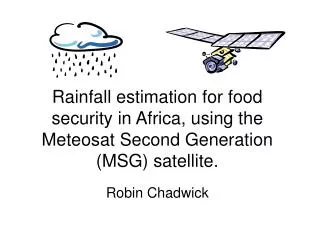
Rainfall estimation for food security in Africa, using the Meteosat Second Generation (MSG) satellite. Robin Chadwick. Contents of presentation. Motivation for satellite rainfall estimation in Africa TAMSAT satellite rainfall estimation methodology

Contents of presentation
E N D
Presentation Transcript
Rainfall estimation for food security in Africa, using the Meteosat Second Generation (MSG) satellite.Robin Chadwick
Contents of presentation • Motivation for satellite rainfall estimation in Africa • TAMSAT satellite rainfall estimation methodology • Met office NIMROD nowcasting precipitation estimation product. • Extension of Met office rainfall estimates to Africa • AMMA Sahelian rain-gauge dataset • Comparison of Met office rainfall estimates against TAMSAT estimates and AMMA gauge data • Current and future work
Motivation for satellite rainfall estimation in Africa • Accurate near-real time estimates of rainfall are vital for humanitarian applications such as famine prediction and prevention, and flood prediction. • Very few precipitation radar networks. Rain-gauges sparce and badly maintained. • Satellite based rainfall estimation algorithms offer one solution to this problem. • Several algorithms exist, using IR data (from geostationary satellites) , passive microwave data (from polar orbiting satellites) or a combination.
MSG wavelength channels Visible Near IR IR Water vapour IR window channels
The TAMSAT rainfall estimation method • Utilises one infrared channel (10.8 microns) from the MSG • Simple method based on the concept of Cold Cloud Duration • Produces operational dekadal rainfall estimates for Africa • Intercomparisons of various satellite rainfall products over Africa have found that the TAMSAT method is as accurate as more complex algorithms. • Should be possible to improve on this because of the information on rainfall provided by other channels on the MSG.
TAMSAT methodology • CCD is the Cold Cloud Duration; the length of time each pixel is below the threshold temperature • Rainfall, R = a + b(CCD) • Threshold temperature and coefficients a, b calibrated for each region using historical rain-gauge data
Met office NIMROD nowcasting precipitation estimation product • Rain-rate estimates over Europe produced operationally every 15 minutes • Radar Satellite Analysis + = Francis et al ‘06
Bright Dark Warm Cold Calibration of NIMROD using only 2 MSG channels Radar rain-rate Meteosat IR channel Meteosat Vis channel Nimrod satellite rain-rate
Extension of NIMROD to multiple channels SZAPrimary correlation method 0o-75o 4-d (0.8/1.6/3.9 refl/10.8) 75o-80o 4-d (0.8/1.6/3.9 refl/10.8) => 3-d (0.8/1.6/10.8) 80o-85o 3-d (0.8/1.6/10.8) 85o-88o 3-d (0.8/1.6/10.8) => 3-d (3.9BT/10.8/12.0) >88o 3-d (3.9BT/10.8/12.0)
The AMMA Sahelian rain-gauge dataset • O.5 degree resolution gridded rain-gauge dataset for May – September 2004 covering the Sahel. • Met office estimates processed for this period & region using historical MSG data • Estimates still use (historical) European radar data for calibration • Comparison of Met office estimates against AMMA gauge data, for grid cells containing gauges only. • Comparison of TAMSAT estimates against AMMA gauge data • Comparison of Met office estimates against TAMSAT estimates
Comparison of Satellite rainfall estimates and gauge data over the Sahel for the July dekad 2 2004 Met office – Raingauge anomaly TAMSAT – Raingauge anomaly Met office – TAMSAT anomaly
Met office and TAMSAT vs gauge dekadal estimates for May to September 2004 TAMSAT vs Raingauge Met office vs Raingauge
Met office vs TAMSAT dekadal rainfall totals for all dekads May to September 2004
Current and Possible Future work • Use of historical local radar data (AMMA or TRMM) to calibrate the Met office algorithm • Use of historical gauge data to constrain or calibrate an MSG based algorithm • Neural network based algorithm