Download
1 / 11
110 likes | 265 Vues
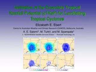
Validation of the Ensemble Tropical Rainfall Potential (eTRaP) for Landfalling Tropical Cyclones. Elizabeth E. Ebert Centre for Australian Weather and Climate Research (CAWCR), Melbourne, Australia A. E. Salemi * , M. Turk†, and M. Spampata*

E N D
Validation of the Ensemble Tropical Rainfall Potential (eTRaP) for Landfalling Tropical Cyclones Elizabeth E. Ebert Centre for Australian Weather and Climate Research (CAWCR), Melbourne, Australia A. E. Salemi*, M. Turk†, and M. Spampata* † - NOAA/NESDIS Satellite Services Division * - Riverside Technology, inc
R D avg = TRaP 1436 UTC Sept 27 1998 V V D Hurricane Georges DMSP SSM/I rain rates TRaP - Tropical Rainfall PotentialSatellite-based prediction of rain in TCs • Three basic assumptions: • Satellite rain rate estimates accurate • Forecast tracks accurate • Rain rates over 24 h period in steady state Diameter (distance along line in direction of TC motion) Average rain rate through a line in direction of TC motion Velocity of TC taken from official forecasts
Studies by Ferraro et al (2005) and Ebert et al (2005) on the accuracy of 24 h TRaP forecasts over US and Australia, respectively, have shown: Generally do reasonable job estimating max rainfall accumulation and its spatial distribution; Underestimate rain volume by 1/3 in both areas Overall accuracy similar to regional NWP models and depends to some extent on sensor with AMSU/TRMM performing better than SSMI Errors more likely related to satellite rain rates and assumption of steady state rain than to errors in track Variation in TRaP performance from storm to storm, and among different TRaPs for single storm is very large. TRaP Validation Studies
Benefits of ensemble approach • Reduction of random error gives more accurate estimates of spatial rainfall field • location of rain maximum • maximum rain amount • rain volume • less streaky than single-sensor TRaP • Variability among individual TRaPs, calculated as part of the ensemble process, gives some indication of the uncertainty associated with the forecast. • Mapped probabilities of rainfall exceeding critical thresholds allows more informed decisions
Combination approach for Ensemble TRaP Ingredients for Rita eTRaP 24 h forecast valid at 00 UTC 25 Sept 2005 First 6 h Valid 0600 UTC Third 6 h Valid 1800 UTC Fourth 6 h Valid 0000 UTC # ensemble members = 7 x 9 x 6 x 3 = 1134 Culled to 1000 members
Weights Recently issued TRaPs should be more accurate than older ones 1.0 0-6h old 0.7 6-12h old 0.4 12-18h old 0.1 18-24h old Some sensors give more accurate TRaP forecasts than others 1.3 AMSU 1.0 TRMM 1.0 AMSR-E* 0.7 SSM/I Each TRaP's weight depends on its latency and relative accuracy wi = wlatency x wsensor * No formal validation of AMSR-E rain rates has been conducted so the AMSR-E weight has been arbitrarily assigned 1.0.
24 h eTRaP forecast for Ritavalid 0000 UTC 25 Sept 2005 AVG QPF PM QPF P => 50 mm P => 100 mm P => 150 mm P => 200 mm
eTRaP Performance for 2004-2008 Atlantic Tropical Cyclones 423 eTRaP and 911 TRaP forecasts for 6 h accum periods 145 eTRaP and 343 TRaP forecasts for 24 h accum periods NCEP Stage IV radar-rain gauge analyses were used to verify forecasts for eighteen tropical storms and hurricanes at 4 km spatial scale: Bonnie, Charley, Frances, Ivan (2004); Arlene, Cindy, Katrina, Rita (2005), Barry, Erin, Gabrielle, Humberto (2007); Dolly, Edouard, Fay, Gustav, Hanna, Ike (2008)
Verification of 6 h accumulated precipitation (top row) and 24 h accumulated precipitation (bottom row) 6 h 24 h
Verification of probability forecasts for 6 h accumulated precipitation (top row) and 24 h accumulated precipitation (bottom row) reliability ROC skillful underconfident 6 h overconfident reliability ROC skillful underconfident 24 h overconfident
Conclusions • eTRaP QPFs are more accurate than single-sensor TRaP forecasts in all important aspects: max rainfall amount, spatial pattern, RMSE, rain intensity distribution, and location. • eTRaP offers the possibility to provide probabilistic forecasts for decision makers Future Work • Apply bias correction step to TRaPs to remove expected systematic errors (underestimate of rain volume) before generating eTRaP forecasts • Incorporate orographic enhancement and rotation in the TRaP extrapolation forecast • Incorporate Rainfall Climatology and Persistence (R-CLIPER) data and NWP model data to the ensemble • Calibration of probability forecasts to correct overconfidence