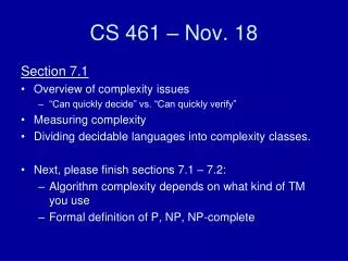
CCNY, Nov 18, 2004
Community Sediment Transport Modeling at the USGS: Application to the Adriatic Sea Rich Signell, Chris Sherwood, John Warner U.S. Geological Survey Courtney Harris & Aaron Bever Virginia Institute of Marine Science. CCNY, Nov 18, 2004. Mapping, Water, Biological, & Geologic Division

CCNY, Nov 18, 2004
E N D
Presentation Transcript
Community Sediment Transport Modeling at the USGS: Application to the Adriatic SeaRich Signell, Chris Sherwood, John WarnerU.S. Geological SurveyCourtney Harris & Aaron BeverVirginia Institute of Marine Science CCNY, Nov 18, 2004
Mapping, Water, Biological, & Geologic Division • Geologic Division: • Hazards: Earthquakes, Landslides, Volcanos • Resources: Energy, Minerals • Landscape: Geologic Mapping, Earth Surface Dynamics, Astrogeology, and Coastal & Marine Geology • Coastal and Marine Geology • Menlo Park, CA; St. Petersburg, FL; Woods Hole, MA • Seafloor mapping, marine geophysics, environmental geochemistry, coastal processes, sediment transport • Sediment Transport • polluted sediments, benthic habitats, water clarity, geomorphology
Sediment Dynamics OCEAN FORCING Surface Heat Flux River inflow Incident light Wind Tides OCEAN RESPONSE DepthDependent Currents Depth Independent Currents Wind Waves Vertical Mixing SEDIMENTRESPONSE Resuspension Transport Scattering and absorption OPTICAL RESPONSE
Adriatic Sea Experiment • Model and observe processes responsible for transporting sediment to depocenters • …with special attention to bottom sediment and suspended particle characteristics associated with flood deposits. • Collect data to assess models. • Test some new instruments. Correggiari et al., 2001
Modeling Collaboration • Wind Modeling: • COAMPS (Doyle & Pullen, NRL) 4 km • LAMI (Chiggiato, ARPA) 7 km • Wave Modeling: • SWAN (Signell, NURC; Sclavo, CNR) • WAM (Cavaleri, CNR) • Circulation & Sediment Modeling: • NCOM (Pullen & Martin, NRL) • ROMS (Warner, Sherwood, Signell, USGS; Harris and Bever, VIMS; Carniel, CNR; Chiggiato, ARPA); • Optics Model: • LSOM (Keen, NRL)
A B COAMPS 4km Met Model 10-m Wind Speed (m s-1) and Streamlines 1500 UTC 7 November 1999 Wind Speed from MAP Research Aircraft (Electra) and COAMPSTM at 350 m A B James Doyle, NRL-MRY
ROMS Ocean Model • Curvilinear orthogonal, S-coordinate primitive equation model w/ free surface, advanced advection schemes, modern coding (F90, MPI, OpenMP), nesting, meteo-ocean coupling, data assimilation, adjoint model • Research model, both ROMS and upcoming TOMS, operational version, heavily supported by ONR • Freely available: Google on “ROMS” “Rutgers”
Community Sediment Transport Modeling System • COAMPS & LAMI Met Models, ROMS ocean model, SWAN wave model,Styles and Glenn wave-current BBL models, Umlauf & Burchard turbulence model including wave breaking effects Salinity; Depth-meancurrents Winds; Wave height Bottom currents; Sus. Seds.
Community Sediment Transport Modeling System • ROMS model: NS equations, heat & momentum fluxes • 3-8 km grid, 21 vertical “S” levels • Initialized with shipboard data from Sep 16-22, 2002 • Zero-gradient b.c. near Otronto, seven tidal components • LAMI forcing every 3 hours, SWAN waves, Po River discharge • k-w turbulence model, Styles & Glenn wave-current b.l. • Resuspension & transport of two grain sizes, ws = 1 mm/s, tc = 0.08 P Salinity; Depth-meancurrents Winds; Wave height Bottom currents; Sus. Seds.
NRL/SLC Barny ADCPS EuroSTRATAFORM , EACE, MAMBO, CNR, IRPEM, IRB, PIRAN NRV Alliance Cruise Track R/V Dallaporta & ADRICOSM Cruises OGS-UHAWAII-NPS Long-Range HF Radar OGS-SLC Surface Drifters Adriatic Sea Field Program Collaboration
USGSTripodLocations Chienti 9-m Chienti 20-m
Chienti 9-mFlow Tripod • BBL velocity profiles (PCADP) • ABS profiles • Pair of ADVs • OBS and trans • T & S • Pressure
Chienti 20-mTripod • WC velocity profiles (600 KHz ADCP) • BBL velocity profiles • ABS profiles • OBS & trans • Pressure • T & S • Video
Chienti 9-mParticle Tripod • ADCP w/ waves • Imaging and fan-beam sonar • LISST 100* • Poking Eyeball* • Particle camera** • Bottom video camera** * First deployment only ** No useful data
9 m ADCP DATA 20 m
Transport Mechanismsfrom Po Source to Apennine Depocenters • Po plume – buoyancy-driven coastal current (WACC) with river-derived suspended sediment (flocculation and settling) • Bora winds – downwelling-favorable enhancement of WACC and wave-induced resuspension (spatial variability and timing) • Alongshore gradients in frequency of resuspension and stability of coastal current (complicated, bottom characteristics) • Boost of coastal current south of Ancona by mid-Adriatic gyre
Conclusions • Data document southward transport of shelf material in Western Adriatic Coastal Current • Combination of data and modeling agree on mechanisms of alongshore transport • Focusing of sediment in model occurs at observed maximum depocenter • Quantities, role of particle dynamics, and cross-shelf transport mechanism yet to be determined • The community sediment modeling system is a viable and valuable framework for addressing these issues