Download
1 / 34
340 likes | 472 Vues
Join us on a fascinating journey to explore the continents of our world and the science of their movement! Today, we'll uncover the history of Alfred Wegener and his groundbreaking theory of Continental Drift, supported by compelling evidence from the fossil record and rock formations. We'll also examine the three types of tectonic plates and how they interact to shape our planet, including an engaging balloon activity to visualize plate movements. By the end of the session, you'll develop your own theories and understand how they compare to established science.

E N D
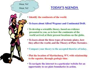
Hear, Ye! Hear, Ye! TODAY’SAGENDA • Identify the continents of the world. • To learn about Alfred Wegener and Continental Drift. • To develop a scientific theory, based on evidence • presented to you, as to how the continents of the • world arrived at their present locations on the globe. • To learn about the three types of tectonic plates, how • they affect the world, and the Theory of Plate Tectonics. • Compare your theory to the accepted theories of today. • Plot the location of Martinsburg, WV, with relationship • to the equator, through geologic time. • To navigate the internet to a particular website for an • opportunity to see plate boundaries in action.
“ Hi! Geology Jimmy here, I’m here to help Mr. Berry (a.k.a. Mr. B.) with the items on your agenda. So here we go! First I have a question for you. How many of you can tell me the number of continents we have on our planet and their names? Take two minutes in your groups and see how many you can come up with. Write them down in the note section of your information packet.”
“How well did you do? Let’s take a look at the names and see how many you got correct!” • Africa • Europe • Antarctica • North America • Asia • South America • Australia “I’ll pause here for a minute, so Mr. B can check to see how well you did.”
GREAT JOB!!! “ Looks like your ready to move on, so here goes.”
“Have you ever wondered how the continents came to be where they are today? Take two minutes, in your groups, and see if you can come up with some answers. Be sure to write your conclusions down in your packets.”
“ Don’t give up your answers just yet. Hang on to them and keep them in your packet, you will need them later.”
“ That brings us to the next item on our agenda. It all began with a man name Alfred Wegener. During World War II Alfred was a soldier in the German Army. After being wounded in combat he had a long time to recover from his wounds. So, he thought about the same thing. What really started him thinking was when he notice, like a lot of other folks, that South America and Africa seemed to fit together.”
“ However, Alfred knew he had to provide more evidence than the appearance of Africa and South America fitting together, so he started looking for more clues; kinda’ like a detective.”
“First he looked at the fossil record. He was amazed to find that a lot of the same fossils that were found on one continent, were showing up on other continents.” “ Then he looked at the rock formations and found out the same thing was happening. The rock found on one continent was showing up on other continents and in places where that kind of rock shouldn’t be. Like, glacial rock deposits where glaciers didn’t exist.”
“Mind boggling, isn’t it!!” “Well, while you think about that for a little while, I’m going to take a little break and turn things over to Mr. B. He has some things with a map, balloons, and something called Pangaea, he wants to show you.” “Remember to keep good notes so you can develop your scientific theories later. Write everything in your note taking section of your information packets.” “ See you in a few minutes. Later!”
BALLOON ACTIVITY INSTRUCTIONS : • Cut out the map of Pangaea. Cut only along the red lines for: Africa, • Antarctica, Australia, Eurasia, India, North America, and South • America. • Blow up your balloon halfway. DO NOT TIE IT OFF OR • ALLOW IT TO DEFLATE!! • 3. Have one of your partners glue the pieces of Pangaea, • that you cut out, to the balloon close to one another as • they appeared on the original map. Be sure that they are • not over-lapping. • Finish blowing up the balloon and observe the movement of your • continents as the balloon expands.
“ Man, that information Mr. B. just showed you sure will be a big help in developing your theories!” “ Next we’re going to take a look at something called Tectonic Plates.” “ This information is very important to developing the theories you are working on, so pay close attention.” “ READY, LET’S DO IT!!!”
“ The Earth’s surface is cracked and separated into plates. We will see how many a little later. There are some that are continental and some that are oceanic. The three types of tectonic plates, as they are called, are: (1) Divergent, (2) Convergent, and (3) Transform.” “Divergent, means to spread apart.” “Convergent, means to come together.” “Transform, means to slide past one another.”
“This illustration really helps to show how the plates move. The arrows are showing which direction they are moving. You can also see some of the results of their movements.”
“ This map shows adivergent plate in Iceland. You can tell from the arrows that the Eurasian Plate and the North American Plate are spreading apart from one another,”
“ The Mid-Atlantic Ridge (shown here) is one of the world’s larges divergent plates, running North to South in just about the center of the Atlantic Ocean. All along this ridge volcanic activity takes place and the sea floor is spreading East and West at a rate of 1.25 centimeters per year. The divergent plate in Iceland is part of the Mid-Atlantic Ridge.”
“ When plates are spreading apart from one another there is a lot of geological activity. Earthquakes, and volcanoes occur here. In some places like East Africa, a rift valley can form that is hundreds of feet deep.”
“Convergent plate boundaries occur in three different ways as illustrated here. Oceanic-continental (OC), Oceanic-oceanic (OO), and Continental-continental (CC).”
“When two plates collide(converge) one plate moves under the other. This process is called “subduction.”
“When convergent plate boundaries come together, many things happen. Earthquakes, island formation, mountain forming, and volcanoes all occur as the result of these plate collisions.”
“ The best example of plates colliding is the Eurasian and Indian Plates. This convergent boundary has resulted in the formation of the highest mountain range in the world – The Himalayas.”
“This illustration shows the movement of the land mass known as India today. As it moved on the Indian plate through time, over millions of years, it finally collided with the Eurasian plate forming the Himalayan Mountains.”
“ Mount Everest (shown here) is the tallest mountain in the world, at over 29,000 ft. and is part of the Himalayas. This is a result of the Eurasian and Indian Plates colliding and it is still getting higher as these two plates continue to collide.”
“ This map shows the large Himalayan Mountain range that has resulted from the collision of these two continental plates; which, as I said before, continues today.”
“ This brings us to our last plate boundary: the Transform Plate boundary. This is where two plates are sliding past one another. Great forces of friction build up between the plate boundaries until they give way and release the built-up force; resulting in an earthquake.”
“ The San Andreas Fault, seen here, is the result of the Pacific Plate sliding past the North American Plate. This is the site of many of the earthquakes that occur in the United States.”
“ Because the Earth has a hot core and mantle, the more liquid asthenosphere experiences tremendous convection currents. They are created when molten magma is heated and rises, then cools and sinks again.”
“ Another way to relate to convection currents is like when you boil soup. As the soup heats up, it rises to the top of the container where it begins to cool and sinks, causing convection currents to form, re-creating the same process that takes place in our Earth.”
“So, as you can see these large convection currents create the energy necessary to move the huge plates found in the Earth’s crust. These plates are constantly moving (approximately 1.25 cm/year) creating earthquakes, volcanoes, islands, and mountains. These in-turn can cause tsunamis, mudslides, and other natural disasters that have a devastating affect on humankind around the world.”
“ The next map you are about to see shows all the plate boundaries in the world.” “ TheREDboundary lines indicate where divergent (extensional) plate boundaries occur, sothey arepullingapart.” “ TheBLUEboundary lines indicate where convergent (compressional) plate boundaries occur, sotheyare comingtogether.” “ TheYELLOWboundary lines indicate where transform (sliding) plate boundaries occur, sotheyaresliding pastone another.”
“ That brings us to the end of our presentation. I sure do hope you learned a lot. Now it’s time for you to finalize your theories.” “ Your job is to write a theory, using the information provided by Mr. B. and yours truly. You will have eight minutes to write your theory on how the continents of the world came to be where they are today. Remember, this is a group activity so you need to collaborate.” “ There is also some awesome additional information in your packets that you might find handy to help you do this.”
“ Mr. B. will provide you with the current accepted theory for the location of the continents after you are through.” “ Then, Mr. B. will be taking you to the computers for some review and to look at some really cool animations.” “ Thanks for letting me help you out today. You really did a GREAT JOB! Until next time, this is Geology Jimmy saying; So Long.” “LATER!! I’M OUT-A-HERE!!!! HAVE A GREAT SUMMER!”