Download
1 / 27
270 likes | 417 Vues
Stream Flow, Habitat, and Biological Assessments of Big Cypress Bayou An Update on USGS Activities. J. Bruce Moring, Ph.D. U.S. Geological Survey Austin, Texas jbmoring@usgs.gov 512.927.3585 (office) 512.940.0505 (cell). Stream Flow. Objectives

E N D
Stream Flow, Habitat, and Biological Assessments of Big Cypress Bayou An Update on USGS Activities J. Bruce Moring, Ph.D. U.S. Geological Survey Austin, Texas jbmoring@usgs.gov 512.927.3585 (office) 512.940.0505 (cell)
Stream Flow • Objectives • Evaluate the accuracyand assumed benefits of prescribed flows derived from the flows-ecology building blocks. • Monitor stream flows during prescribed releases from Lake O’ The Pines (LOP). • Provide the USACE with stage and discharge data in support of modeling efforts to evaluate areas of inundation during releases from LOP. • Coordinate with USACE FW District Reservoir Control in translating prescribed flows to prescribed hydrographs for releases from LOP.
Stream Flow, cont. …. Eleven sites on Big Cypress Bayou instrumented with pressure transducers to monitor stage and temperature. Pressure transducers at 4 USGS study sites have been recording since the early winter of 2006. Seven USACE x-sections were instrumented with pressure transducers in late Jan 2007 to record LOP releases.
Stream Flow, cont. … • Tasks Completed -Began evaluation of the accuracy of prescribed flows to maintain connectivity and aquatic diversity in the low-flow channel. -Developed preliminary ratings for four USGS sites -Provided stage data from Jan 07 release from LOP to USACE for travel-time analysis.
USGS Reaches BC00 – Big Cypress below Jefferson (Rainey’s) BC01 – Big Cypress above Hwy 59 (Sander’s) BC02 – Big Cypress near Lynn Oil Field (Locke’s) BC03 – Big Cypress below Lake O’ The Pines (Thomas Camp) BC00
1500 cfs 536 cfs 40 cfs 13 cfs 6 cfs
Stream Flow, cont. … • Future Tasks (i.e., planned through Sept 2007) -Complete stage to discharge ratings for USGS sites and prelim. ratings for 7 USACE x-sections that are instrumented with pressure transducers. -Determine the variability in high-flow pulses and low-flows in Big Cypress Bayou required to provide the geomorphic and ecological benefits defined in the building blocks with differences largely upstream and downstream of Jefferson! - Emphasis on flows between bankfull and subsistence! - Consider a controlled release from LOP in late summer 07 to evaluate accuracy of prescribed high summer base and subsistence flows. -Acquire highly accurate elevations (± 5 cm) using RTK GPS at the 7 USACE x-sections that are instrumented and convert all stage data to elevations to support HEC modeling of extent of inundation of backwater areas.
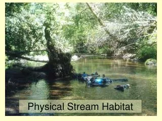
Geomorphic/Habitat • Objectives -Determine basic geomorphic characteristics of the low-flow channel at selected sites on Big Cypress Bayou between Lake O’ The Pines and the confluence of Black Cypress Bayou. -Evaluate the accuracy of prescribed flows as they relate to geomorphic features, .e.g., bankfull height, connectivity of geomorphic channel units such as riffles – runs – pools. -Compare differences in basic geomorphic characteristics between a primary reach on Big Cypress Bayou (BC01 at Sander’s Ranch) and an adjacent reach on Black Cypress Bayou.
Geomorphic/Habitat, cont. … • Tasks Completed -Measured and compared basis geomorphic and characteristics for 4 USGS ‘ study reaches. -Evaluated the accuracy and variability in prescribed flows as related to basic geomorphic features at 4 USGS study sites.
Geomorphic/Habitat, cont. … • Future Tasks (i.e., planned through Sept 2007) -Complete field assessments of primary reach on Big Cypress (BC01) and adjacent reach on Black Cypress (BLC01). -Expand on comparing variability of channel features such as bankfull width and height (and bankfull discharge) in Big Cypress Bayou between LOP and the confluence of Black Cypress Bayou by adding USACE x-sections.
Aquatic Biota • Objectives -Baseline (pre-release of prescribed flows) assessment of the fish assemblage in Big Cypress Bayou at four USGS study reaches between LOP and the confluence of Black Cypress Bayou. -Mesohabitat-specific (i.e., riffle-run-pool) assessment of fish and benthic macroinvertebrate (emphasis on FW mussels) taxa richness and relative abundance in a primary reach on Big Cypress (BC01) and an adjacent reach on Black Cypress (BL01).
Mesohabitat Assessments • Complete mesohabitat assessments of fish and benthics in conjunction with late summer ‘07 releases from LOP. • Evaluate fish occurrence and distribution in each mesohabitat at primary reach during summer high base flow (40-100 cfs) vs. summer low base/subsistence flow (6-20 cfs). • Accomplish baseline mesohabitat-specific fish and mussel surveys during summer 07 subsistence flows in Big Cypress and paired reach on Black Cypress Bayou. • Other opportunities during late summer release? - Sediment transport (e.g., bed and suspended load) - Drift and dispersal of benthic macroinvertebrates in relation to flow. - Monitor temperature before, during , and after period of release.
Cumulative total of 42 species From Four USGS reaches in Big Cypress Bayou Fish from USGS assemblage surveys Bigmouth buffalo, Blackstripe topminnow, Blacktail shiner, Bluegill, Bluehead shiner, Bluntnose darter, Bowfin, Brook silverside, Bullhead minnow, Chain pickerel, Channel catfish, Common carp, Dollar sunfish, Dusky darter, Flathead catfish, Freckled madtom, Freshwater drum, Gizzard shad, Golden topminnow, Grass pickerel, Green sunfish, Largemouth bass, Logperch, Longear sunfish, Pirate perch, Pugnose minnow, Red shiner, Redbreast sunfish, Redear sunfish, Redfin shiner, Scaley sand darter, Smallmouth buffalo, Spotted bass, Spotted gar, Spotted sucker, Spotted sunfish, Swamp darter, Threadfin shad, Warmouth, Weed shiner, Western mosquitofish, White crappie 72 species of fish known historically from Big Cypress Bayou Species historically known from Big Cypress but not collected at USGS reaches Arkansas darter, Yellow bullhead,Flier, Lake chubsuckker, Mud darter, Slough darter, Harliquin darter, Cypress darter, Eastern redfin darter, Western starhead topminnow, Blackspotted topminnow, Cypress minnow, Mississippi silvery minnow, Longnose gar, Orangespotted sunfish, Spotted sunfish, Common shiner, White bass, Yellow bass, Golden shiner, Pallid shiner, Emerald shiner, Blackspot shiner, Ironcolor shiner, Spottail shiner, Tailight shiner, Mimic shiner, Tadpole Madtom, Blackside darter, Creek chubsucker
Aquatic Biota, cont. … • Tasks Completed -Baseline fish assemblage Surveys at 4 USGS Study sites -Post Jan 07 release fish survey of Oxbow Lake that was connected with over-bank flow during January release • Individual component • metrics and IBI score • very similar to Black • Cypress Bayou • (Black Cypress nr Jefferson • IBIs 48 – 56, TCEQ 2005)
Cluster Analysis: Big Cypress vs. Black Cypress nr Jefferson at Hwy 59 (used fish species presence-absence input file)
Aquatic Biota, cont. … • Future Tasks (i.e., planned through Sept 2007) -Compare recent baseline fish data to historical data from Big Cypress and Black Cypress Bayou (i.e., source, Bonner et al. @ TSU). - Emphasis on addressing species gain/loss, and number of obligate riverine obligate vs. generalists. -Mesohabitat-specific fish and mussel surveys comparing habitat utilization between primary Big Cypress reach (BC01) and adjacent reach on Black Cypress Bayou (BL01). -Comparison of mussel and fish diversity between primary reaches on Big Cypress and Black Cypress Bayou done in conjunction with summer low-flow releases from LOP.
25 - 29 16 - 27 13 - 24 31 30
BC03 (Thomas Camp) COE16 (USACE X-section below Jefferson and just above confluence of Black Cypress Bayou