Download

1 / 23
230 likes | 372 Vues
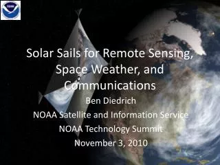
Solar Sails for Remote Sensing, Space Weather, and Communications. Ben Diedrich NOAA Satellite and Information Service NOAA Technology Summit November 3, 2010. Abstract.

E N D
Solar Sails for Remote Sensing, Space Weather, and Communications Ben Diedrich NOAA Satellite and Information Service NOAA Technology Summit November 3, 2010
Abstract Solar sails are large, lightweight mirrors that push spacecraft by the gentle pressure of reflected sunlight. In the vicinity of Earth, the gentle, continuous, fuel-free thrust of solar sails enables whole new families of orbits with a new perspective on the Earth and sun-Earth connection. Solar sails may enable early detection of space weather events that disrupt power grids, communications, and navigation. They may also enable continuous monitoring of polar weather and climate parameters, and intercalibrate multiple observing systems in space and on Earth. NASA’s Galileo mission to Jupiter provided valuable remote sensing proxy data during an Earth flyby in 1990. The unique vantage point of solar sails may also enhance data transfer from polar satellites and polar ground stations. Solar sails are no longer science fiction; the Japan Aerospace Exploration Agency (JAXA) is flying the first solar sail spacecraft on a test flight to Venus. Several small Cubesat solar sail spacecraft are under development for flight over the next few years. Prior NASA research developed high performance sail technology on the ground.
Summary • Solar sails & solar sailing • Why NOAA? • Orbits • Space Weather • Weather and Climate • Communications • Challenges • Opportunities
Sailing Equal & opposite Force on the sail “Stuff” with momentum (e.g. air, sunlight) Force on “stuff” from deflection by sail Sail deflects “stuff”
Solar Pressure • Sunlight • Electromagnetism • Electric field induces current, magnetic field induces force • Relativity • Photons have momentum: E=mc2 -> p=E/c • Low pressure: ~9x10⁻⁶ N/m2 • Solar wind • Charged particles • Thousands of times less pressure • Highly variable j jxB E B Incident jxB B j E Reflected
1999, DLR 20-m ground demo 1996, NASA/JPL/L’Garde 14-m Inflatable Antenna Experiment 2005, Cosmos 1 flight launch vehicle failure GOES I-M solar sail & trim tab 2004, NASA/L’Garde 20-m prototype 2004, NASA/ATK 20-m prototype 1993, SRC Znamya-2 20-m orbital reflector 1981, WSF 15-m ground demo Solar Sails • All spacecraft perturbed by solar pressure, some employ it • Large, lightweight mirror maximizes acceleration from sunlight • Numerous ground developments, orbital & suborbital deployments • Japan Aerospace Exploration Agency (JAXA) flying the first solar sail to Venus • Interplanetary Kite-craft Accelerated by Radiation Of the Sun (IKAROS) 2010 JAXA IKAROS flight
Total force Incident Reflected Solar Sailing • Steering the sail points force direction • Force from absorbed sunlight & reaction force from reflected sunlight • Total force perpendicular to sail • Pointing with orbit velocity grows orbit, sailing away from the sun • Pointing against velocity shrinks orbit to sail towards the sun
Why NOAA? • Space weather • Communications • Weather • Climate
Lagrange Orbits • Orbits closer to the sun than Earth move faster; those farther move slower • At L1, Earth’s gravity subtracts from the sun’s gravity (at L2 it adds), changing the orbit speed to match Earth’s • NASA Advanced Composition Explorer (ACE) and Solar and Heliospheric Observatory (SOHO) orbit L1, 1.5Mkm sunward of Earth • ACE detects solar wind changes leading to geomagnetic storms at Earth 30-60 minutes later
Artificial Lagrange Orbits (ALOs) • Continuous thrust subtracting from solar gravity (adding to Earth’s) can move a Lagrange orbit closer to the sun than L1 • Thrust out of the orbit plane can lift a Lagrange orbit high enough to view Earth’s poles year round • Solar sails, ion engines, combination of the two • Solar sails maintain without propellant 1.5 Mkm 150 Mkm to sun
L1 Earth L2 Sail Performance & ALOs • Sail of given performance (mass/area) has choice of orbit positions
Solar Wind • Solar wind disturbances impact Earth’s magnetosphere causing geomagnetic storms • Damaging currents in power grids & oil pipelines • Ionosphere disruption degrading communications & navigation
Solar Wind Observation • Present • NASA Advanced Composition Explorer in L1 orbit • Planned • Deep Space Climate Observatory (DSCOVR) • Future • Commercial service? • Sub-L1 solar sail • 2X to 10X warning time?
Aurora & Ionosphere • Auroral boundary, energy deposition, and imagery are used to identify impacts to radar operations and communications in polar latitudes. • Ionospheric scintillation affects HF communications at high latitudes
Auroral & IonosphericScintillation Observation • Present • Maps stitched together every few hours from particle detectors and imagers on polar environmental satellites • Future? • UV imagers in polar L2 ALOs would produce hemispheric auroral maps near realtime • Radio beacons in polar ALOs coupled to array of ground receivers for scintillation measurement, augmented by UV imaging
Weather and Climate • Realtime, continuous, hemispheric observation of the poles • Studies over several years identified several potential applications • Clouds • Aerosols • Vector winds • Earth radiation budget • Ozone • Carbon gases • Sea surface temperature • Intersatellite calibration • “Stitching” piecemeal high resolution LEO & GEO data North Pole view in winter North Pole view in summer
Earth Science Proxy Data • Galileo Jupiter Mission • Earth flyby provided similar view to Lagrange and polar ALO • Deep Space Climate Observatory (DSCOVR) • Solar wind mission • Imager and radiometer will observe poles for extended durations • Higher resolution and more channels Galileo Near Infrared Mapping Spectrometer Aerosols derived from Galileo Composite of DSCOVR view from MODIS data Cloud feature changes derived from Galileo
Polar Satellite Communications • 30 minute data latency requirement from polar environmental satellites • SafetyNet is a network of 15 ground stations under construction to handle 3 polar environmental satellites generating 15 Mbps data downlinked at 150 Mbps • Includes McMurdo, with GEO crosslink • >6 minute average, 42 minute max latency
ALO Satellite Crosslink • Two solar sail spacecraft in opposite north/south ALOs • Continuous visibility of one ground station each • ~66.5° elevation • 30 seconds average, 130 seconds max latency • 2 sailcraft & ground stations and near realtime data vs. 15 ground stations
Polar Communications • National Science Foundation (NSF) operates the South Pole research station. • Limited communication coverage (several hours per day) from old geosynchronous satellites in inclined orbits. • A single ALO satellite >22.5° south of L1 or L2 has year-round visibility to the South Pole. • Remaining close to the sun-Earth line also permits solar wind monitoring.
Challenges • NOAA depends on NASA for new spacecraft technologies • Current barriers to development • NASA develops technologies for science, not operational requirements • Changing political priorities • Competition between technology programs • Solar sails not flight validated despite compelling applications and progress in ground development • Research to operations transition process is long and arduous • NASA • Researches & develops new technology • Flight validation • Proposes science mission • Flies science mission • NOAA • Evaluates science mission for operational utility • Performs research to operations transition • Flies operational mission
Drivers and Opportunities • National Academy of Sciences • National Space Weather Program • NASA Space Technology Office • Small satellites (nanosatellites, cubesats) • JAXA IKAROS • DSCOVR • Solar wind as operational NOAA capability • Earth science research to operations opportunity • Commercial services
Conclusions • Solar sails enable new orbits • Early solar wind disturbance warnings • Continuous aurora & ionosphere monitoring • Continuous hemispheric polar remote sensing • Greatly reduced infrastructure & latency for polar satellite data downlink • Continuous polar data transmission • New opportunities to overcome historical challenges