M apping the harappan civilization
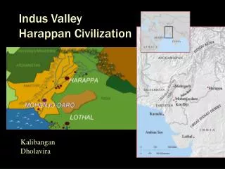
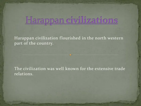
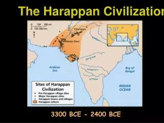
M apping the harappan civilization. I can locate and describe the major river system and discuss the physical setting that supported the rise of this civilization. What type of map do you see here? What do the different colors represent?. Mehrgarh.


M apping the harappan civilization
E N D
Presentation Transcript
I can locate and describe the major river system and discuss the physical setting that supported the rise of this civilization.
What type of map do you see here? What do the different colors represent?
Mehrgarh Highlight the village of Mehrgarh in GREEN
The Himalayas Underline the Himalayas and Mt. Everest inBROWN. (Look southeast of Nepal. They run northwest)
The Indus river Find the headwaters of the Indus River Trace the Indus River from the headwaters in the Himalayas to the Arabian Sea. Use BLUE!
The four tributaries • Trace the four tributaries that feed the Indus River in BLUE. • Indus • Jhelum • Chenab • Ravi
Harappa • Draw a dotted line from Mehrgarh to Harappa in GREEN. • Under Harappa write “palace” in pencil.
MohenjoDaro • Draw a dotted line from Mehrgarh to MohenjoDaro in GREEN. • Under MohenjoDaro write “Great Bath”
Seaports • Highlight the following seaports in bright YELLOW! • SutkagenDor • Allahdino • Amri
The sarasvati river • Yamuna River – Put RED dots on these places – The headwaters of the Yamuna River, Kunal, Banawali, Kalibangan, Ganweriwala. Connect the dots with a RED line. • Sutlej River – Put dots on these places – The headwaters of the Sutlej River, the word “Sutlej River” and Ganweriwala. Connect the dots with a RED line. • SarasvatiRiver – Draw a RED line from Ganweriwala to Dholavira.
Rakhigarhi • Draw a RED line from Rakhigarhi to Banawali. This was a small river that led to the Yamuna River • Find: • Kunal • Banawali • Kalibangan
Ganweriwala • Color the copper-mining region ORANGE!
Dholavira • Highlight the city in bright YELLOW. It was a seaport. • Under Dholavira, write “Grave”
Lothal • Highlight the city in bright YELLOW. It was a seaport. • Under Lothal, write “Dock” • Highlight the Gulf of Cambay in YELLOW. • Highlight the Gulf of Kutch in YELLOW.
Why did the harappans abandon their city? • Draw a RED zigzag line from the Headwaters of the Indus River to Dholavira. • Put a RED X on MohenjoDaro and Harappa. • Trace the routes of two rivers, Yamuna and Sutlej, in BLUE. • Halfway between Ganweriwala and Dholavira, write : THAR DESERT.