Download
1 / 25
250 likes | 541 Vues
GEOGRAPHIC PATTERNS OF THE PHYSICAL ENVIRONMENT. CHAPTER 2. INTRODUCTION. Every region is based on the criteria used to define it. One could theoretically superimpose an infinite number of regional schemes on North America.

E N D
INTRODUCTION • Every region is based on the criteria used to define it. • One could theoretically superimpose an infinite number of regional schemes on North America. • The authors choose to subdivide North America based on the regions depicted on the map on page 6. • Primarily based on human criteria • Maps on pages 19, 27, 29, 31, and 33 are based on physical criteria - AND ARE JUST AS VALID!!!
PHYSICAL ENVIRONMENT OF NORTH AMERICA • Topography • Extremely large topographic regions (map on page 19). • Based on physical relief • Regions are generally oriented north-south. • Impacts • Barriers to movement • Canalize transportation networks • Source of natural resources
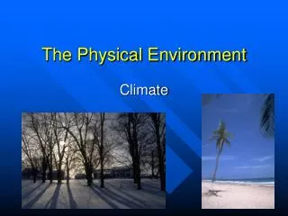
CLIMATE • Climate • Patterns are indicated on the map on page 29. • Based on "Koppen Classification,” the most widely used climate classification system. • Vegetation types are a direct response to climate. • Regional boundaries in his scheme delineate the temperature and precipitation association with vegetation limits.
CLIMATE PATTERNS
CLIMATE • Geographic controls • Latitude • Relationship between land and water • Continentality • Maritime influence • Topography • Impact of air masses and wind systems
CLIMATE(CONTINUED) • Latitude • Temperature is a function of an area's exposure to the direct rays of the sun. • Exposure is maximized at the equator and minimized at the poles. • Consider the earth-sun relationship during the course of the year and its effects on various latitudes in the form of seasonality.
CLIMATE(CONTINUED) • Relationship Between Land and Water • Land tends to heat and cool more rapidly than water. • Large bodies of water > moderating effect on climate • Compare the annual temperature ranges • Coastal locations versus the interior of the continent • Continentality • Non-equatorial places far from large bodies of water experience greater seasonal extremes of temperature than do coastal communities. • Maritime influence • Locations close to large bodies of water experience minimal fluctuations in temp range.
CLIMATE(CONTINUED) • Topography (specifically elevation) • Higher elevations are cooler than lower elevations. • Adiabatic cooling rate of rising air: 5.5º per 1,000 ft. • Impact of Air Masses and Wind Systems • Prevailing wind patterns across the U.S. provide distinct climatic patterns. • North American Pattern • Western U.S. - topography is the key control • East - latitude is significant in determining variations in temperature and precipitation.
KEY TERMS • Orographic Rainfall • Precipitation that results when moist air is lifted over a topographic barrier, such as a mountain range • Leaching • A process of soil nutrient removal through the erosive movement and chemical action of water • Tree line • Either the latitudinal or elevational limit of normal tree growth • Beyond this limit, climatic conditions are too severe for such growth.
VEGETATION • North's America's regions (map on page 31) • Climax vegetation • The final stage in the succession of a vegetative community • Stable climate and soil conditions and protection from human disturbance • Prairie wedge • An unusual and controversial eastward extension of the grasslands across Illinois and into western Indiana • The use of fire by Native Americans??
VEGETATION PATTERNS
SOILS • North American soil types (map on page 33) • Soil • A mixture of weathered rock and organic matter • Shaped & altered by the physical environment over time • Described in terms of distinguishing properties… • color • texture • structure • ability to hold water and air • degree of acidity or alkalinity • Where soils are well developed, vertical zonation may occur, producing distinct layers or soil horizons.
MINERAL RESOURCES • Metallic Minerals - see map on page 38 • Fossil Fuels - include oil, gas and coal • Oil and Gas Fields - see map on page 35 • Coal - see map on page 36 • Major Fields • Appalachian • Eastern Interior • Western Interior • Western
TYPES/GRADES OF COAL • Anthracite • Hardest and lowest in moisture content • Appalachian Field • Home heating • Bituminous • Coke for use in steel-making & burning in power plants • Overwhelming percentage of the coal presently mined • Lignite • A soft, brownish coal • Much less economic value than either anthracite or bituminous • Peat • Softest and highest in water content