Download
1 / 35
360 likes | 602 Vues
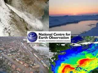
4 th Global Vegetation Workshop, June 16-19, 2009. China Earth Observation Satellite Program. Dr. Yuan Zeng yuanz@irsa.ac.cn Institute of Remote Sensing Applications, Chinese Academy of Sciences (IRSA) China Centre For Resources Satellite Data & Application (CRESDA)

E N D
4th Global Vegetation Workshop, June 16-19, 2009 China Earth Observation Satellite Program Dr. Yuan Zeng yuanz@irsa.ac.cn Institute of Remote Sensing Applications, Chinese Academy of Sciences (IRSA) China Centre For Resources Satellite Data & Application (CRESDA) China National Space Administration (CNSA) China Meteorological Administration (CMA) China Oceanic Administration (COA)
China Earth Observation Satellite Program • Meteorological Satellite (FY series) • Oceanic Satellite (HY series) • China-Brazil Earth Resources Satellite (CBERS series) • Environmental and Disaster Monitoring Satellite System (HJ-1 series)
China Meteorological Satellite Program • Polar orbiting meteorological satellites were launched • FY-1A Sept. 7, 1988 • FY-1B Sept. 3, 1990 • FY-1C May 10, 1999 • FY-1D May 15, 2002 • Geostationary meteorological satellites were launched • FY-2A June 10, 1997 • FY-2B June 25, 2000 • FY-2C Oct. 19, 2004 • FY-2D Dec. 8, 2006
Water Vapor Image of FY-2C MIR Image of FY-2C
Applications of China Meteorological Satellites Typhoon May 13, 1991 July 25, 2002
Applications of China Meteorological Satellites Urban heat Island
Applications of China Meteorological Satellites Cloud and Wind Map from FY-2
Applications of China Meteorological Satellites FY-1D RGB Image June 17, 2003, 1km
Applications of China Meteorological Satellites Aerosol Optical Depth monthly over global sea by FY-1D June, 2003 MODIS Aerosol Product over global sea in the same period for comparison
HY-1 Development objectives China Ocean satellite To detect the marine environmental parameters of theChina Seas • developing and utilizing the marine bio-resources • constructing and managing the harbor • detecting the ocean pollution • investigating and developing coastal resources • studying the global environmental changes
Satellite and orbit characteristics • 10-band Chinese Ocean Color and Temperature Scanner (COCTS) , 8VNIR, 2TIR, 1.1km • 4-band CCD – 0.42-0.89µm, 250m • Launched on 15th May, 2002
3 Days coverage of HY-1 COCTS
Suspended sediment distribution
SST from COCTS
The China-Brazil Earth Resources Satellite (CBERS) CBERS was jointly developed by China and Brazil since 1988 • Orbit: sun-synchronous recurrent and frozen orbit • Mean altitude: 778Km • Local time at descending node: 10:30 AM • Repeat cycle :26 days • Repeat cycle: 100.26 min • Revolution/Day: 14+9/26 • Inter-track distance: 107.4 Km • Time interval between adjacent track: 3 days
CBERS-01/02 payloads CBERS-01: Oct. 1999 - Aug. 2003 CBERS-02: Oct. 2003 – present Download for free based on research contract in China
CBERS-02B payloads CBERS-02B: Sept. 2007 - present
CBERS-03/04 payloads CBERS-03/04 will be launched in 2011
Applications of CBERS – Crop Growth Monitoring 2004.02.05 2004.03.28 2004.04.20 NDVI green index map for wheat based on WFI data of CBERS-02
Applications of CBERS – Fire monitoring Forest fire disaster in Anning county, Yunnan province, Mar. 29, 2006 Fire disaster monitoring, Lantao Island and Tuen Mun Mountain in Hongkong, November 2007 Fire disaster in Inner Mongolia, May 2005
Applications of CBERS – Flood monitoring Flood evaluation in Xincai and Huaibin counties, Henan province, July 18, 2007
Applications of CBERS – Algae bloom monitoring in Taihu lake Blue-green algae bloom regions in red color, Mar. 28th and Apr. 23rd, 2007
Applications of CBERS – Desertification monitoring Jinta in Gansu province, 1987(Landsat) and 2000(CBERS-01)
Applications of CBERS – Urban expandingmonitoring Wuxi in JiangSu province, 2000 to 2003, urban expanding regions in red color
Applications of CBERS – land use classification Jiangni region, Nanjing city, Jiangsu province Integration image of CBERS-02B CCD and HR CBERS-02B CCD Vegetation Map CBERS-02B CCD Land Use Map
Applications of CBERS – Beijing Olympic Construction CBERS-02B HR, Aug. 2008 Beijing Olympic Center Tianjin Olympic Center Shanghai Olympic Center
Applications of CBERS – Snow disaster monitoring CBERS-02B WFI, Jan. to Feb. 2008, south of China before after
Applications of CBERS – Earthquake disaster monitoring CBERS-02B CCD and HR, Jun. 1st, 2008, Beichuan county, Sichuan province
Environmental and Disaster Monitoring Satellite System • HJ-1 series satellites: HJ-1A, HJ-1B and HJ-1C • “HJ” is the “environment” in Chinese for short • HJ-1A/B were launched in Sept., 2008 • High spatial and high temporal resolution of HJ-1A/B • Currently, HJ-1A/B data are available for free based on research contract in China • HJ-1C is a SAR sensor, will be launched in 2009
Applications of HJ-1 – Change detection HJ-1A/B CCD combined with Landsat TM/ETM for land use change detection, natural protection area of Huanghe Delta between 1999 to 2008 2008 (HJ-1B) 2006 2005 2004 2001 1999
Applications of HJ-1 – Fire monitoring Forest fire in Chayu county, Tibet, Dec 13, 2008 Estimating fire area using HJ-1A/B CCD and IRS images
Applications of HJ-1 – Hyperspectral data HJ-1A Hyperspectral image, Zhujiang, Guangdong province, Oct. 1st, 2008
Applications of HJ-1 HJ-1A CCD, California, Dec. 17th, 2008