Kurt Menke, GISP
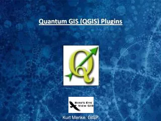
Quantum GIS (QGIS). Kurt Menke, GISP. First of all, how do you say QGIS?. They took a poll once… Q-G-I-S = 42% Queue-Jis = 30% Queue-Gih-Is = 23% Inka-Dinka-Doo = 3% Qwig-Is = 2%. What Is It? A viewer for common vector and raster formats

Kurt Menke, GISP
E N D
Presentation Transcript
Quantum GIS (QGIS) Kurt Menke, GISP
First of all, how do you say QGIS? • They took a poll once… • Q-G-I-S = 42% • Queue-Jis = 30% • Queue-Gih-Is = 23% • Inka-Dinka-Doo = 3% • Qwig-Is = 2%
What Is It? • A viewer for common vector and raster formats • An editor for common vector formats, including shapefiles and PostGIS layers • A front-end for GRASS data and modules • A set of libraries and bindings for application development in C++ and Python • An extensible platform • Now a project under OsGeo
More about QGIS • It's undergoing rapid development • It has great help resources: • User manual • Listserv • Wiki • Conferences
A Brief History • Version Milestones • July 2002 v0.0.1 - First release • Aug 2002 v0.0.3 - Support for OGR formats • June 2003 v0.0.11 - Plugin support • Feb 2004 v0.1 – “Moroz” Raster support for GDAL formats • Oct 2004 v0.5 – “Bandit” First Windows version • Dec 2004 v0.6 – “Simon” First Mac OS X binary, vector editing • Nov 2005 v0.7 – “Seamus” Projection support, GRASS integration • Dec 2006 v0.8 – “Titan” Port to Qt4, WMS, and library refactor • Sep 2007 v0.9.0 – “Ganymede” Python bindings • Jan 2009 v1.0!!! “Kore”
Version 1.0 Features • Several milestones had been listed for 1.0 • Needed to be able to load numerous vector and raster formats e.g. :Shp, mif, gml, PostGIS, Gtiff, ECW, SID, img, etc, etc. • Act as an OGC Client for WMS & WFS • Act as a GRASS Front end • Have Python language bindings with rich plugin ecosystem • Stable API and Frozen User Interface
Why So Long to 1.0? • Seven years to get to 1.0! • Version numbers are arbitrary • The feature set of 1.0 was established long ago • They were working towards that feature set • At 1.0 they wanted a stable API, interface, and user experience
A Brief History cont… • Version Milestones • May 2009 v1.1 “Pan” • September 1, 2009 v1.2 “ Daphnis ” • September 20, 2009 v1.3 “ Mimas ” • January 2010 v1.4 “ Enceladus ” • July 29, 2010 v1.5 “Tethus” • November 27, 2010 v1.6 “Copiapo” • June, 2011 ??? v 1.7 “Wroclaw” Moons of Saturn
Some Development Statistics as of 2009 • 38 developers over the life of the project • 26 person years of effort • Approximately 124K lines of code
GDAL Command line utilities Made available via a python plugin Adds Raster menu
Resources QGIS Documentation Page – User Guides as PDF's
Resources • Listserv's • User • Developer • Community Team • Education • Release Team • Etc. • FAQ's • Commercial Support • Developer Support • User Groups
Quantum GIS • Review • Part of the C tribe • Available for Windows, Linux & Mac • Active Development community • User Plugins • Active listserv's • Lots of new functionality • Easy intuitive interface • Can be used as a front end to GRASS