Download
1 / 17
170 likes | 605 Vues
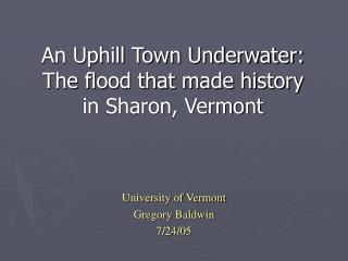
An Uphill Town Underwater: The flood that made history in Sharon, Vermont. University of Vermont Gregory Baldwin 7/24/05. November, 1927 Vermont. October, 1927 rainfall for the state of Vermont was already 50% above normal.

E N D
An Uphill Town Underwater: The flood that made history in Sharon, Vermont University of Vermont Gregory Baldwin 7/24/05
November, 1927 Vermont October, 1927 rainfall for the state of Vermont was already 50% above normal. A tropical storm, thought to go out to sea, collided with a high pressure barrier in New England causing torrential downpours on Vermont Governor Weeks pronounced the disaster as “The greatest catastrophe in Vermont’s history” 9,000 people were left homeless; 275 houses destroyed;1500 damaged; 1250 bridges destroyed; 84 dead. LS00172_000 (Main St during the flood, Richford, VT) LS00172_001 (Present day Main St, Richford, VT)
Sharon, VT Sharon is a six square mile town located in the eastern-central part of Vermont Sharon was chartered in 1761 The White River flows diagonally through the center of the town Currently, there are 1411 people living in the town according to the 2000 census report www.mapquest.com (map of town) Sharon’s location in the state Highway bridge, center of town
The 1927 Flood: Sharon, VT LS06374_000 (washout during the flood)
Aerial view of Sharon and the white River, November 1927, and April 2000 LS01448_000 (November 1927, White River flooded) LS01448_001 (April 2000) Two aerial photographs, one taken in 1927, and the other taken in 2000. In the 1927 photo, the destruction of the flood can be seen. There are flood deposits visible, along with the excess water expanding the width of the river at the top of the picture. The 2000 Picture is the same, though without the flood damage. The railroad bridge was rebuilt and there is now an interstate running through what use to be a forested area.
What happened to Sharon? Markings were made along the northern interstate bridge of how high the water rose during the flood. Currently, the markings read up to sixteen feet. The spring thaw usually raises the river in this spot not much more than a few feet. Water passing underneath the interstate bridge is seldom seen over one foot in depth.
The Flood: Sharon, VT Before the iron bridge was built in 1928, there was a wooden bridge that stood in the same spot. It was swept away during the flood. The new iron bridge was built higher and stronger than the old bridge. Restored in 1994, the iron bridge is still in use today (Current view) 7/05 LS06374_000 (washout during the flood) LS06374_001 (1928 new bridge)
The Railroad Bridge Just over $7,000,000 in damage was done to the railroads throughout the state, including the Central Vermont Railroad (CVRR) that ran right through Sharon. The CVRR bridge in Sharon was one of the first railroad bridges in the valley to fall. There is still debris in the water, left from the previous bridge, that has proven to be treacherous to swimmers and bridge jumpers. Though the water is naturally deep, railroad ties and spikes were left behind. LS01450_000 (the washout of the railroad bridge in Sharon, 1927)
The Deaths Resulting: Sharon 3 of the 84 deaths that occurred in Vermont happened in Sharon. Claude Reynolds and her two children were washed away in their house, after an attempt to be saved by her brother. The picture shows where part of the highway washed out just a little south of Sharon. Steep banks are visible where the water washed away part of the road. LS01451_000 (Arial view of the white river)
The Sharon Dam Pictures taken 7/05, The Sharon Dam It was the rush of water from the fall of the dam that took the lives of the Reynolds family. It was also the suspected reason for the amount of damage done to West Hartford, VT a few miles down the river.
Broad Brook Two bridges along the road were washed away due to the rising water of the Broad Brook in Sharon. (A Shallow Chute of the Broad Brook in Sharon, 7/05) (A view of one of the rebuilt bridges on Broad Brook, 7/05)
Baldwin Hill The overflow of Quation Brook along Rt. 132 in Sharon caused a washout on Baldwin Hill leading into Strafford, VT. (Baldwin Hill leading into Strafford, 7/05) (Quation Brook, 7/05)
Sharon Roads After the flood, it was estimated that more than 25% of all the roads in Sharon were washed out, including the washout of the steel highway bridge. The picture shows part of the washout along the highway in Sharon. LS06606_000 (Flood damage to the highway just south of Sharon)
New Roads were built due to the damage the flood left behind LS06607_000 (Construction work for a new road in Sharon) Road Construction that was being done in Sharon for a cutoff road in 1928
Closing Thoughts… The Flood of 1927 was one of the greatest disasters the state of Vermont has ever seen. The whole state felt the effects of the flood, along with other areas all throughout New England. Sharon, the small town along the White River, survived the disaster though it saw a significant amount of damage. Roads, bridges, railroads, and homes were all destroyed along with people’s lives. Somehow, people were able to work together, and rebuild the small town into what it is today.
Photos: Landscape Change Program Website http://www.uvm.edu/perkins/landscape/ (*Photos with LS captions) Other Photos taken by Gregory Baldwin. Sharon, Vermont. July 23, 2005. Photos (Sharon Church, and Historical Society 7/05) LS01448_001 (April 2000)
References Atwood, R.E. (1927) Stories and Pictures of the Vermont Flood Belding, P.W. (1996) Through Hell and High Water in Barre Vermont Fava et al, Bailey, V.C. (November 2002) 75th Anniversary November 3-4 1927 Flood Waterbury Historical Society Johnson, L.B. (1996) The ’27 Flood: An Authentic Account of Vermonts Greatest Disasters. Greenhill Books. Randolph Center, Randolph, VT (Pages 141-145) Minsinger, W.E. (2002) 1927 Flood in Vermont and New England. Blue Hill Observatory pp 40-42 Potash et al. (2004) Freedom and Unity: A History of Vermont. Vermont Historical Society. Barre, Vermont. Rootsweb.com 2000. 20 July 2005 <http://www.rootsweb.com/~vermont/ 1927NewEngFlood2.html> condensed from:UNITED STATES DEPARTMENT OF THE INTERIOR, Ray Lyman Wilbur,Secretary U. S. GEOLOGICAL SURVEY, George Otis Smith, Director Water-Supply Paper 636-C UNITED STATES GOVERNMENT PRINTING OFFICE WASHINGTON: 1929 Contributions to the hydrology of the United States, 1929 (Pages 45-100) Sharon Historical Society. History Pamphlet on town of Sharon. 2005 “Sharon Vermont” Vermont Towns 20 July 2005. <http://vermonttowns.com/ Sharon/welcome.html> “Sharon, Vermont” Wikipedia.org 2 May 2005. 20 July 2005. <http://en.wikipedia.org/ Wiki/Sharon%2C_Vermont> “Sharon, Vermont” Mapquest 24 July 2005. <http://www.mapquest.com/maps> “Vermont’s Great Moments in the 20th Century” Vermont Today 1999. 20 July 2005 <http://www.vermonttoday.com/century/topstories/flood.html > Vermont Only. 2005. 20 July 2005 <http://www.vtonly.com/hstysep2.htm> cited from: Johnson, C.W. 1988. The Nature of Vermont. University press of New England, Hanover, New Hampshire Virtual Vermont Internet Magazine: Sharon. 14 June 2005. 20 July 2005. <http://www.virtualvermont.com/towns/sharon.html>