Download
1 / 18
180 likes | 191 Vues
This case study explores the use of the Watershed Vulnerability (WARP) approach to design a monitoring program for identifying waters potentially at risk from pesticides, specifically atrazine. The program aims to evaluate ecological impacts and develop mitigation strategies.

E N D
Use of WARP to Design a Monitoring Program to Identify Waters Potentially at Risk from Pesticides Nelson Thurman, U.S. Environmental Protection Agency Office of Pesticide Programs (OPP) National Water Quality Monitoring Conference San Jose, CA, May 12,2006
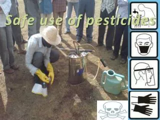
Case Study: Atrazine Risk Assessment • Atrazine is a persistent, mobile herbicide with widespread use • In areas of high atrazine use • Potential adverse effects on sensitive aquatic populations and communities • Potential effects greatest where concentrations recurrently or consistently exceed 10 to 20 ug/L • Concern is not a single endpoint, but magnitude-duration
Coordinated EPA Review of Atrazine • EPA Office of Water aquatic life criteria and Office of Pesticide Programs level of concern for aquatic organisms: • OW:http://www.epa.gov/waterscience/criteria/atrazine/ • OPP:http://www.epa.gov/oppsrrd1/reregistration/atrazine/ • The monitoring plan to evaluate ecological impacts was developed jointly to meet the needs of both programs
Goals for Monitoring Atrazine in Watersheds for Ecological Risk • Identify an ecological level of concern, i.e., magnitude and duration of exposure of aquatic plants to atrazine that potentially adversely affects aquatic communities and/or ecosystems. • Develop a tiered watershed monitoring & mitigation program that specifies the frequency, location, and timing of sampling + coordination w/TMDL programs and other watershed based remediation programs.
Monitoring Program Objectives • To WHAT EXTENT do waters exceed effects-based thresholds (primary productivity) for atrazine? • Fraction of watersheds have flowing water bodies exceeding the trigger with a specified level of confidence • WHERE are the waters that are exceeding effects-based atrazine thresholds? • Use knowledge gained from the monitoring program to help identify additional watersheds of likely concern
Acknowledging the Work of Many… • US EPA OPP: Jim Lin, Doug Urban, Mary Frankenberry, Stephanie Irene, Kevin Costello, Nelson Thurman • USEPA OW: Laura Gabanski, Ruth Chemrys, Susan Holdsworth, David Wells, Donald Brady • USEPA ORD: Russell Erickson, Tony Olsen, Naomi Detenbeck • Syngenta Crop Science: Paul Hendley, Peter Hertl, Juan Gonzalez-Valero, Alan Hosmer • Waterborne Environmental: Chris Harbourt
Starting Point: Use • Best national use information is from surveys • Agricultural uses (okay for atrazine) • Estimated downward to county scale (okay for major use chemicals, but may have holes for minor uses)
Identifying Contributing Vulnerability Factors Percent of soils in Hydrologic Groups C & D (STATSGO) R Factor, which reflects amount and intensity of rainfall, from USDA National Resource Inventory (NRI) Other soil factors included pesticide surface runoff potential, soil erodibility (K factor) Other climate factors included precipitation (annual, seasonal)
Simple Overlaps Didn’t Work • Little overlap between use (orange), pesticide runoff potential (green) • Doesn’t capture the interaction between vulnerability factors
WARP Approach • Empirical model integrates use with basin, soil, hydrology, climate factors • Use WARP to estimate atrazine concentrations for HUC-10 watersheds (where available) covering the atrazine use area (focused on corn, sorghum) • Rank the watersheds based on estimates of 95th percentile annual concentrations of atrazine • Use the most vulnerable watersheds, based on WARP ranking, as a sampling pool for further monitoring
Searching for appropriate watersheds • HUC-8 too broad in scale • HUC-10 not available everywhere • Merged what we could get • Result was messy, but viable The best we had at the time…
How Well Does It Work? • Compared WARP vulnerability to atrazine surface water monitoring data • 1581 stations in 797 HUC’s in 37-state group • How well does WARP separate: • Upper 20th %ile of stations ranked by detections (roughly concentrations >3.0 ppb) • Lowest 20th %ile of stations ranked by detections (<0.1 ppb) • Do additional factors add to the WARP model?
Additional factors considered • USDA NRCS pesticide surface runoff potential • Based on inherent soil properties • Potential based on slope, soil hydrologic group, erosivity • Flow accumulation under row crops • Calculated from Natl. Elevation Data (NED), Natl. Land Cover Data (NLCD) • Reflects channelized flow, percent row crop area
Selecting a representative sampling • Generalized random tessellation stratified (GRTS) design (Tony Olsen, ORD Corvalis) • Unequal probability sampling based on WARP estimates, use
Summary • A vulnerability ranking of watersheds in the atrazine use area using WARP effectively separated monitoring stations with high atrazine detections from stations with low or no detections • WARP was used to target a monitoring survey of 40 flowing water bodies in the most vulnerable watersheds. The monitoring study will allow EPA to estimate the fraction of watersheds with water bodies exceeding effects-based thresholds • Vulnerability based on physical attributes that can be used to predict other watersheds of concern. Site-specific watershed characteristics will help improve our understanding of drivers