Download
1 / 23
240 likes | 280 Vues
Learn about earthwork calculations, soil properties, volumetric measures, density, and common formulations for project planning.

E N D
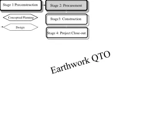
Design Stage 1 Preconstruction Stage 2: Procurement Conceptual Planning Stage3: Construction Stage 4: Project Close-out Earthwork QTO
Earth Work QTO • Soils that contain large amounts of clay or organic materials or soils that are contaminated are not suitable for fill. • The ideal situation is that the amount of usable cut equals the amount of fill.
Soil Volume Changes • The soil will be in one of three conditions: • Loose: after cut. Least unit mass and maximum volume. • Compacted: after the soil is dumped and utilized as fill. Highest unit mass and least volume. • In situ or bank: In between unit mass and volume.
Basic Terminology • Volumetric Measures: • Vl, Vb, Vc. In meters. • Density Measures: • Sw = Swell, density, percentage. • Sh = Shrinkage, density, percentage. • Wl = Weight per Loose Cubic Meter • Wb = Weight per bank Cubic Meter • Wc = Weight per compacted Cubic Meter
Common Formulation • Wb = Wl ( 1 + Sw ) • Wb = Wc ( 1- Sh ) • Sw = (Wb / Wl ) – 1 = (Vl / Vb) -1 • Sh = 1- (Wb / Wc){relationship between bank and compacted} • Swell Factor = Load Factor (LF) = Wl/Wb = 1/ (1+ Sw) = Vb / Vl or Vl = Vb(1+ Sw) • Multiply the bank weight by the load factor to get loose wt. Wl = LF * Wb • Shrinkage Factor (SF) = Wb / Wc= 1 - Sh • Vl = Vb / LF = Vc /(LF *SF) • Vb = Vc / SF = Vc /(1 - Sh ) = (Wc * Vc ) / Wb
Then, Vl = Vb(1+ Sw) , Vc = Vb (1 - Sh ), and • LF = Vb / Vl = Wl/Wb = 1/(1+ Sw) • Example • A given material exhibits the following characteristics: shrinkage = 10% swell = 15%. if 10,000 cubic meters (in situ measure) of material are to be transported in trucks capable of carrying 8 cubic meters, how many truck loads will be required? How much volume will the material consume when compacted? • total number of truck loads = 10,000 (1 + 0.15) / 8 = 1438 • compacted volume = 10,000 (1 - 0.1) = 9000 cubic meters • If the material has an in situ (bank) unit mass of 1600 kilograms per cubic meter, how heavy is a single truck load? • LF = Wl/Wb = 1/(1+ Sw) = 0.87, Wl = Wb (LF) then • load per truck load = 8 X 1600 X 0.87 = 11,136 kilograms.
Grid (Borrow-Pit) Method • Consists of overlaying the topographic information of the site with a grid • Grid size is determined according to the desired level of accuracy. • The volume on any part of the grid is equal to the area of that part times the average height of cut or fill over that part. • Elevations at the corners of the grid are estimated from the contour lines within a foot, usually.
Before 40 ft grid “each square is 40 ft” After
The height of cut or fill is computed at the corners of the grid. • A line at design elevation is drawn to separate the cut from the fill. Points along that line are of zero cut or fill (the daylight point). • The volume of the cut or fill on the full squares is computed first. • The volume of the cut or fill on the rest of the shapes is then computed individually. • The total Volume of the cut and the total volume of the fill are then computed • Examples and homework
Double End-Area Method • More Suitable for linear structures such as highways and utility trenches. • The method consists of cutting a series of parallel cross-sections through the transverse direction of a given cut and/or fill area. • A minimum of two section cuts must be made on a project. The number of the cross sections needed depends on how rough the topography is. • The existing and the proposed topography are drawn to scale at each cross section. Section cuts could be cut, fill or transition.
A reference vertical line is chosen along the cross sections. The distance of each inflection point from that reference line is written on that point. Distances to the left of the reference line are considered negative. • A scale that represents the elevations is drawn to the right of the cross sections. • The area of the cross section is then computed using the traverse area method. Assuming that the values along the X axis are the distances from the reference line, and that the values along the Y axis are the elevations, the area can be computed as follows: A = 1/2 { Xi (Yi+1 – Yi-1)}
Volume between two end areas is then computed. That volume is equal to the average of the two areas times the distance between them. • The cut and fill volumes are computed and summed up separately. • Example