Download
1 / 25
250 likes | 356 Vues
Review of the 2005 NRI photography acquisition, Landsat acquisitions, contractors, scanning services, and issues faced. Explore NRI Register software, contract history, and delivery details. Plan for 2006 imagery including locations, weather challenges, and enhancements.

E N D
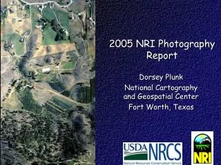
2005 NRI Photography Report Dorsey Plunk National Cartography and Geospatial Center Fort Worth, Texas
Topics • Review the 2005 NRI photography acquisition • NRI_Register Software • 2005 Landsat acquisitions
USDA Small Area Photography Contract • 5-yr IDIQ contract • 2005-2009 • 6 companies • Options for • Flying services • Scanning • Orthorectification
NRI Contract Awards • 10 Year History • Total Contract Awards • Administrative Charge
Scanning Services • May 17, 2005, Task Order Modification for scanning services • 64,810 scans @ $7.45 each • Total = $483,181.11 (includes 1.5% APFO Admin. Charge) • 600 dpi • Delivered on firewire
Other Issues • Crab – More rejections than in the past • Restricted airspace • Emulsion damage • Blank scans • Duplicate scans • Permanent marker on sleeves • Debris between film and sleeves • Corrected labels (old one still partially visible)
2006 NRI Imagery Planning Meeting - Items • Standardize film sleeves • North oriented scans • Early photo periods now mandatory • Prepare for higher costs because of fuel • Most contractors indicated they can fly more, however, the SE US required numerous photo season extensions • In 2006, we will attempt to balance “good” and “bad” weather states among the contractors • Metadata matching scan to camera report • “Best Available” DOQ and DEM to be used for orthorectification
Alabama,1401 Arizona,658 Arkansas,1406 California,2150 Caribbean,450 Colorado,1667 Connecticut,457 Delaware,297 Florida,1953 Georgia,1606 Hawaii,375 Idaho,1624 Illinois,2211 Indiana,1514 Iowa,1759 Kansas,1960 Kentucky,1451 Louisiana,1952 Maine,700 Maryland,1070 Massachusetts,668 Michigan,2063 Minnesota,2352 Mississippi,1713 Missouri,2142 Montana,1493 Nebraska,1714 Nevada,740 New Hampshire,520 New Jersey,603 New Mexico,1386 New York,1701 North Carolina,1567 North Dakota,2014 Ohio,1657 Oklahoma,1539 Oregon,1334 Pennsylvania,1818 Rhode Island,291 South Carolina,1245 South Dakota,1847 Tennessee,1536 Texas,4803 Utah,829 Vermont,573 Virginia,1746 Washington,1364 West Virginia,826 Wisconsin,1850 Wyoming,919 TOTAL 71,514
S. CA Emergency Watershed Protection Priority Community Change Detection Project
NRI_Register • Streamlined version of LPS • Simple interface for less experienced users • Many parameters will be set automatically • Projection • Name and location of input and output files • Many options will be hidden • NRI is doing single frame orthorectification • This approach should minimize confusion and reduce mistakes
NRI Register Steps • Automatically create the LPS block file • Fixed format directories and files • Menu to select pre-built .cam files • Interface to measure fiducial marks • Auto driving and accuracy feedback • Interface to measure control points • Auto driving, auto populated (DOQ, DEM, GCP) • Output files named correctly • Creates ortho image, metadata, block file, and triangulation report