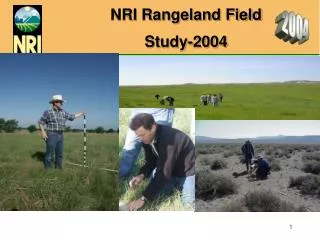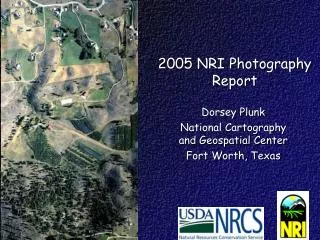
2005 NRI Rangeland Field Study
180 likes | 320 Vues
This document outlines the data collection protocols for the 2005 National Resource Inventory (NRI) Rangeland Field Study. It details the procedures for data gatherers, ownership determination, and land cover/use classification. Data gatherers must be trained in collecting rangeland information using CASI operation and GPS navigation. The study categorizes ownership types and defines land cover and use. The methodology includes historical data consideration and analysis of various classification systems to ensure accurate and comprehensive data collection.

2005 NRI Rangeland Field Study
E N D
Presentation Transcript
2005 NRI Rangeland Field Study • Data Collection Protocols • Data Gatherer • Ownership • Land Cover/Use
2005 NRI Rangeland Field Study • Data Collection Protocols • Data Gatherer – Chapter 3 • Ownership – Chapter 5 • Land Cover/Use – Chapter 6
2005 NRI Rangeland Field Study – Data Gatherer • Procedure: • – Enter Primary & Other gatherer(s) name & title for each PSUs in the Rangeland Field Study. • Prior to data collection: • – Data gatherers must have been trained in: • Collecting rangeland information • CASI operation • Garmin Map 76 GPS navigation
2005 NRI Rangeland Field Study • Data Collection Protocols • Data Gatherer – Chapter 3 • Ownership – Chapter 5 • Land Cover/Use – Chapter 6
2005 NRI Rangeland Field Study - Ownership • Determine Ownership for every sample point. • Collect at the same location where it was collected in the most recent survey and all preceding surveys.
2005 NRI Rangeland Field Study - Ownership • Consider Historical Information • Land cover/use classification • Wetlands classification • Soils classification
2005 NRI Rangeland Field Study - Ownership • Resources used to establish ownership include the basic data collection materials plus: • Maps published by Federal & State agencies • Local tax & land office records • NRCS & FSA office records • USGS Topographic Quads or Digital Raster Graphics (DRG) • Geospatial data layers
2005 NRI Rangeland Field Study - Ownership • 7 Ownership Categories - Defined in 5.5.1 of Instructions for Rangeland Field Study Data Collections • Private • Municipal • County or Parish • State • Federal • Indian tribal & individual Indian Trust lands • Water unspecified
2005 NRI Rangeland Field Study - Ownership • Procedures : • Determine correct sample point location for data collection. • Determine Ownership for the sample point. • Enter Ownership category onto CASI screen. For this study it can be codes 1-4 and 6-7. • It cannot be code 5 – Federal.
2005 NRI Rangeland Field Study • Data Collection Protocols • Data Gatherer – Chapter 3 • Ownership – Chapter 5 • Land Cover/Use – Chapter 6
2005 NRI Rangeland Field Study – Land Cover/Use • Definition Land Cover/Use- A term that includes categories of land cover and categories of land use. Land cover is the vegetation or other kind of materials that covers the land surface. Land use is the purpose of human activity on the land; it is usually, but not always, related to land cover. The NRI uses the term “land cover/use” to identify the categories that account for all the surface area in the United States. [BS-1982, NRI-92]
2005 NRI Rangeland Field Study – Land Cover/Use • The definitions for the various land cover/use categories and specific land cover/use types are in the glossary of “NRI Land Cover/use Terms” found in Section 6.6, of the Instructions for Rangeland Field Study. The LCU codes are found in Table 1 of Section 6.5.2.
2005 NRI Rangeland Field Study – Land Cover/Use Collect LCU data at the same location where it was collected in the most recent survey and all preceding surveys. LCU data are gathered for or all non-Federal (Ownership code = 1-4 and 6-7) sample points.
2005 NRI Rangeland Field Study – Land Cover/Use • Other materials useful for collecting LCU data: • Digital Orthophoto Quads (DOQ) • USGS Topographic Quads or DRG • NRCS and FSA records.
2005 NRI Rangeland Field Study – Land Cover/Use Procedures for entering Land Cover/Use (LCU) information: – Identify the LCU for the area where the sample point is located. – Enter LCU information in the CASI for the current survey year. – If any other LCU code other than 250 “Rangeland” is entered, the data collection for the point is complete and CASI entry is locked for the remaining rangeland sample information.
2005 NRI Rangeland Field Study • This concludes the discussion on the Data Collection Protocols • Data Gatherer, Ownership and Land Cover/Use • ANY QUESTIONS ?