
SlideServe
Menu
Préférences
© SlideServe · v2026

Celestial equator

perrin avatar
7 diapositives · 692 Views · Jul 16, 2014

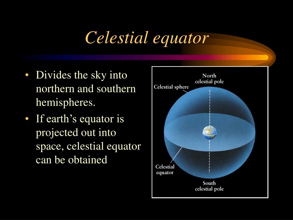
Celestial equator. Divides the sky into northern and southern hemispheres. If earth’s equator is projected out into space, celestial equator can be obtained. Ecliptic. It is apparent annual path of the Sun as projected onto the celestial sphere. Equinoxes and Solstices.
Celestial equator - slide 1
01 / 7Celestial equator
1 / 17

Télécharger la présentation

Celestial equator
Une image / un lien ci-dessous est fourni (tel quel) pour télécharger la présentation

Politique de téléchargement : le contenu du site vous est fourni TEL QUEL pour votre information et votre usage personnel ; il ne peut être vendu, concédé sous licence ni partagé sur d’autres sites sans l’accord de son auteur.Le contenu vous est fourni TEL QUEL, pour votre information et votre usage personnel uniquement. Téléchargez la présentation en cliquant sur ce lien. Lors du téléchargement, si vous ne parvenez pas à télécharger une présentation, l’éditeur a peut-être supprimé le fichier de son serveur.Pendant le téléchargement, si vous ne parvenez pas à obtenir une présentation, le fichier a peut-être été supprimé par l’éditeur.

F I N

Plus de contenu associé

Transcription de la présentation
  1. Celestial equator • Divides the sky into northern and southern hemispheres. • If earth’s equator is projected out into space, celestial equator can be obtained

  2. Ecliptic • It is apparent annual path of the Sun as projected onto the celestial sphere.

  3. Equinoxes and Solstices • Ecliptic and celestial equator intersect only at two points : Equinox (Latin word for “equal night”). • Vernal (Latin word for spring): March 21. • Autumnal: September 23. • Solstice (Latin word for “solar standstill”). • Two other significant locations on the ecliptic. • Northernmost point: Summer solstice (June 21). • Southernmost point: Winter solstice (Dec. 21).

  4. Latitude and longitude

  5. Celestial coordinates • Declination: Angular distance north or south of the celestial equator. • Declination corresponds to latitude. • Measured in degrees, arcminutes, and arcseconds.

  6. Celestial coordinates • Right ascension: Angular distance from the vernal equinox eastward along the celestial equator. • Right ascension corresponds to longitude. • Measured in hours, minutes, and seconds.

  7. Altitude and azimuth • Altitude: The angular height of an object above (0 to +90 degrees) or below (0 to – 90 degrees) horizon. • Azimuth: The angle along the horizon, with zero degrees corresponding to North, and increasing in a clockwise fashion. Thus, 90 degrees is East, 180 degrees is South, and 270 degrees is West. Using these two angles, one can describe the apparent position of an object (such as the Sun at a given time).