Download
1 / 25
250 likes | 446 Vues
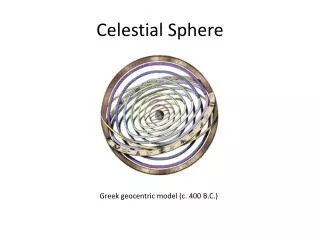
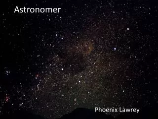
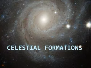
The night sky captivates us with its multitude of stars and celestial bodies, stirring our curiosity. Historically, without artificial light, stars served as guides, forming constellations that provided a sense of familiarity and organization in the vast cosmos. As astronomers studied the heavens, they categorized stars, predicting their movements, which helped in navigation. With tools like the Base Disk, one can learn to identify stars and their locations relative to Earth's horizon, enhancing our understanding and appreciation of the sky above.

E N D
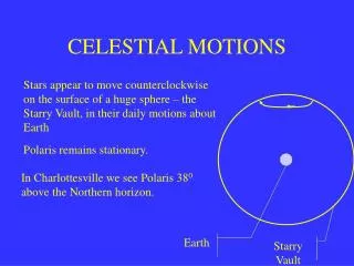
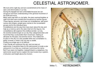
We look at the night sky and are overwhelmed at the mass of stars and other bodies in our sky. During the daylight we feel comfortable because we can recognize and have understanding of the general movement of the SUN and moon. Many years ago with no city lights, the stars seemed brighter at night and stars were studied and visualized as familiar figures. These figures, pictures, are known as constellations, with given names and shapes, people gave names to the constellation groups and to the individual stars. Constellations are the way that many learn about the sky and help as a memory aid to the stars that form the figures, the constellations did organize this endless wonder, our sky. As scientist looked longer at our sky they categorized stars and found that they could predict their movement, making an almanac for the past, now and the future. This makes the location in the sky of a star possible when the constellation is partly covered, or when only one star is visible. Finding one single star is not difficult. If two friends are looking at the sky, and one was an astronomer, it would be easy for the astronomer to locate a star and point to it so that you could see it and know the name. But! If you were not together, instead linked to a telephone, the astronomer would have to explain the star location by a system, of direction and height above the horizon. CELESTIAL ASTRONOMER. Intro 1. ASTRONOMER.
V, North 000 d “Your Horizon Your Sky” <{1}North 35degrees = your Latitude. • THE HORIZON System. (See figure “Your Horizon ”. Numbers are places to look.) > • The Astronomer could describe the NORTH STAR as “{1.} Look NORTH and (your LATITUDE) 35 degrees above your horizon.” He could say “look eastward or {2.}) 055 at 40 degrees high” for another {3.} Look westward at 260 and 20 degrees high” for another star. With little practice you can section off and locate areas of the sky for easy star identity. Without the Astronomer to give direction and height you need the Celestial ASTRONOMER to take his place. • After dark, while out side, you can find the North star or use a compass to find a close to North direction. After some practice you can section off your sky in to bearings and altitude. Let North be at 12 o'clock, the hour hand of the clock hours gives 30 degree sections of bearing around horizon. • The altitude at the horizon, looking straight ahead is zero. Ninety degrees is overhead, You can use the hour hand for altitude, over head =12 o'clock down to your horizon at 3 o'clock and zero altitude, this will help sectioning your sky. ^{2} 055@ 40 < W 270 <E 090 <You ^{3} 260@20 Intro 2. S V 180
24 Understanding PARTS of the CELESTRIAL ASTRONOMER 1.BASE DISK. The purpose of the BASE DISK is to interact and supply information to other disk. Description: (opaque and circular.) The BASE DISK is approximately nine inches in diameter. The BASE DISK is of a bird eye view of the NORTH hemisphere with the WEST to the left and the EAST hemisphere to the right. A pin in the center (that all other disk can rotate on) contains the earth as a molecule that projects into far outer space useful information on its outer rims in terms of: 1. DEGREES labeled every ten from zero to 360 that are used for LONGITUDE. (LONG.) The same DEGREES are used for GREENWICH HOUR ANGLE (GHA) and SIDEREAL HOURS ANGLE (SHA.) (Used for Celestial Bodies.) 2. MONTHS of the YEAR. With the days of the month, each day equals one degree. 3. GREENWICH MEAN TIME (GMT) and Time ZONES. With 12:00 military time at Greenwich England Zero Longitude and each of 24 time zones of 15 degrees for the complete 24 hours day. The Base Disk will enable interaction reading of between degrees, Time of the year, ( month and day) and time of the day, ( hour and minuets.) PBD 3
Parts Base Disk. • Information on the Base Disk Rim. See drawing> • 1. LONG is measured from zero degrees East and West to180 degrees (for your position.) • 2. GHA and SHA are measured from zero degrees to 360 (CW) westward only (Used for celestial positions) • 3. Dates on the rim: Months and days Measure, NOV. + 4 days/ degrees is NOV 4th. • 4. Greenwich Time is the Time on the rim. To read Time on the rim: 14 hours +14 degrees equals, 14 hours and 56 minutes. • (There are 60 minutes to one hour. There are 15 degrees to one hour 15/60=4min per degree.) • Read/Interact on the disk: NOV 9th=15:16 and Long, GHA&SHA 49 degrees. • In order to read Your wall clock and convert to GMT time on the rim, read ZONE DESCRIPTION below. • Zone Description, to convert your Local Clock to Greenwich Mean Time as read on the Rim. • Zone Description (ZD) is the difference between 12:00 at Greenwich England and your Longitude. • Example: 50W on the rim is closest to 15 and is +3 hours from Greenwich(12) Zone Description is +3. • Your LONGITUDE is 50W your local clock reads 06:02 ZD is +3. In order to change you local time on your clock to The rim Greenwich Mean Time, (GMT) you must add ZD. 06 :02 +3=GMT is 09:02 In order to change GMT to LOCAL TIME, reverse the sign and add. GMT 09:02 – ZD=0602 is Local Mean Time. month 1 Hour Longitude W&E 4 2 3 {2} GHA &SHA360 West 180 [1] East 180 {1}Longitude Nov 9=15:16 &49W pbd4
{1} 35N {1} 35N Horizon Disk. {3} YOU PARTS. Celestial ASTRONOMER HORIZON DISK. The purpose is to project your position and horizon (sky) in to outer space and to grid your sky in to bearings and altitude. (This will enable you to read the Horizon system and go out side to locate stars.) Description: Opaque. There are nine Horizon disks that range from 05 North just above the equator to 85 North (N) near the pole, they are back to back, making 5 disk. Each of the nine Horizon’s has a different shape due to latitude (LAT) distortion (from a round earth projected to a flat paper tangent to the named latitude (LAT). 5N is oblong and 85N is a circle. {1} 35N Detail: Each of the nine Horizon Disk are labeled with the Lat. that it was projected from. You use the LAT. nearest to your known LAT. position. You put the disk on the BASE DISK pin and rotate the LONGITUDE (LONG) {2} pointer to your (LONG). The + {3}in the white center is your position. Looking N towards the pin you will see your horizon 90 degrees from your position bearing 000. The bearings will increase to the right 90 to 180 to 270 back to 000. Over your position (+) is ninety degrees altitude from any horizon/ bearing, with ten degree increments down to your Horizon of zero. Any celestial body that enters this grid can be read off, bearing and altitude. Each of the disks are read in the same way. <{2}Long pointer {2} LONG Pointer HD 5. Horizon System Disk
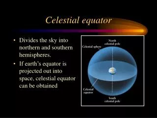
PARTS CELESTRIAL ASTRONOMER STAR DISK Transparent. The purpose: to lock named stars and other celestial bodies together as to read/ interact with the BASE DISK and HORIZON DISK. Details: Transparent and circular. The Star Disk has one pointer. Called ARIES.{1} ARIES controls all stars and bodies on the disk, as ARIES pointer rotates around the Months, days Hours, minutes and degrees on the BASE DISK so will all bodies rotate. The EARTH EQUATOR and the CELESTRIAL EQUATOR are projected into outer space midway from the center to the rim. All bodies are either NORTH declination (DEC) (ABOVE) or SOUTH DEC. (BELOW) the CELESTIAL EQUATOR. ( Declination is the same as Latitude.) The Base Disk will supply the correct placement of Aries on the Base Disk so that the Horizon Disk grid can be used to read the Bearing & Altitude of bodies on the star disk. SD 6 {1} Aries
Putting the Parts to work. 3 STARS 2 75W ASTRONOMER Instructions Set up. {STARS. {Numbers are, go to places on the Star Diagram.} 1. Place the HORIZON SYSTEM DISK (HSD) ON the BASE DISK (BD). Use the LATITUDE (LAT) nearest to your LAT. (05N) {1} 2. Rotate the HSD arrow to your LONGITUDE (LONG), (CW to West Hemisphere) (75W) {2} this is your position at the center of the HSD represented by. {3}+ You can now read any body that enters in-to the Grid in terms of bearing and altitude. 1 S 7
{Numbers are Places on the diagram.} Example LAT. 05 North. LONG.75 3. Find the Month JUNE and count 11 degrees ,CW towards July, for 11 days on the BD. rim, read the time (GMT) of 5:20. {3} (This is for the first minute after midnight. JUNE 11.) Each degree = one day and also 4 minutes of time. Date 11 June 0000. =05:20 4. Decide when you want to observe the stars,* perhaps 10:00 GMT. ADD GMT 5:20 and GMT 10:00 for 15:20 GMT.{4} this will be the correct place for ARIES, for your observation at 10:00 GMT Observe GMT. 10:00 June 11 =05:20 + 10:00 = GMT15:20 5. Place the STAR DISK on the HSD and rotate the ARIES (V) arrow to 15:20 {5} on the outer rim of the BASE DISK. 6. The sky is now set for your position and 10:00 GMT to List and observe your stars. STARS June 11 3 11 degrees=days 3 05:20 July 4&5 15:20 V S 8.
{Numbers are Places on the diagram.} Star List {5} Aries 15:20 Stars, Name Alt Bearing 1.Schedar 32 022 2.Alpheratz 55 043 3. Diphda 48 125 F 4.Formallhaut 54 167 STARS Make a list. 1 2 4 2 4 . 5 3 Aries 15:20 {5.}Your 10:00 OB’S S 9.
STARS Star finding. Unique, How it works The ASTRONOMER uses the Base Disk outer rim, and other Disk to solve difficult problems. For Star Identity, the Base Disk, Horizon Disk and the Star Disk are used. The Eternal Almanac for Aries (Months & Days) on the rim simplifies and eliminates the need for an Almanac and the computation of figures and formulas on paper. The Eternal Almanac’s on the BD, Aries months are equal in degrees to the start of the same month in the almanac. Each of the degrees, days on the BD, after the month is equal to each day reading in the almanac at 00 Greenwich Mean Time for that day. . By reading the GMT on the ASTRONOMER Base Disk for the Month and day 11 June as 05:20 you are selecting 00 minutes GMT of the day 11 June for Aries as if you read that same month and day out of the Almanac in degrees. Since you are working in GMT, you can conveniently add your desired observation time directly, 10:00 GMT of desired observation time to the 00 minutes for 11 June time 05:20 to place the Aries pointer on the GMT of 15:20 on the BD. This easy procedure will give you the same answer as if you worked the difficult paper formula using the Almanac. The GMT 15:20 is now equal to GMT of 10:00 on 11 June. Another advantage of the GMT on the rim is you can work forward in observation time to see how the bodies moves in relation to your position on earth, as time increases. Also, you can quickly catch any mistake, the complete problem is visible 0n the ASTRONOMER. S 10. Note (Later) See GMT& LMT to convert to Local Time.
V CELESTRAL^ EQUATOR @ zero & 90 V N&S Declination Pole Center Pin CELESTIAL ASTRONOMER PARTS. TRANSFER ARM. The purpose of the TRANSFER ARM is to transfer planets and other celestial bodies on the STAR DISK. It can also be used to solve Great Circle problems. Description: transparent and circular. The TRANSFER ARM is a disk split in half with a pointer at each rim. The CELESTIAL EQUATOR circles the pole (pin.) The split pointer line intersects the equator at zero declination/and projected earths zero latitude. The top pointer line runs from the celestial Equator to 90 degrees north at the pole, to 90 degrees south at the south pole. The lower pointer, runs from the equator to 30 degrees north and south and is cut with a slot wide enough to insert a marker through to the STAR DISK to add Planets or stars. T11. Slot >, zero to 30 degrees N & S V
<slot Declination 2 V GHA 43 & S14 < Arm Slot pointer v PLANET & OTHER BODIES ASTRONOMER Instructions. {Numbers are places to go to on the Diagram.} Adding Planets, Sun Moon or other bodies to the STAR DISK. Using the an ALMANAC for the Year, Month, Day and GREENWITCH TIME desired. Write the Greenwich Hour Angle (GHA) and Declination (DEC).of desired bodies on a paper. Example. June 11 1500 GMT Venus is GHA 43 DEC S 14 Mar is 129: DEC S 10 Jupiter’s GHA is 170: DEC S17: (Round of to nearest degree.) Place the star Disk on to the Base Disk and point the pointer to Zero LONG. {1} leave it there. Place the TRANSFER ARM on the Star Disk. Move the pointer on the Transfer Arm to each Planet’s GHA of the 360 degrees on the rim {2} for each of the Planets, through the slot place a grease mark at the DEC. and the body name. Planets wander among the stars, but this position can be used for about one week. Stars can be permanently added in the same manner using SHA as GHA and DEC. Greater than 30 degrees (out side of the slot) use the other side DEC 180 degrees, lift the ARM and mark the first letter of the planets on the Star Disk for identification. The Sun and moon also move among the stars, they can be placed on the star disk for a short period of time. Using their GHA and DEC. An unknown star that you observe, bearing and altitude can be placed on the star disk for looking up later using the bodies SHA and DEC. Read off the demonstrator, and found in an Almanac. ARIES {1}. ^ 0 Long. Your local library may have This year’s ALMANAC. The internet http://aa.usno Navy.mil/data has GHA of Planets and other bodies. P 21.
2007 {1} {2} {1} {2} SUN & MOON ASTRONOMER Instructions. Set up using the NAUTICAL ALMANAC {Numbers are places to go to on the Diagram.} Adding Sun, or Moon to the STAR DISK. Using the NAUTICAL ALMANAC for the Year, Month, Day and GREENWITCH TIME. Write the Greenwich Hour Angle (GHA) and Declination (DEC).of the SUN or MOON to the nearest whole degree.) Enter the Almanac for the day desired. Look on the almanac for ARIES and the closes to Zero degrees (5:58.7 at 09) and the Time in whole hours. Write them on a paper, (09, Time and whole degrees for GHA & DEC.) SUN or Moon as desired. Example , Year 2007, Month & Day May 13, Aries GMT 0900 {1}GHA 6. with the {2} SUN GHA 316, DEC N18, MOON 180 S 8 SEE fig. {1}. Place the star Disk on to the Base Disk and point the pointer to GHA 6 Degrees, . {1} Place the TRANSFER ARM on the Star Disk. Move the pointer on the Transfer Arm to the SUN’S GHA {2} 316 and mark with a grease pencil the DEC of N18 & if desired mark the MOON at GHA180 and DEC.S8. The Sun and moon also move among the stars, the Sun can be used for a time, but the MOON will move out of position daily. O SUN {2} P21A
SUN RISE/SET ASTRONOMER. INSTRUCTIONS 3 Disks are used, the Base Disk, The Family of horizons and the Transfer Arm. The Base disk carries information, Greenwich Mean Time & LONGITUDE on the rim. The Family of Horizons Disk carries a {1.} LONG. pointer, and the image of 10 Latitude horizons {2.} with a Declination Design {3.} The DEC Design is the sun’s path in dots labeled in letters, for each month. of the year. The Transfer Arm with a slot {4.} (30 degrees N&S) ending with a pointer 5. for reading (GMT) time of the Base Disk. Next {Numbers are Places on the diagram.} 3 2 1 2 Long 1. 4 .> 5 S12.
ASTRONOMER Instructions. Sun Rise / Set. {Numbers are Places on the diagram.} Place the Family of Horizons on the Base Disk and rotate the Longitude pointer to your Longitude.72W {1.} Find your Latitude on the Family of LAT {2.} (interpolate if you are between the LATs.) ( This is your LONG 72W> Your LAT will be 35N.) 35N 35N 2 Horizons 1. 72W 2 35N S 13.
Sun Rise/ Sun Set {Numbers are Places on the diagram.} Place the Transfer Arm on the Family of Horizons and rotate the Slot {1.} to the DECLINATION DIAGRAM {2.} Each Month has dots that represents months of the year. For the Month and day desired, interpolate between the dots for the Day and mark, with a grease pencil a mock sun on the slot inline with the pointer {3.} “Mock SUN” between A.&S. Date AUG 06 on the DEC DIAGRAM Month and day place, Mock Sun {1} Arm after rotation 2 3 Horizons 2 3 S 14.
SUN RISE {Numbers are Places on the diagram.} Rotate the mock sun AUG. 06 on the Transfer Arm toward the Rise Family of Horizons. Continue until the sun touches your Horizon at Latitude 35N ,as sun rise would actually do {1.} Read the time of occurrence on the outer rim of the Base Disk using the slot pointer. {2.} The time is for Greenwich Mean Time and is 10: + 2 degrees Each degree is 4 minuets of time. Sunrise is 10:08 GMT. AUG. 06 35N 35N. 1 1 2 S 15. 1 slot
2. 23:56 GMT SUN SET. V23:56 2 {Numbers are Places on the diagram.} Continue Rotating the mock sun AUG. 06 on the Transfer Arm toward Sun Set. With the Sun touching the 35N Horizon, {1.} read the GMT Time off the Base Disk as 23 and 14 degrees {2.} Convert Degrees as Time 56 minutes. Sun Set is 23:56 GMT Note see GMT to LMT to convert to Local Time. Slot Dec. Design 1 S 16.
GREAT CIRCLE ASTRONOMER Instruction.{Numbers are Places on the diagram.} GREAT CIRCLE. To find the course or bearing and shortest distance between two places on our round earth you need to find the GREAT CIRCLE (GC) that runs between the two places See {2.} and {4.} This GC bearing is also the direction that is needed for a directional antenna for best signal. GC G 17.
Place the HORIZON SYSTEM DISK (HSD) on the BASE DISK (BD.) 1 Instructions. {Numbers are Places on the diagram.} The Horizon Disk closest to the know Latitude 35N {1.} Is placed on the Base Disk and the Longitude Arrow is rotated to the Longitude of you the observer. This is your LAT 35N & Long 72W {2.} You Next Place the Transfer arm on the Horizon Disk and rotate the 180 degree pointer to your destination of LONG 06W {3.} and mark with a grease pencil at 36 N {4.} along the pointer latitude line. This is the LAT & LONG of the destination {4}. 06W &36N. you 90 Lat Line 36N Long Pointer Des 4 3 G 18. 2
Course and Distance. {Numbers are Places on the diagram.} The Course and distance is from the center {2} + to the destination dot at {4}. The Great Circle Course is 069. Note. The ALTITUDE is 37 degrees (above the horizon) of the right angle (90) to your overhead +. Overhead to Horizon= 90 90-37=53Degrees (Zenith distance.) There are 60 NM. in each degree 53x60= 3180Nautical Miles from 2+ to 4. You to Destination. Cs 069 37alt 3180 Nautical Miles to 4 X 4 53 ZD. 2 72 G 19.
Use as a training aid and for radio direction finding. Not for use for Ship or Plane navigation. Use Large scale Chart for safety. ASTRONOMER Information is for planning and training purpose. G 20.
ASTRONOMER Instructions. GREENWITCH MEAN TIME and LOCAL MEAN TIME... The Demonstrator Base Disk can enable you to convert Greenwich Mean Time (GMT) to Local mean time LMT by using Zone Time and Zone Description. Greenwich Mean Time (GMT) is the time at Greenwich England, and zero longitude, GMT is used mainly for Sun rise/set and positioning the First point of Aries, the reference for stars and other celestial bodies. Local mean time is the time at your central longitude (the closes TZ.) where you live and the time on your clock. Zone Time is a multiple of every 15 degrees of longitude (15, 30, 45…) and labeled with 24 hour military time. Zone Description is the difference between Greenwich England (12:00) and where you live your closest labeled Zone Time. The importance of each is: GMT keeps track of the Celestial bodies. LMT is your clock that schedules your day and night and places the sun high in your sky at 12:00 noon. Your Zone Time is your longitude and is the closes one of the 24 time numbers on the base Disk. Zone Description describes the difference between12:00 at GMT and your longitude Zone Time. It will be + in the West or – in the East ASTRONOMER Instructions.Greenwich and Local mean TIME GMT-LMT 22.
23:20 2 GMT=Greenwich Mean Time. LMT= Local Mean Time your Long & Clock ZT= Zone Time, one of 24 hours found by Long ( the closes hour to your Long) ZD= Zone Description, difference in hours from 12:00 to another Time Zone. Greenwich and Local Mean TIME. KEY: +7 19 3.100W 17 closest The Base Disk is designed to aid you in this conversion of time from your LMT to GMT, or GMT to LMT. See design below. {Numbers are places to go to} The outer rim of the Demonstrator Base Disk is labeled in GMT only and can be read from Zero degrees of Longitude 12:00 (at Greenwich) to the left (WEST HEMISPHERE) from 12:00, clock wise to +00/24. To the right (EAST HEMISPHERE) from 12:00 counter clockwise to -00/24. Example. {Numbers are places to go on the diagram below} Question: You are at longitude 72 W hemisphere. Your longitude {1} 72W, reading is Zone Time 17:00 on the Base Disk outer rim; your LMT clock on your shelf reads 10: 03. You want to convert to GMT? Answer. The difference between Greenwich 12:00 and your longitude (72W) 17:00 is plus +5, so Zone Description is +5.You must add + 5 to your clock, 10:03 plus +5 =15:03 GMT. Question: You read off the Demonstrator outer rim the GMT of Sunset 23:20 {2}. Your longitude is 100 W {3} what would your LMT on your clock read? Answer. The difference Greenwich 12:00 and your longitude (100 W) 19:00 is plus +7, so Zone Description is +7. To go from GMT to LMT you must always reverse the sign and subtract 7. The GMT off the BD reads 23:20 – 7 hours LMT is16:20. The Eastern Hemisphere works in the same way, the difference is that the counter clock wise longitude would have a zone Time of 72 E is -5 and 100 E would be a -7. 1. 72W +5 GMT LMT 23.
GMT=Greenwich Mean Time. LMT= Local Mean Time your Long & Clock ZT= Zone Time, one of 24 hours found by Long ( the closes hour to your Long) ZD= Zone Description, difference in hours from 12:00 to another Time Zone. h h Demonstration InstructionsGreenwich and Local Mean TIME. <WEST HEMISPHERE EAST> GMT_LMT 24.