Download
1 / 17
170 likes | 341 Vues
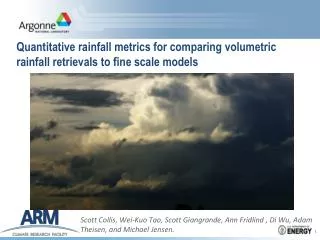
Quantitative rainfall metrics for comparing volumetric rainfall retrievals to fine scale models. Scott Collis, Wei- Kuo Tao, Scott Giangrande , Ann Fridlind , Di Wu, Adam Theisen , and Michael Jensen. ARM, MC 3 E and the Southern Great Plains.

E N D
Quantitative rainfall metrics for comparing volumetric rainfall retrievals to fine scale models Scott Collis, Wei-KuoTao, Scott Giangrande, Ann Fridlind, Di Wu, Adam Theisen, and Michael Jensen.
ARM, MC3E and the Southern Great Plains. • The Atmospheric Radiation Measurement Climate Facility is a DoE user facility with the goal to improve climate models. • The flagship site for ARM is the Southern Great Plains site in Oklahoma, USA. • Recently this site has hosted the Mid-latitude Continental Convective Clouds Experiment MC3E, a joint DoE/NASA IOP involving ground and airborne in-situ and remote sensing assets. Quantitative rainfall metrics for comparing volumetric rainfall retrievals to fine scale models, EGU 2013
The SGP Multi-Scale Observing network Large Scale • The SGP site is designed to sample cloud systems at various scales. • Synoptic coverage from the NEXRAD network including polarimetric KVNX. Mesoscale • Pol. C-Band (5cm) radar out to 120km with dense coverage pattern. Storm scale • Network of 3 X-Band (3cm) systems allowing kinematic and microphysical retrievals. Cloud scale • Ka/W band scanning cloud radar for observing non-precipitating and drizzling clouds out to ~30km. Quantitative rainfall metrics for comparing volumetric rainfall retrievals to fine scale models, EGU 2013
Working at 5cm in Oklahoma, challenging but rewarding! • Most of the US rain sensing network is at 10cm, a very weak attenuating wavelength. • In order to gain more detail ($(4 radars) ~ $(1 radar)) and higher temporal frequency ARM uses 3 and 5cm radars. • In OK (ie heavy precipitation) this raises the challenge of dealing with attenuation in reflectivity and differential reflectivity, however we get a nice bonus that polarimetric phase measures are much more sensitive! Quantitative rainfall metrics for comparing volumetric rainfall retrievals to fine scale models, EGU 2013
Rainfall rate retrieval technique • Reflectivity (Z) is ~D6 so sensitive to changes in DSD (ie same Z could be many rain rates). • Specific differential phase (Kdp) is a non-attenuating, calibration insensitive moment however is gradient based so noise prone and not useful at low R. • Solution! Retrieve specific attenuation (A) using Kdpand a self consistency with Z (a Z-PHI like technique after Bringi et al) which natural folds in available polarimetric data. • Retrieve R using R=aAb,after Ryzhkov et al. • Verifies very nicely across many values of R against the Oklahoma Mesonet, ARM and NASA rain measurements. Quantitative rainfall metrics for comparing volumetric rainfall retrievals to fine scale models, EGU 2013
Quantitative rainfall metrics for comparing volumetric rainfall retrievals to fine scale models, EGU 2013
The challenge of using precipitation • A typical field campaign for ARM involves the generation of a forcing data set for the initialization and periodic nudging of fine scale models. • An input for this is domain averaged rainfall, commonly derived from Radar. • This complicated model derived rainfall to observed rainfall comparison. • We want a metric of model health (how representative of the “real” processes). • We are interested in using fine scale models for process studies. Insensitive to timing and location, we need a metric that reflects this. • The simpleidea is to look at morphological qualities as a function of rainfall intensity. Quantitative rainfall metrics for comparing volumetric rainfall retrievals to fine scale models, EGU 2013
Rainmapthresholding, 20th of May 2011 • This analysis of the same timestep presented before reveals a fascinating dual peaked structure! • The first peak in N(R) is due to the detail on the trailing stratiform region. • The second broad peak occurs when features on the leading edge are resolved (into separate convective cores). • The valley between represents the convective/stratiform separation between the broad line and trailing rainfall. Quantitative rainfall metrics for comparing volumetric rainfall retrievals to fine scale models, EGU 2013
Rainmapthresholding, 20th of May 2011 • This analysis of the same timestep presented before reveals a fascinating dual peaked structure! • The first peak in N(R) is due to the detail on the trailing stratiform region. • The second broad peak occurs when features on the leading edge are resolved (into separate convective cores). • The valley between represents the convective/stratiform separation between the broad line and trailing rainfall. Quantitative rainfall metrics for comparing volumetric rainfall retrievals to fine scale models, EGU 2013
Temporal continuity! • The previous plot was for a single time step. • Does the dual peaked feature persist in time, develop or is it a result of cherry picking data? • We ran our analysis over the whole may 20th event as observed by our C-Band system. • We did the dual Gaussian fit (two pass) for all these times. • Interesting evolution with separation occurring evolving in a smooth fashion throughout storm! Quantitative rainfall metrics for comparing volumetric rainfall retrievals to fine scale models, EGU 2013
MC3E WRF Simulations: NASA Unified WRF (NU-WRF) Di Wu, Wei-Kuo Tao, Toshihisa Matsui, Stephen Lang Three domains: 18, 6, and 2 km, and 40 vertical layers. Physics: Goddard Microphysics scheme Grell-Devenyi ensemble cumulus scheme (for outer most domain only) Goddard Radiation schemes MYJ planetary boundary layer scheme Noah surface scheme Eta surface layer scheme Initial condition (NARR) Quantitative rainfall metrics for comparing volumetric rainfall retrievals to fine scale models, EGU 2013
Rainmap results from NU-WRF • Single peak at low rain rate. • Smooth transition from convective rain rates to stratiform rain rates. • This is reflected in N(R), A(R) and mean rain rate. • So why is this so? • These metrics provide an observational target. • They are indirectly microphysically related. While microphysical insight is difficult they at least allow us to examine, objectively, the veracity of the model. Quantitative rainfall metrics for comparing volumetric rainfall retrievals to fine scale models, EGU 2013
Rainmap results from the Radar • Single peak at low rain rate. • Smooth transition from convective rain rates to stratiform rain rates. • This is reflected in N(R), A(R) and mean rain rate. • So why is this so? • These metrics provide an observational target. • They are indirectly microphysically related. While microphysical insight is difficult they at least allow us to examine, objectively, the veracity of the model. Quantitative rainfall metrics for comparing volumetric rainfall retrievals to fine scale models, EGU 2013
Rainmap results from the WRF output • Single peak at low rain rate. • Smooth transition from convective rain rates to stratiform rain rates. • This is reflected in N(R), A(R) and mean rain rate. • So why is this so? • These metrics provide an observational target. • They are indirectly microphysically related. While microphysical insight is difficult they at least allow us to examine, objectively, the veracity of the model. Quantitative rainfall metrics for comparing volumetric rainfall retrievals to fine scale models, EGU 2013
Rainmap results from the WRF output (Morrison) • Better transition from convective rain rates to stratiform rain rates. • This is somewhat reflected in N(R), A(R) and mean rain rate. • Super FRESH! Only a limited number of time steps studied due to bad hotel internet! • These metrics provide an observational target. • So whyis the Morrison microphysical scheme generating a different storm morphology to the Goddard Scheme? Quantitative rainfall metrics for comparing volumetric rainfall retrievals to fine scale models, EGU 2013
Advertisements! http://bit.ly/16KRasg • Is this too simple? Do you think you can do better? I bet you can! All the code is available as an iPython notebook! (apologies for the bit.ly link) • LP Phase processing, Attenuation Calculation and rainfall calculation were performed using the Python-ARM Radar Toolkit Py-ART. Which I am pleased to announce (FOR THE FIRST TIME) the public release! https://github.com/ARM-DOE/pyart • LP Phase processing, Attenuation Calculation and rainfall calculation were performed using the Python-ARM Radar Toolkit Py-ART. Which I am pleased to announce (FOR THE FIRST TIME) the public release! http://www.arm.gov/data/vaps (click evaluation) Quantitative rainfall metrics for comparing volumetric rainfall retrievals to fine scale models, EGU 2013
Danke! Questions? scollis@anl.gov