Download
1 / 29
290 likes | 432 Vues
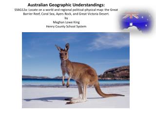
Australian Geographic Understandings: SS6G12a: Locate on a world and regional political-physical map: the Great Barrier Reef, Coral Sea, Ayers Rock, and Great Victoria Desert. by Meghan Lowe King Henry County School System. Additional Ideas and Explanation of Slides….

E N D
Australian Geographic Understandings:SS6G12a: Locate on a world and regional political-physical map: the Great Barrier Reef, Coral Sea, Ayers Rock, and Great Victoria Desert.byMeghan Lowe KingHenry County School System
Additional Ideas and Explanation of Slides… • Generalization: team up with a general education 6th grade teacher, and allow students to attend a class with their nondisabled peers and work with a partner to identify the specified features of Australia on a globe and political-physical map (take a series of photos to document generalization of this skill). • Further Adaptations: Place stickers or putty on a globe to help student focus on the correct region (color-coding can help—different colored stickers/putty and different color-coded labels). • Slides 4—14 can be used as an introductory booklet for students. • Slides 15—24 can be used to address the standard/element as written. • Slides 16—18 have picture cues for students to match correct answers to when identifying where specific features on a map belong. • Slides 19—21 do not have picture cues for students to match to, but do have picture cues on labels to be used as a hint. • Slides 25—27 give students the opportunity to label the map with additional information about the features of Australia – the animals/sea life that live on Australia’s land and in its water. • Slide 28 is a blank map of Australia to be used for any additional activities you may have.
Coral Sea • Australia's Coral Sea is one of the world's last remaining pristine tropical marine environments. • Covering approximately 1 million square kilometers - three times the size of the neighboring Great Barrier Reef (and four times the size of Great Britain!) - the Coral Sea comprises a series of spectacular coral reefs, formed by underwater mountains, rising thousands of meters from the sea floor. • The Coral Sea is a rare example of a marine environment that is thriving. Bountiful fish populations including grey and white tip reef sharks, hammerheads, manta rays, tuna, barracuda, turtles, whales and rare sea creatures such as the nautilus inhabit the waters, alongside an incredibly diverse range of corals.
The Great Barrier Reef • This spectacular coral reef, about 1,250 miles (2,000 km) in length contains the world's largest deposit of coral. It's not one continuous reef, but rather an irregular jigsaw puzzle of over 2,800 individual coral reefs and assorted coral cays. Famed worldwide for its beauty and wildlife (over 1,500 species of fish alone), it became Australia's first World Heritage Area in 1981.
The Great Barrier Reef & Coral Sea provide a home for millions of fish and other sea life!
Ayers Rock • AYERS ROCK (Uluru)Considered the largest solitary rock on the planet, its red sandstone surface smoothed by high winds over time is revered as a holy place and called Uluru by the aboriginal peoples It's 1,143 ft. (348 m) high.
Great Victoria Desert • Famous for its red sand dunes, indigenous wildlife and isolation, the Victoria Desert (250,000 sq. miles in size) extends for about 450 miles (750 km), and is mainly a barren area of red sand hills and ridges, dry salt lakes, with very little grassland.
Name ____________________________________________Date ________________________ Directions: Color land masses green, and water blue. Identify the continent of Australia (Oceania) by circling it.
Name ____________________________________________Date ________________________ Directions: Identify the continent of Australia (Oceania) by circling it.
Name ___________________________________________________Date ________________________ Cut the labels on the right and glue on the appropriate place on the map of Australia. with picture prompts
Name ___________________________________________________Date ________________________ Cut the labels on the right and glue on the appropriate place on the map of Australia. SS6G12a with picture prompts
Name ___________________________________________________Date ________________________ Cut the labels on the right and glue on the appropriate place on the map of Australia.
Name ___________________________________________________Date ________________________ Cut the labels on the right and glue on the appropriate place on the map of Australia. NO picture prompts
Name ___________________________________________________Date ________________________ Cut the labels on the right and glue on the appropriate place on the map of Australia. NO picture prompts
Name ___________________________________________________Date ________________________ Cut the labels on the right and glue on the appropriate place on the map of Australia. NO picture prompts
Name ___________________________________________________Date ________________________ Cut the labels on the right and glue on the appropriate place on the map of Australia. NO picture prompts SS6G12a
Name ___________________________________________________Date ________________________ Cut the labels on the right and glue on the appropriate place on the map of Australia. NO picture prompts SS6G12a
Name ___________________________________________________Date ________________________ Cut the labels on the right and glue on the appropriate place on the map of Australia. NO picture prompts SS6G12a
Name _____________________________________________ Date ___________________________ Cut the images on the right out and glue the animals in the appropriate place on the Australian map: on land or in the ocean. Great Barrier Reef Coral Sea Ayer’s Rock Great Victorian Desert
Name _____________________________________________ Date ___________________________ Cut the images on the right out and glue the animals in the appropriate place on the Australian map: on land or in the ocean. Great Barrier Reef Coral Sea Ayer’s Rock Great Victorian Desert
Name ______________________________________________ Date ___________________________ Color the land green and the water blue in the map below. Then, cut the images on the right out and glue the animals in the appropriate place on the Australian map: on land or in the water. Great Barrier Reef Coral Sea Ayer’s Rock Great Victorian Desert
Helpful links… • http://www.worldatlas.com/webimage/countrys/oceania/aussnewld.htm