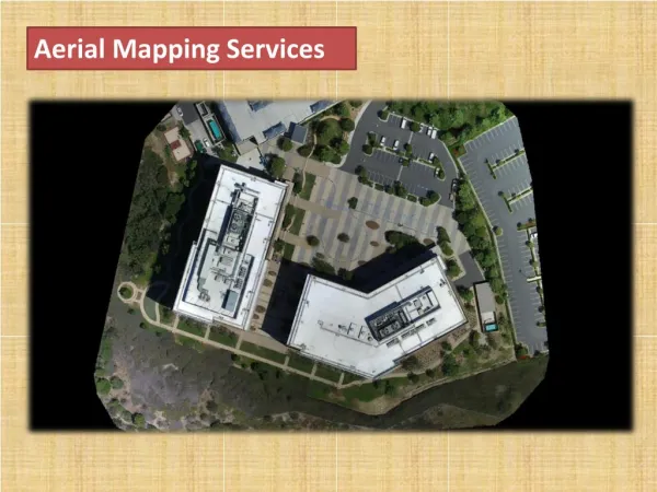
A presentation on Aerial Mapping Services
270 likes | 637 Vues
A presentation on Aerial Mapping Services. Index:. The Workflow Aerial Photography - Activities Aerial Photography - Aircraft Aerial Photography – Camera Photo Laboratory – Activities Toward Digital Process –Scanner Digital System Archiving System Photogrammetry – Activities.

A presentation on Aerial Mapping Services
E N D
Presentation Transcript
A presentation on Aerial Mapping Services
Index: • The Workflow • Aerial Photography - Activities • Aerial Photography - Aircraft • Aerial Photography – Camera • Photo Laboratory – Activities • Toward Digital Process –Scanner • Digital System • Archiving System • Photogrammetry – Activities • Photogrammetric Equipment • The Printer • Special Services • Falcon II • SHOALS • LIDAR Power Industry Application • OPS
Workflow: Traditional Analog System DTM Othophotos Line Map Update Revision 3D Images Analysis DSM GIS OPS Scanners Analog Stereo Ploter Film Processing B/W or Color Vexcel Ultra Scan 5000 Zeiss SCAI RMK TOP Camera AGFA Film Digital System LIDAR or Digital Camera Printer LAMBDA 130 Digital Cam Raw Data process INPHO SuitesAltexisTopIt TemporaryMass Storage Archive System Falcon II LIDAR Digital WorkStationSummit Evolution Batymetry
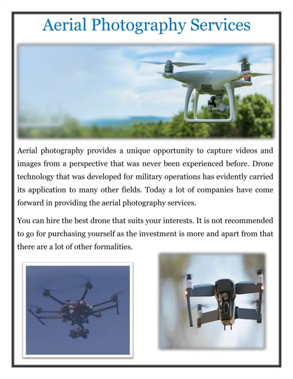
Flight Planning Kinematic Aerial Photography Black & White Color Negative / Positive Color Infra-Red • Aerial Photography (Activities): Aerial Photography is executed based on the requirements of the clients, such as the required map scale, contours and accuracy of the deliverables. Execution of Aerial Photography
Aerial Photography (Aircraft): • Beechcraft KING AIR C90 • (Pressurized Cabin Aircraft) • Max.Flight Duration: 5 hours, • Ceiling: 30.000 feet, • Speed : 90-180 Knots
Aerial Photography (Aerial Camera): ZEISS RMK TOP 30 Aerial Camera ZEISS RMK TOP Film Magazine with FMC CCNS Navigation Unit with Airborne GPS AEROCONTROL II (Inertial Measurement Unit) Gyro Stabilised Mount Omnistar FUGRO Airborne DGPS Ashtech Z Ssurveyor GPS Base Receiver World Wide Mission Planning (WWMP) (IGI Gmbh) Aerooffice (IGI Gmbh)
Photo Laboratory (Activities): • Film Processing: • Black & White • Color Negative/Positive • Color Infra red • Printing: • Diapositives • Contact Multi Purpose Roller Transport Film Processor Roller Transport Paper Processor Film Processing B/W or Color RMK TOP Camera AGFA Film
Toward Digital Process (Scanners): Scanning is the bridge between analog to digital process. Analog System Digital System Deliverables Vexcel Ultra Scan 5000 DTM Othophotos Line Map Update Revision 3D Images Analysis DSM GIS OPS B/W or Color Archive System Digital WorkStationSummit Evolution Printer LAMBDA 130 Zeiss SCAI
Toward Digital Process (Scanners): Currently using ZEISS SCAI scanner in the production facility, however we are also the authorized dealer of Vexcel Ultra Scan 5000 and the DeltaScan. Click image for details DeltaScannner ZEISS SCAI High Precision Scanner Vexcel UltraScan 5000
Digital Camera & LIDAR: The Vexcel UltraCam-D large format digital aerial camera system delivers digital imagery that is radiometrically and geometrically superior to that of conventional film cameras at significant savings Click image for details FALCON IIis An airborne LIDAR (Light Detection & Ranging) system for the acquisition of digital elevation models (DEM) and ortho images. It comprises an on-board sensor system (hardware) and a modular software package to process acquired data Raw Data process INPHO SuitesAltexisTopIt TemporaryMass Storage Archive System UltraMap Server Batymetry
Archive System: Archiving is the artery of the digital processing. This is where the data reside and distributed to any part of the process. Vexcel UltraScan 5000 Vexcel UltraCam Vexcel UtraMap Serveris a powerful digital image catalog and archive system with integrated distributed process management. UltraMap Server is the link between the UltraCam and the potogrammetric stereo processing software, making it the solution for implementing a fully digital aerial mapping workflow. Media Falcon II Digital WorkStationSummit Evolution Archive System UltraMap Server Printer LAMBDA 130
Photogrammetric Activities: Exisiting Facility of Photogrammetric System 25 UnitsSilicon Graphics Indy/Indigo Workstation 53 Units Personnel Computer 01 UnitHigh Presicion Scanner (ZEISS SCAI) 01 Unit Plotter; HP Designjet 2500 01 Unit CADJET2 Media Archive System UltraMap Server Digital WorkStationSummit Evolution Existing facility Printer LAMBDA 130
Photogrammetric Activities (Digital Process): B&W Orthophotos Line Map Color Orthophoto GIS Application Contour map Summit Evolution WS Click image for details Hard Copy or Digital
Photogrammetric Equipment (WorkStation): Authorized dealer, distributor and agent of various equipment of digital photogrammetric process: Summit Evolution WS PlanScan Click image for details Media Archive System UltraMap Server Digital WorkStationSummit Evolution Printer LAMBDA 130 Delta Photogrammetric W/S
Photogrammetric Equipment (Digital Printer): Durst Lambda 130: Direct digital printing with unsurpassed image and text quality Analog Stereo Ploter DTM Othophotos Line Map Update Revision 3D Images Analysis DSM GIS OPS Archive System UltraMap Server Digital WorkStationSummit Evolution Printer LAMBDA 130 Click image for details
Special Services involving Aerial Survey: Northwest POV Eastern POV Airborne LIDAR Survey Southwest POV Southern POV Oblique Photogrammetric Solution (OPS) Airborne LIDAR Hydrography (SHOALS) Click images for details
Special Services (LIDAR Survey): Multi sensor system operated on-board an airplane or helicopter. Scanning the survey area strip by strip the position and altitude measurements are also recorded. Falcon II are made of the LIDAR and the Optical Scanner. • Applications: • 3D City Models and Urban Planning • Monitoring and Protection of Coastal Zones • Corridor Mapping, Pipelines and Transmission Lines • Forest Inventory and Precision Management • Surface Mining and Deposits • Flood Protection and Hydraulic Simulations • Power lines Virtual Reality
Special Services (LIDAR Bathymetry): Airborne laser bathymeter system SHOALS 1000T can survey over large areas, far exceeding the capabilities and efficiency of traditional survey methods at IHO Order 1 accuracy or better. SHOALS 1000T has a unique capability to map shallow waters, shoreline and topography simultaneously, integrating land and water measurements in the same data set This technology not only speed up the total survey mission and project turn around time, but also allow surveys over sensitive environmental coastal zones or inland water ways. • The products include: • Digital Terrain Models (DTM) • Digital Surface Model (DSM) • Ortho-photos and mosaics • Topographic maps • Other LIDAR data
Special Services (LIDAR in Powerline Industry): • Acquisition of terrain elevation in the power line corridor • Mapping of vegetation, land use and infrastructure • Creation of power line information and maintenance systems • 2D and 3D presentation of power line pylons • Determination of pylons centers and suspensions points • Vectorisation of power lines • Determination of the clearance between vegetation and power line • Creation of vegetation maintenance and management plans • Overlaying with additional geoinformation
Special Services (OPS): Oblique Photogrammetric Solution (OPS) is a software program that provides a dynamic lateral viewing with the added features of measurement. In contrast to a map or an Orthophoto where viewing is limited from above and measuring is limited on the horizontal surface of the ground, OPS enables the display and measurement of objects on the ground, from various angles and directions. The horizontal viewing which OPS solves is the convenient angle to which we are all accustomed. Measurement GIS Integration
For more information please contact: Abduljalil Aldoseri Chief Executive Officer Aeromap Technology Systems Tel: 973-17-530-100 Fax: 973-17-5330513 Jalil.aldoseri@aeromapss.com For other products and services visit: www.aeromapss.com O G C . . Aeromap Technology Systems (AeroMap) is providing products and services in collaboration with its various international partners: • End of Presentation PanIndia شركة الأوار العالمية